
Tonight: Snow moves in overnight causing temperatures to drive down to a low of 28º.

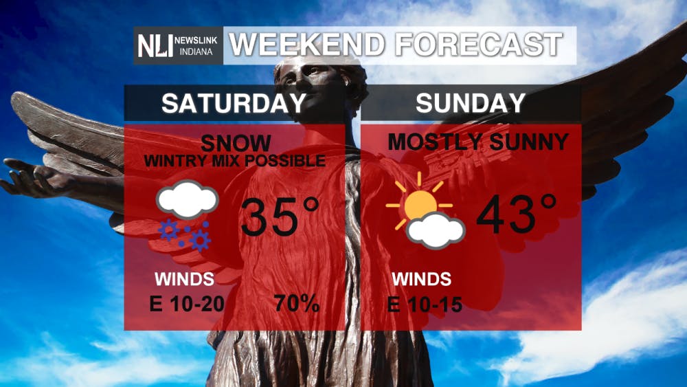
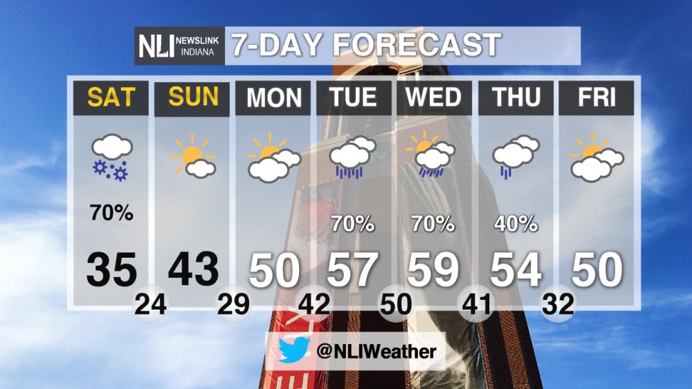
This Weekend: Snow prevails throughout Saturday with temperatures right above freezing at 35º. Expect the most precipitation within the morning hours on Saturday. A Winter Storm Warning is currently in place, Saturday 2am-8pm, for the majority of our viewing area except Jay and Blackford counties. On Sunday, all precipitation backs off allowing for a mostly sunny day with a high of 43º.

7-Day Forecast: Over the course of the next week, temperatures are back right around average. With temperatures above freezing, we begin to see more rain than snowfall. Rain chances increase during the middle of the work week. Make sure to keep a pair of rain-boots handy.
--- Weather Forecaster Payton Domschke
For more updates be sure to follow us on Twitter @NLIWeather.
NewsLink Indiana is a proud Ambassador for the NOAA Weather-Ready Nation program.
For more information about the Weather-Ready Nation program please click HERE
Read More
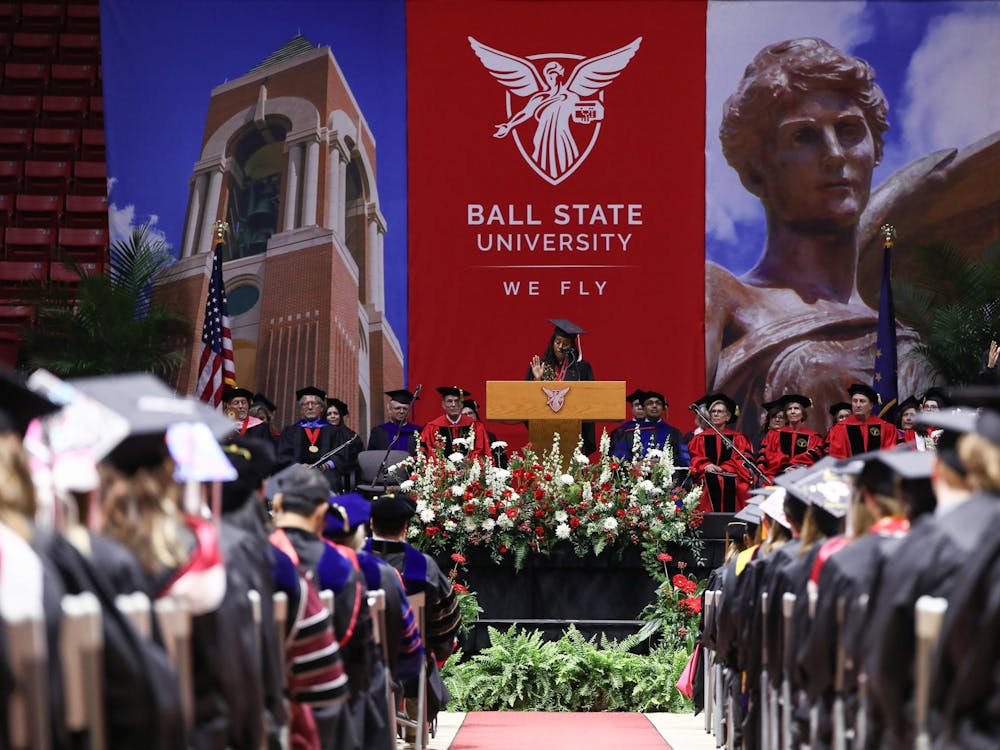
Ball State holds Spring 2025 Commencement Ceremony
By Jessica Bergfors / YesterdayBall State University celebrated its 201st commencement ceremony on May 3 at Worthen Arena, where thousands of guests gathered to honor the graduating class of 2025.
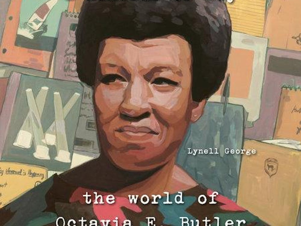
The discovery of a beautiful afrofuturist: Octavia E. Butler
By Amira Alquraishy / YesterdayAward-winning essayist, journalist, and nonfiction author Lynell George gives us a glimpse into the esteemed writer Octavia E. Butler’s origins of becoming one. Going into her personal confides of her very own journals, we get a crash course into her psyche, and how she overcame the highs and lows of becoming the first African American woman to break into the science fiction genre.

Spring 2025 Commencement offfically moved indoors
By Staff Reports / YesterdayThe main ceremony will still take place at 10 a.m. May 3 with details amended for the new location
