
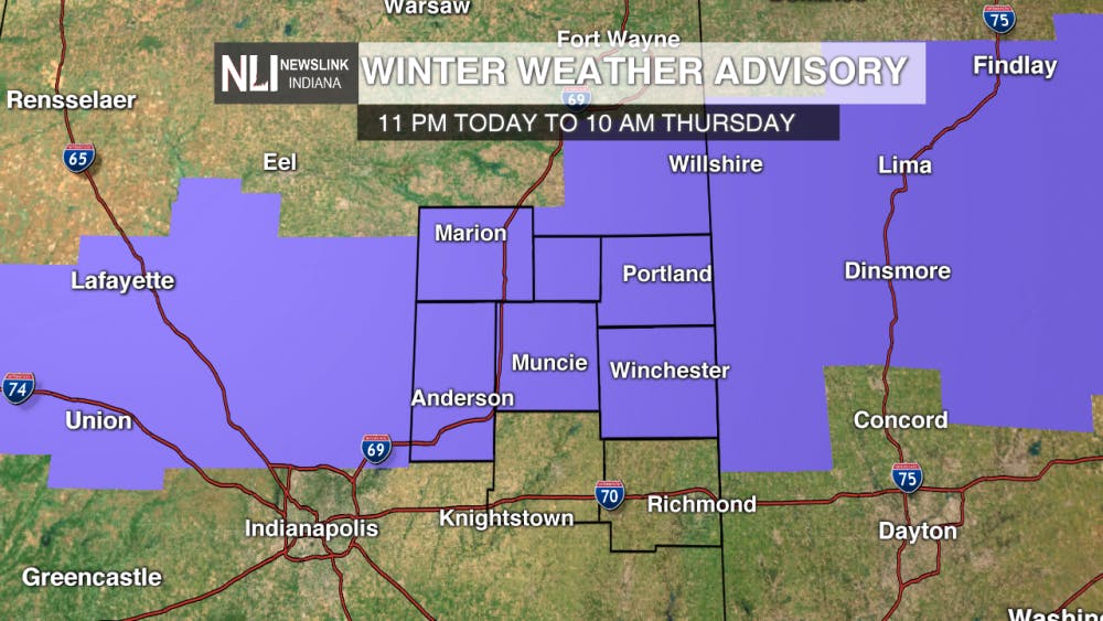
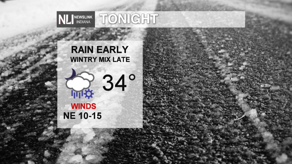
Tonight: Rain showers enter the picture late this evening, becoming widespread overnight. By daybreak, freezing rain, sleet, or snow may mix in with the rain. As a result, the National Weather Service has issued a Winter Weather Advisory for Grant, Blackford, Jay, Madison, Delaware, and Randolph counties in our area until 10 AM Thursday. Watch out for slick spots heading out in the morning.
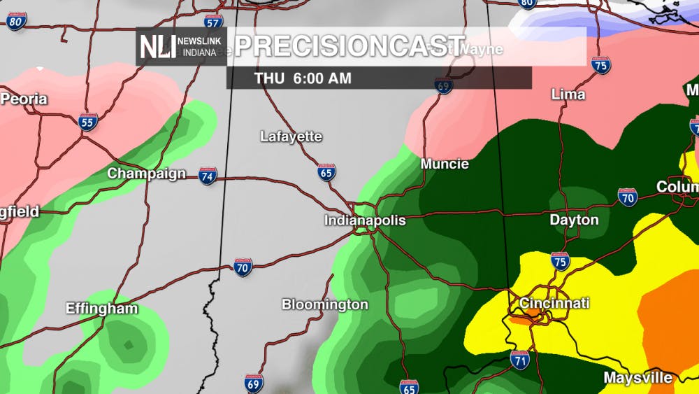
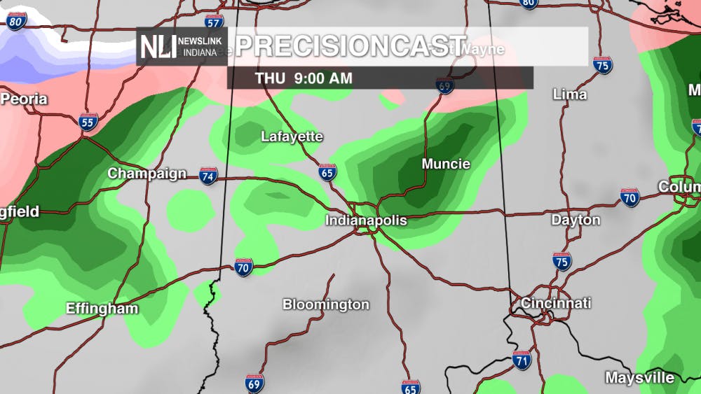
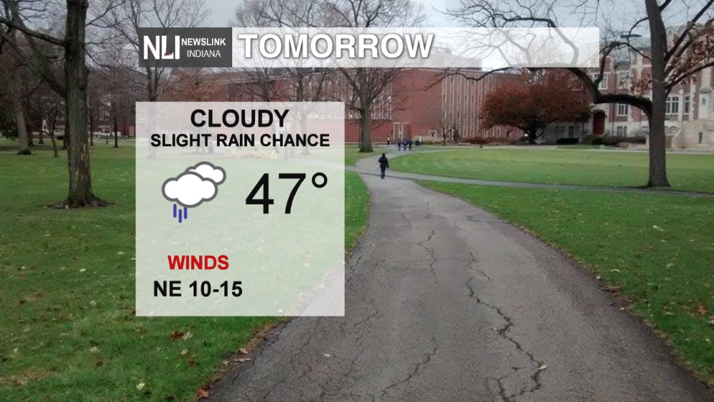
Tomorrow: Any wintry precipitation will transition to all rain by the late morning hours. Rain showers will exit the region by the early afternoon, leaving cloudy skies and temperatures in the mid-to-upper 40s.
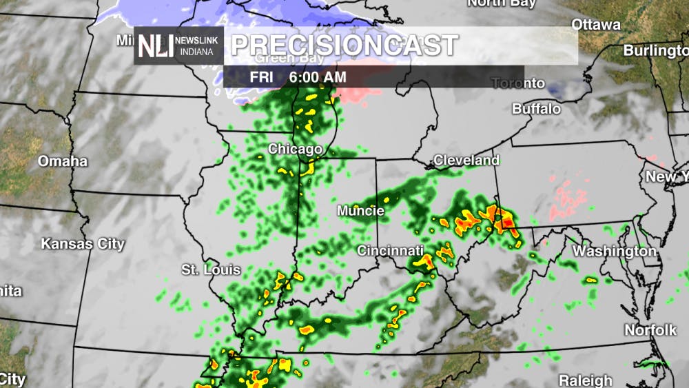
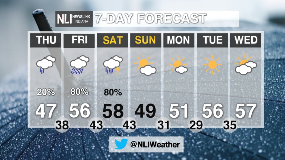
Late Week: Widespread rainfall returns to Central Indiana Friday through Saturday. A few thunderstorms are also possible on Saturday. A soggy, but warm start to the weekend is expected, before sunshine finally returns on Sunday.
7-Day Forecast: Once we make it past a soggy Friday and Saturday, next week looks much better. Temperatures will be cooler, but sunshine will prevail. Highs will gradually work their way back up toward the upper 50s by midweek.
For more updates be sure to follow us on Twitter @NLIWeather.
---Weather Forecaster Nathan Gidley
NewsLink Indiana is a proud Ambassador for the NOAA Weather-Ready Nation program.
Read More

Muncie launches Designated Outdoor Refreshment Areas
By Staff Reports / 48 minutes agoBeginning July 7, the City of Muncie announced three new Designated Outdoor Refreshment Areas (DORAs).
IPR: Gov. Mike Braun says tolling needs to be an option for Indiana’s road funding future
By Indiana Public Radio / 20 hours agoGov. Mike Braun was given slightly more expansive authority this year to explore tolling Indiana’s interstate highways.

Fairs, Fiction and Fun: Muncie’s Week of Events
By Ball State Daily / YesterdayMuncie is buzzing with events July 6–12 that won’t break the bank. Cheer on young talent at the Delaware County 4-H, or give back during Cardinal Greenway Volunteer. Prefer stories over sports? Don’t miss a cozy Evening with Author Robin Lee Lovelace. Then, tee off for a cause at the Liberty Township Fire Department Golf Tournament. Farm, read, or rally — whatever your vibe is, Muncie can match it.
