
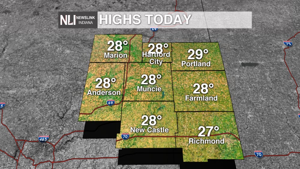
Today:
We saw temperatures across the viewing reach the upper 20's today. It's the first day in several experiencing below average temperatures, with the average for this time of year being 35 degrees.
Tonight:
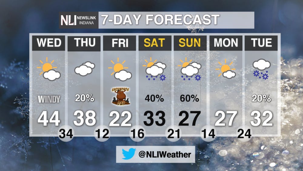
We'll see the winds start to pick back up through the overnight. Partly cloudy conditions will ensue with an overnight low of 23 degrees.

Tomorrow:
We'll see winds continue to ramp up throughout the workday Tuesday. Note the winds blowing from the south-southwest. These southerly winds will allow for the increase in temperatures, however; it will feel much colder outside despite a high in the mid 40's. By 4 pm, the time we can expect our daily high, the feels like temperature will be in the lower 30's due to the wind chill.


7 Day:
We'll see our next system work in late Wednesday into Thursday morning. This brings a 20% chance for overnight snow flurries in the area. The bigger picture within the 7-day forecast is in play for the weekend, with a mixture of snow and rain possible Saturday into Sunday. A chilly Groundhog Day is in store for Friday, with a high of only 22 degrees.
--Chief Weather Weather Forecaster Balint Szalavari
NewsLink Indiana is a proud Ambassador for the NOAA Weather-Ready Nation program.
For more information about the Weather-Ready Nation program please click HERE
Read More

9-1-1 What's Your Hot Take E7: Favorite Storylines
By Willow Emig and Sam Jasionowski / 19 hours ago

Where does it go?: Ball State has a complex relationship with recycling.
By Antonia Liakas / 23 hours agoBall State has a complex relationship with recycling.

‘Freedom in letting go’
By Kate Farr / 23 hours agoMy time here made me realize I’m more than my academic career.
