


It's that time of year again where severe weather becomes prominent in the Midwest, and especially here in Muncie. The severe weather threat tonight has all hazards possible including heavy rain, winds, hail and tornadoes. We are here to break it down and give you the info you need to know.
Background behind the storm system
As with typical storms, a low pressure system is tracking across the United States. Typically, cold fronts attached to these pressure systems are associated with thunderstorms. As systems move from west-to-east, they create windy conditions to help power storm formation. In addition, a warm front to our north has brought warm, moist air from the Gulf into our area. This results in higher dew points and instability to further give storms the energy they need. Finally, winds above the surface are strong and going in different directions. This is called shear and is especially associated with fronts. As winds change direction and increase as you move upward, it allows storms to rotate and have the chance to produce tornadoes. Essentially, the low pressure system combined with moist air and strong winds is the cause of this weather.
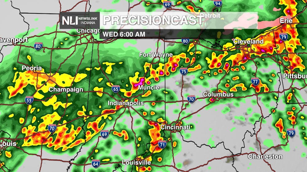
Timing of the storms
Scattered rain will continue through the evening and these showers will not cause issues. Things begin to pick up overnight and storms will become stronger. Although the severe threat to our north will begin much earlier, our best chance of severe weather in Muncie will be from 5-9 a.m. Expect for there to be difficulties in the morning commute, so give yourself extra time when leaving the house. Following the strong storms, rain will continue Wednesday until 5 p.m. where a large drop in temperatures will then occur.
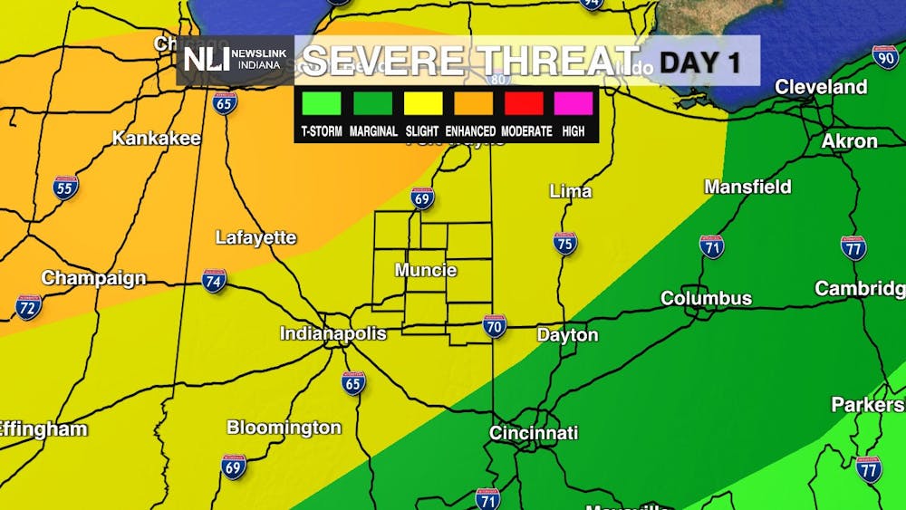
Hazards possible tonight
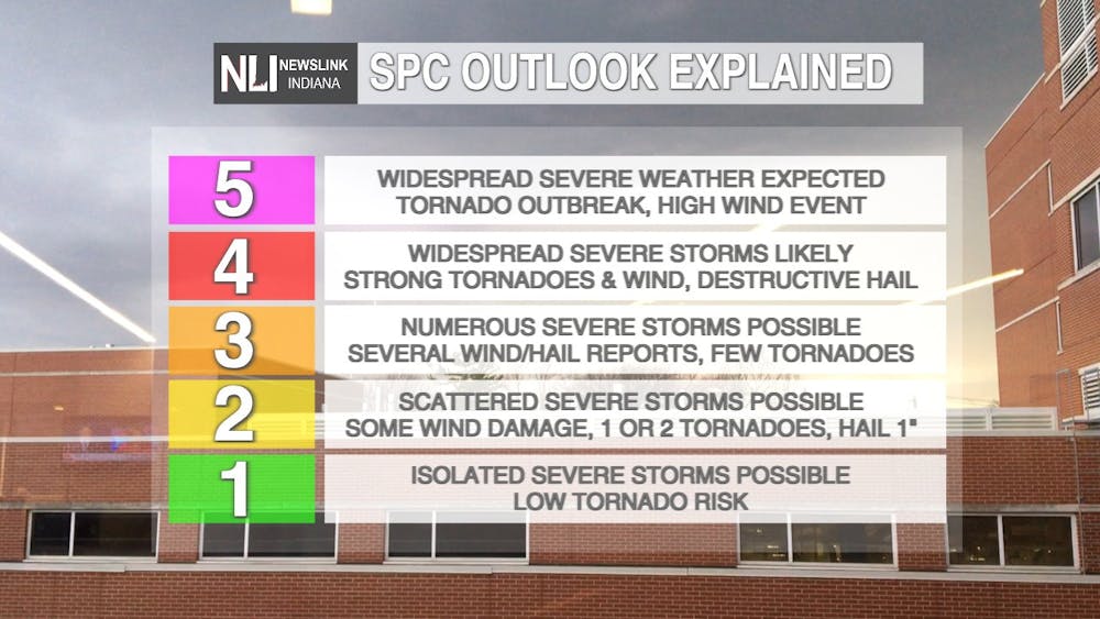
The Storm Prediction Center has placed the NewsLink Indiana viewing area in a Slight risk, which is 2/5 on the severe weather scale. All hazards will be possible tonight. This includes heavy rain with an isolated flood threat, wind gusts up to 60 mph, hail up to an inch, and possible tornadoes. The main threat area will be to our northwest and include Metro Chicago. However, just because we are not in the highest risk area does not mean to take this lightly. Weather can change fast and storms can become severe quickly.
In short, expect for there to be strong storms tonight and for them to affect your commute tomorrow. Storm systems like this are already dangerous, but this occurring at night makes them even more difficult. Remain weather aware and have a way to receive warnings this evening, and enjoy the warm temperatures today before they drop.
- Chief Weather Forecaster Joseph Sawicki
Follow us on Facebook, Instagram, and X @NLIWeather for breaking weather updates.
NewsLink Indiana is a proud Ambassador for the NOAA Weather-Ready Nation program.
For more information about the Weather-Ready Nation program please click HERE
