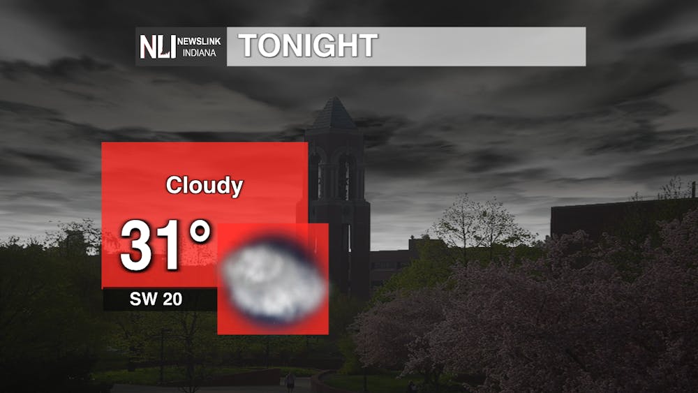
Tonight: We are going to see a low of 31 degrees tonight staying just below freezing and having pretty persistent cloud cover throughout the night. Wind gusts are still going to be pretty high even reaching 40 mph in some places.
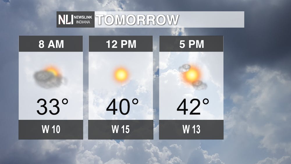
Tomorrow: We can start to feel some of those warmer temperatures start to come through with a high of 45 degrees and will also see the sun peek out as clouds start to roll out of the area. Winds will stay lower around 10 to 15 mph, but still having a possibility of gusts up to 20 mph.
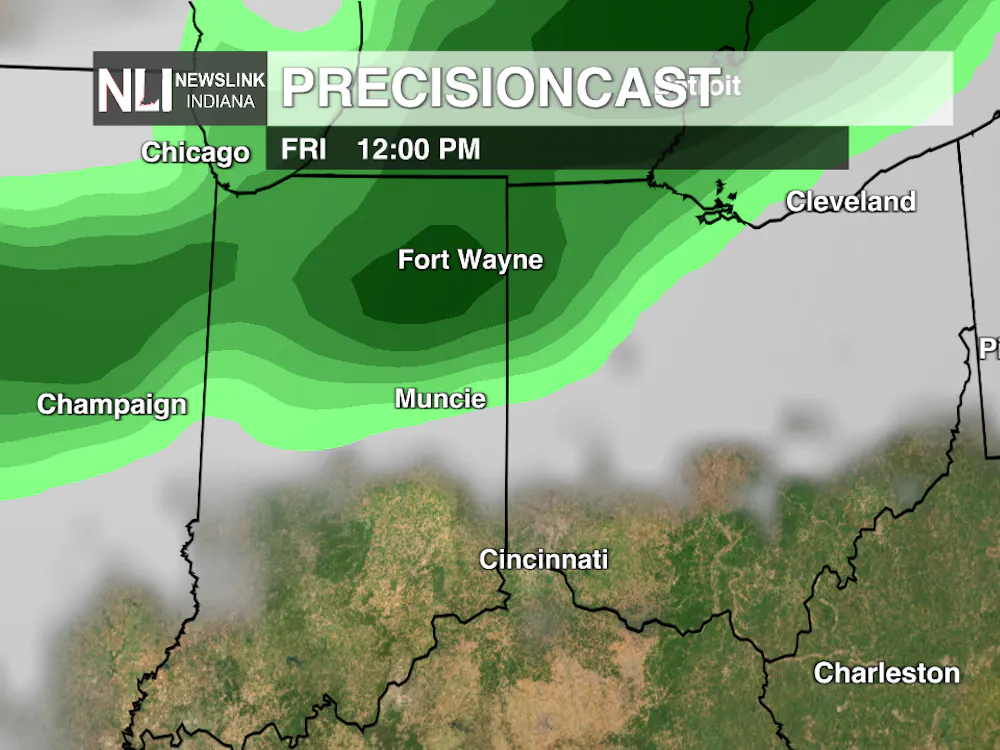
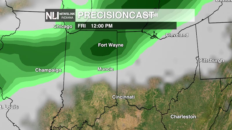
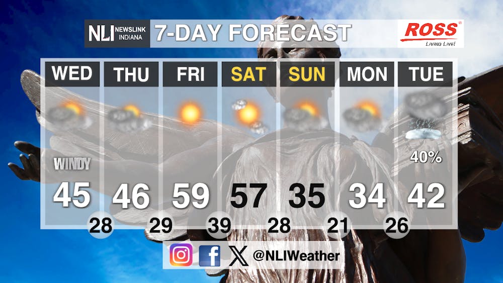
Seven-Day Forecast: We are going to be a little all over the place tracking the next seven days. We are going to start off with temperatures in the mid-40's on Wednesday and Thursday and then seeing a big spike to almost 60 degrees on Friday. Saturday we are also going to see similar temperatures to Friday but then we will cool back down to the mid-30's by the end of the weekend. Cooler temperatures will still linger around on Monday but Tuesday we could actually see a possibility of freezing rain as some cold core showers pass through the area.
- Weather Forecaster Jonas Hinderer
Follow us on Facebook, Instagram, and X @NLIWeather for breaking weather updates.
NewsLink Indiana is a proud Ambassador for the NOAA Weather-Ready Nation program.
For more information about the Weather-Ready Nation program please click HERE