


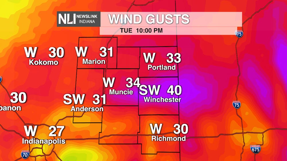
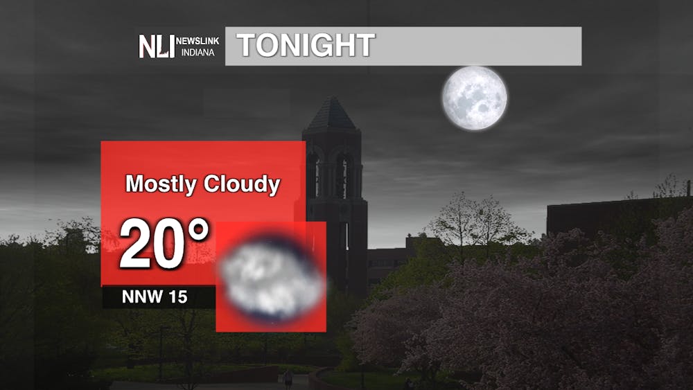
Tonight: Surface and upper-level ridging will make its way into our area tonight as low pressure exits eastward. Looking at models, mid to high level clouds riding tonight's ridge will provide the cloudiness for tonight. Along with this ridge warm air will also return, but will mostly lead to slight upper level warming. Another notable element worth mentioning is wind chill temperatures and wind gusts. The wind chill and wind gust combo will make tonight's low of 20 degrees feel a lot colder. Dress very very warm.
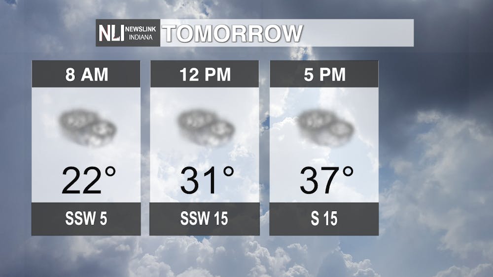
Tomorrow: Low pressure from the west assisted with short waves will enhance the probability of a system coming into our area. Tuesday specifically will serve as a transitional day where weather will change from one pattern to another. As high pressure moves eastward out of our area the winds shift direction becoming southerly. This provides our area with warmer air (warm air advection). This warmer air from the south is the leading reason our temperatures will be in the 40's.
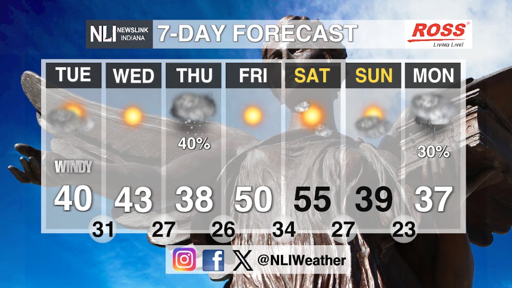
Seven-Day Forecast: That low pressure that I mentioned before will continue to strengthen just west of us (towards the upper Mississippi) on Wednesday. The more it strengthens, the more we're at risk for wind and better snow and rain chances. During the day Wednesday we'll continue to experience warm temperatures and more of the southerly wind along with mostly dry conditions. But come Wednesday night into Thursday morning a cold front associated with our strengthening low will increase our cloud coverage and create pre-frontal rain, possibly snow. As our low moves towards the Great Lakes and the cold front passes through, temperature drop and wind direction shifts Northwest , no longer receiving warm southerly flow. Thursday is when we'll feel the change in everything . Come Friday though, the return of high pressure will build again clearing out the skies and pushing for low-50's. The warm up is a result of the angles ridge shifted towards the Atlantic coast. Saturday will likely be our warmest day starting our Spring break off with warmth. A clipper also known as a small, quick, light precipitation along with a cold air snap may also bring colder temperatures, increasing cloud coverage and possible rain and snow mix Saturday into Sunday.
- Weather Forecaster Rachel Fulton
Follow us on Facebook, Instagram, and X @NLIWeather for breaking weather updates.
NewsLink Indiana is a proud Ambassador for the NOAA Weather-Ready Nation program.
For more information about the Weather-Ready Nation program please click HERE
