


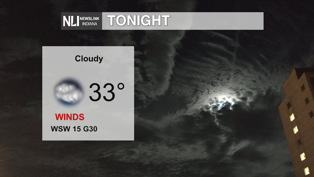
Tonight: Another cold night is ahead for us with the low being 33 degrees. The conditions will be cloudy with heavy wind gusts up to 30 mph so make sure to bundle up as you're going outside this evening.
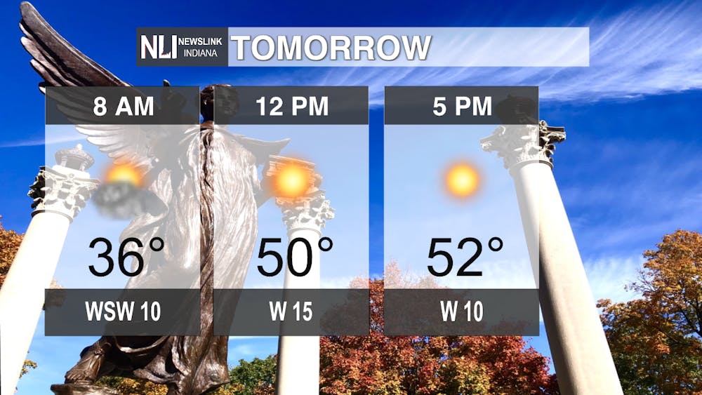
Tomorrow: The cloudy conditions from Tuesday night will persist throughout most of Wednesday morning with the temperature as you start your walk outside to work or school will be 36 degrees. It will start to rapidly warm up towards the afternoon, as the high for tomorrow is expected to be in the mid-to-low 50s. The cloud cover will dissipate throughout the day, leaving sunny conditions for a beautiful day outside.
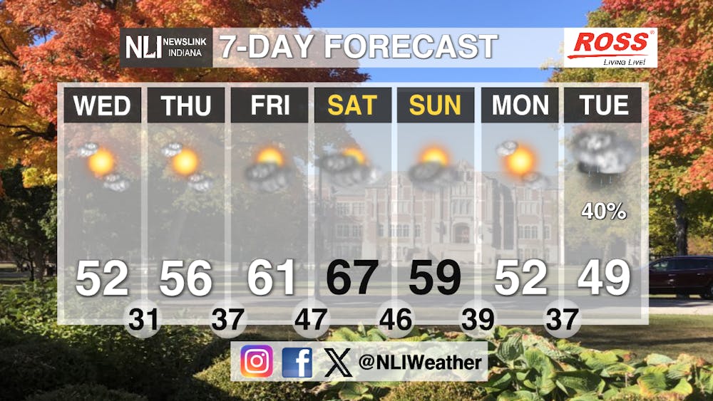
Seven-Day Forecast: After the cold temperatures and the snowy conditions of the weekend, those fall temperatures and conditions return to our area. The end of the week will see temperatures in the mid-50s and low-60s. Saturday will be a warmer day with the high being 67degrees. It will start to cool off again on Sunday, with temperatures dropping back into the high-50s. As the next workweek begins, chances of rain move into our area again with a 40 percent chance of precipitation on Tuesday. Conditions throughout the end of this week will mostly sunny, with more clouds moving in towards the weekend, with mostly cloudy conditions being the normal this weekend.
-Weather Forecaster Evan Reed
Follow us on Twitter @NLIWeather for breaking weather updates.
NewsLink Indiana is a proud Ambassador for the NOAA Weather-Ready Nation program.
For more information about the Weather-Ready Nation program please click HERE
