


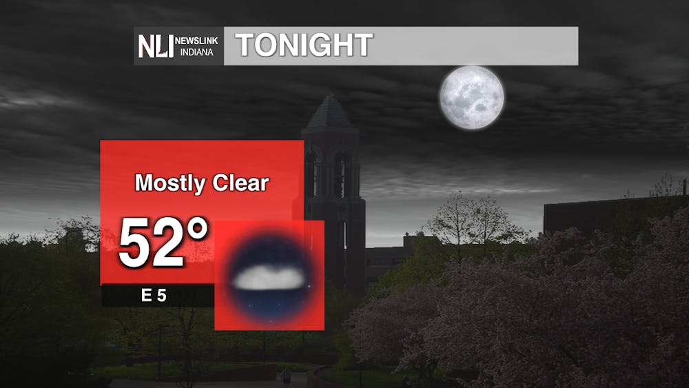
Tonight: Keep that jacket or hoodie handy because lows are going to drop into the low-50s overnight. Mostly clear conditions are in the forecast with light winds. These cool overnight temperatures are helping us to avoid a constant heat bubble similar to what the Midwest experienced in June and July.
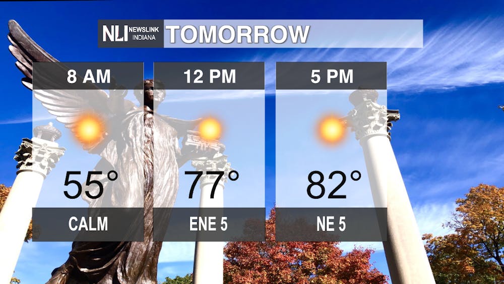
Tomorrow: Similar to the previous days, temperatures are going to start off in the mid-50s before rapidly heating up into the high-70s by the lunch hour. High temperatures will peak in the 80s with little relief. Low wind speeds and cloud cover will make for a hotter day before the worst heat moves in by the weekend.
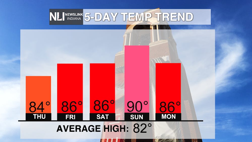
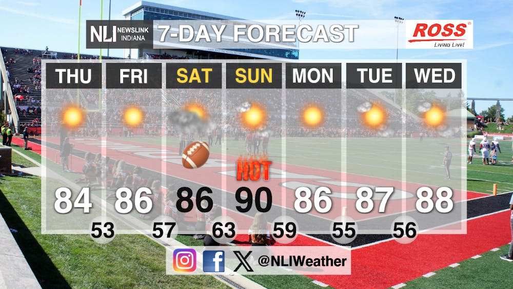
Seven-Day Forecast: The forecast is looking like we are back in mid-summer, with highs reaching into the high-80s and reaching the 90 degree mark on Sunday. Saturday's forecast for Ball State's first home football game is going to be in the mid-80s with moderate cloud cover throughout the day. The chance of a rain shower in the evening is starting to appear in weather models, so be on the lookout for some sprinkles Saturday evening. Lows will be in the 50s and 60s, helping to cool things down before temperatures rise again throughout each day of the week.
-Chief Weather Forecaster Joseph Sawicki
Follow us on Twitter @NLIWeather for breaking weather updates.
NewsLink Indiana is a proud Ambassador for the NOAA Weather-Ready Nation program.
For more information about the Weather-Ready Nation program please click HERE


