


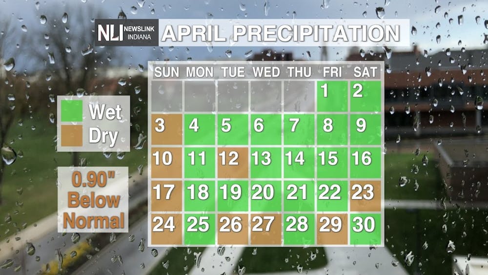
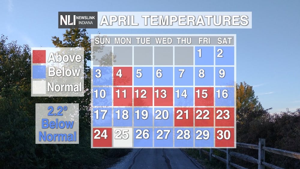
April was a cool and dry month across northeastern central Indiana. The Delaware County Regional airport received measurable rainfall almost every day in April. Most days, however, it was usually less than 0.10". Interestingly enough, every Sunday in April was dry! Despite record breaking temperatures in the 80s on the 23rd and 24th, we ended the month over 2 degrees below normal! We saw several cool stretches throughout the month and 4 nights with low temperatures below freezing.
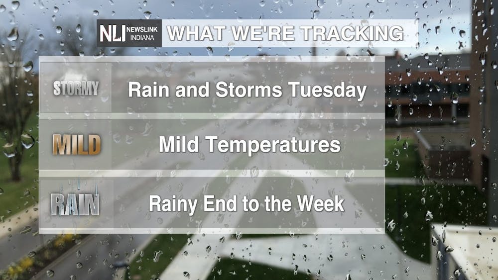
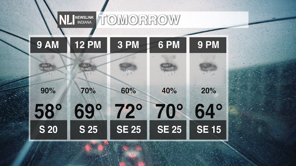
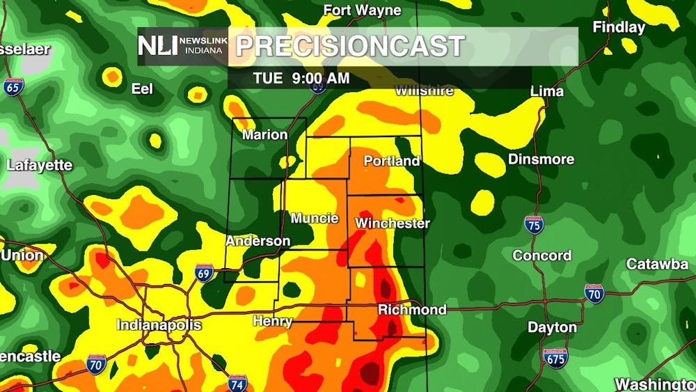
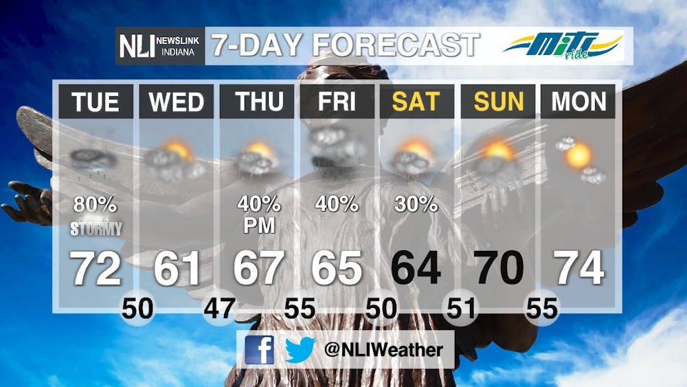
Tuesday: Rain and thunderstorms are on tap throughout the day tomorrow for the first day of Finals Week! Widespread rain will move into northeastern central Indiana after midnight. The heaviest rain will move through during the morning hours, so if you have any finals tomorrow morning make sure to have an umbrella on hand! With an already saturated ground from last weekend's rain, localized flooding is a concern. Never drive through a flooded roadway! Turn Around, Don't Drown!
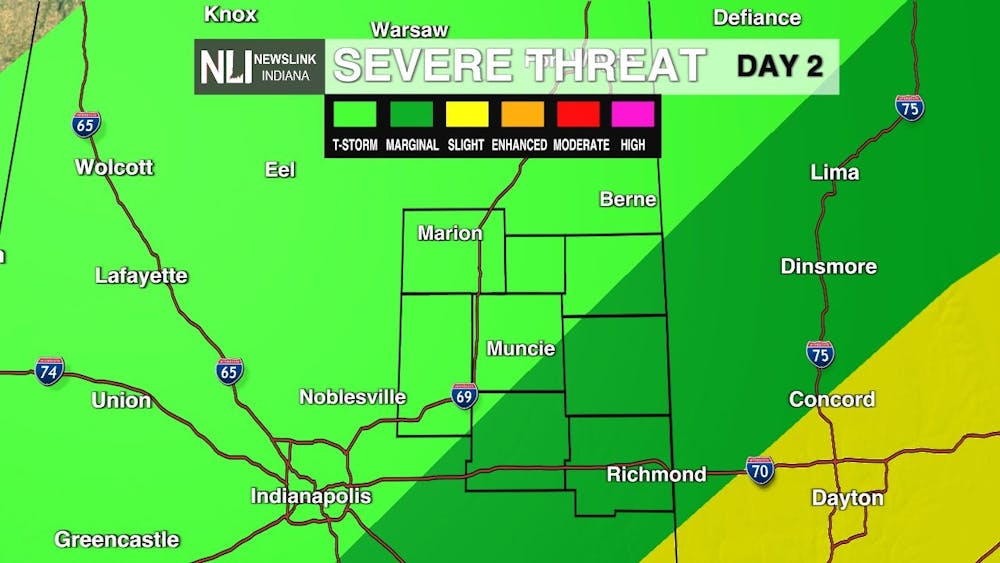
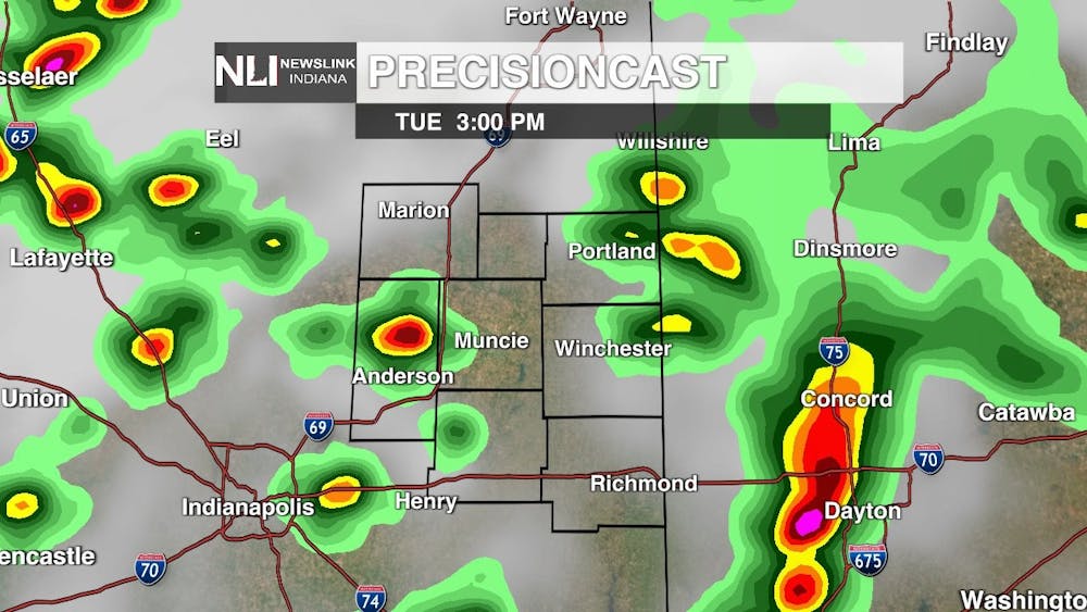
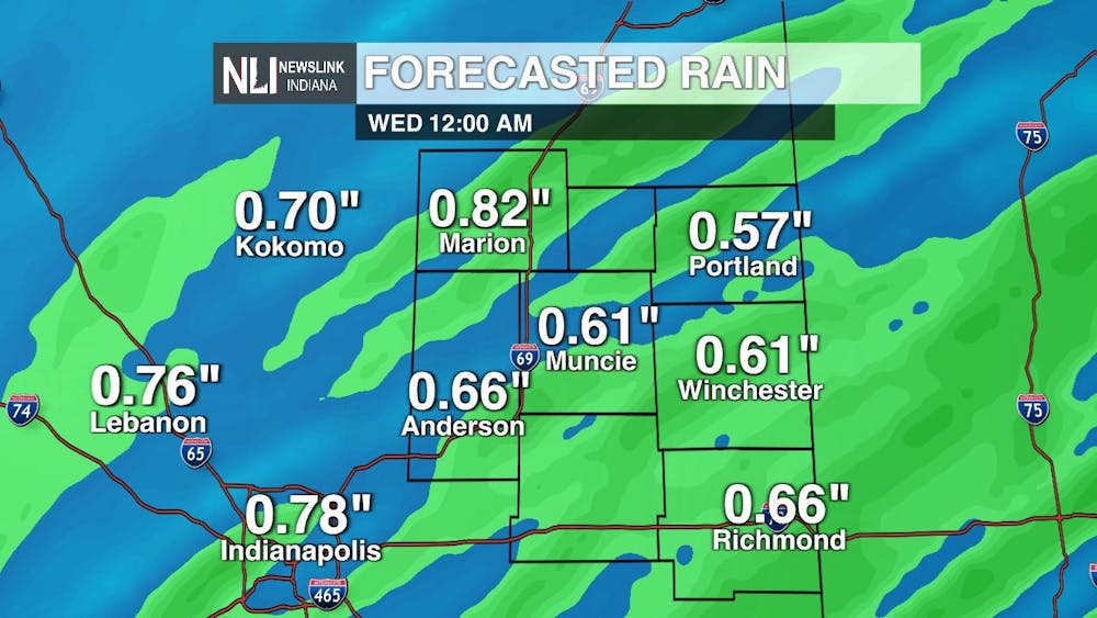
Embedded thunderstorms are also possible throughout the day, especially for the southeastern half of our viewing area, where a Marginal Risk (level 1/5) for severe weather is in place for Tuesday. The primary threat is damaging wind gusts of 60+ MPH. Winds will be strong out of the south at 15-25 MPH with 35 MPH gusts possible. Forecasted rain totals are between 0.50-0.75" by midnight on Wednesday, with locally higher amounts possible where thunderstorms set up.
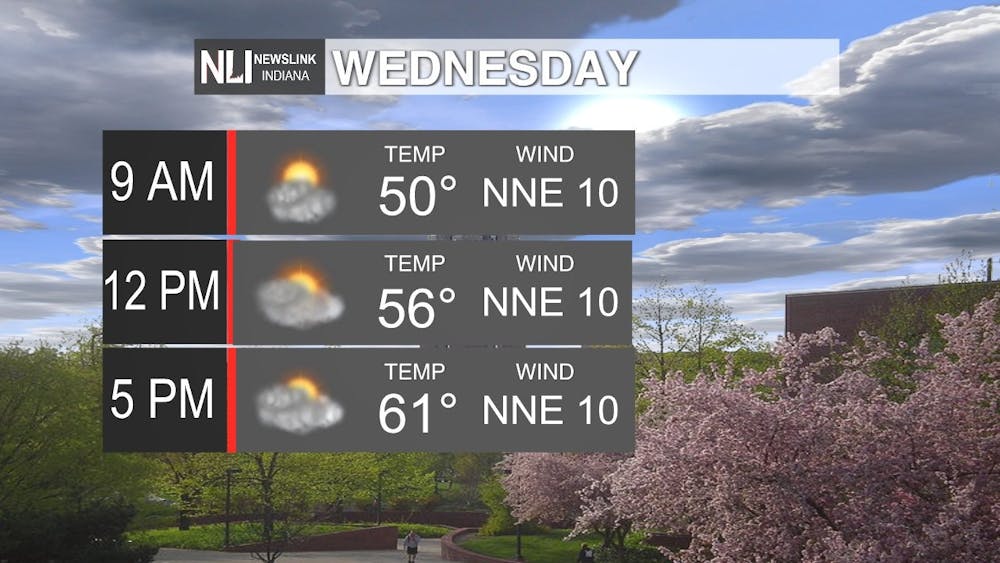
Wednesday: For the second day of finals week, it will be dry and mild with mostly cloudy skies. Winds will be out of the north northeast, which will help keep temperatures below average in the lower 60s.
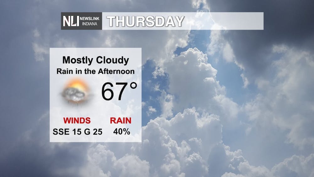
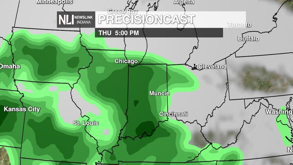
Thursday: On Thursday, a dry morning is expected with rain moving in during the afternoon. Temperatures will be right at average for this time of the year with a high of 67 degrees. It will be breezy with south southeasterly wind gusts of up to 25 MPH.
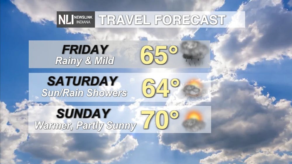
7-Day Forecast: For the end of the week and into the weekend, it will be mild with intermittent sun and rain showers. If you have plans to head home for the summer, expect rainy travel conditions on Friday and into Saturday morning. Sunday will be warmer and dry. Into next week, there will be sunny skies and warmer temperatures into the mid 70s.
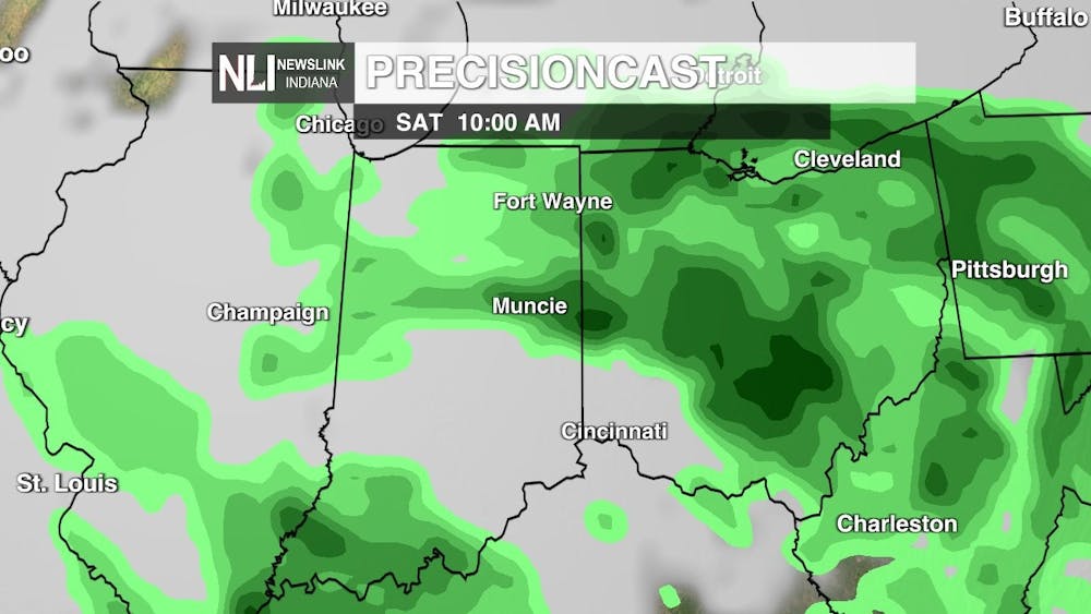
If you are graduating on Saturday, May 7th, congratulations! Unfortunately, we are tracking chances for rain on Saturday morning. Models are currently showing rain at 10 AM on Saturday when Commencement starts, but this could change as we fine tune the forecast in the coming days. Saturday looks to have intermittent showers throughout the day.
---Chief Weather Forecaster Maddi Johnson
Follow us on Twitter and Facebook @NLIWeather for breaking weather updates.
NewsLink Indiana is a proud Ambassador for the NOAA Weather-Ready Nation program.
For more information about the Weather-Ready Nation program please click HERE
