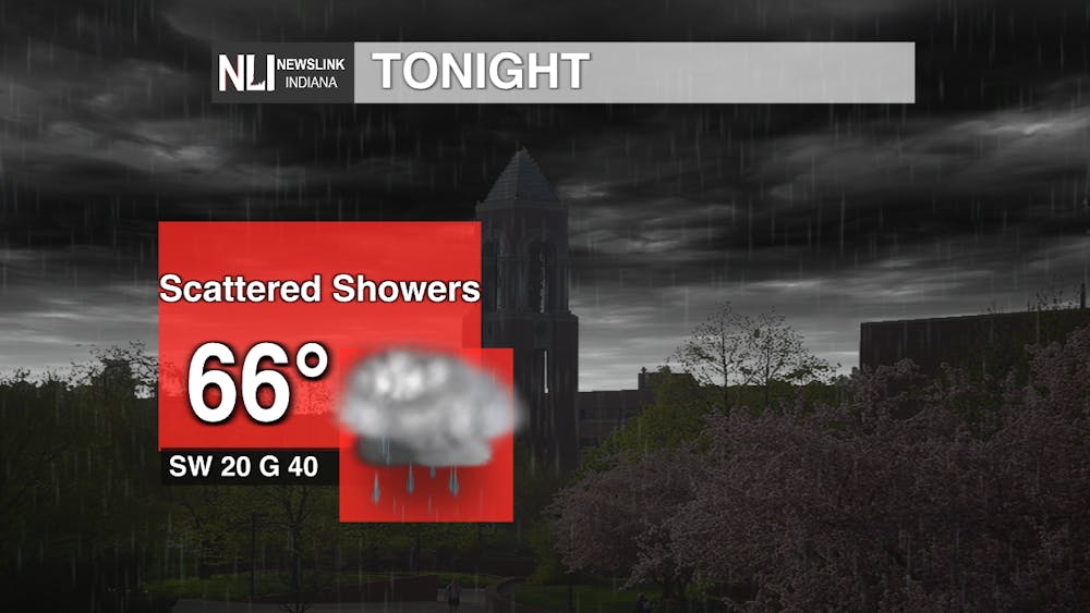
Tonight: A line of showers and thunderstorms will push through our area shortly after dark. High wind gusts and potential hail will be the biggest threat. This is a fast moving storm, so it will be out of our area in an hour or so. There will be some widespread scattered showers and thunderstorms following the first system.
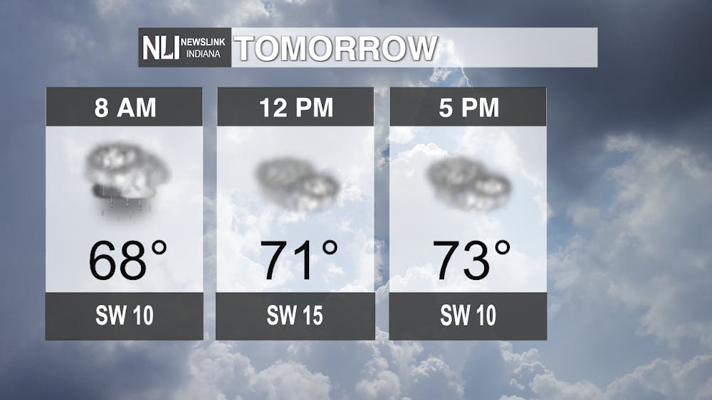
Tomorrow: Chance of short-lived showers on and off throughout the day. The temperature will reach 70 degrees. Overcast skies all day.
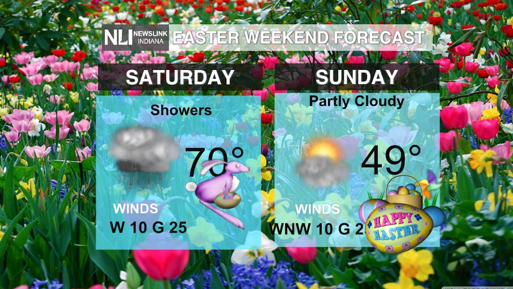
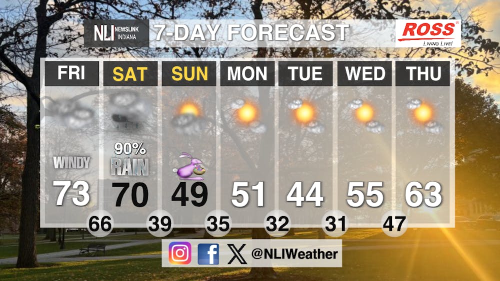
Seven-Day Forecast: Cold front coming through Saturday afternoon, causing temperatures to drop and a chance for heavy downpours in the afternoon. Easter Sunday will be a little chilly, but dry for now. Starting the work week with below to right at average temperatures. Temperatures will be back in the 60s towards the end of the work week.
-Weather Forecaster Elia Stowers
NewsLink Indiana is a proud Ambassador for the NOAA Weather-Ready Nation program.
Follow us on Facebook, Instagram, and X @NLIWeather for breaking weather updates.
For more information about the Weather-Ready Nation program please click HERE