


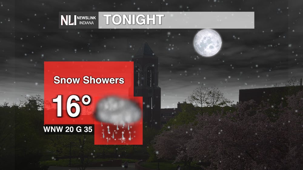
Tonight: Temperatures will be well below freezing as we hit mid-high teens. Snow showers are expected to continue into tonight with broader accumulations than what we saw today. Expect to see anywhere between dusting to possibly an inch of snow. Colder air will continue through the area as westerly surface winds assisted with strong wind gusts come through. With a combination of dry upper air, well-below freezing temperatures, and strong wind conditions , the wind chill values are expected to drop as the night continues reaching single digits. With that being said conditions will feel drastically colder this evening into early tomorrow.
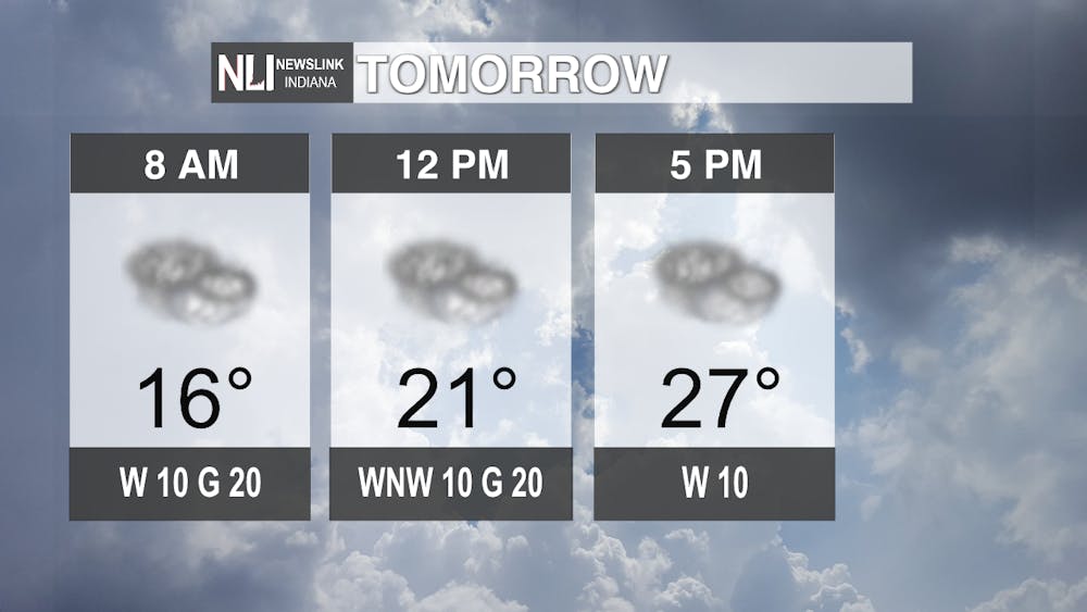
Tomorrow: Below normal temperatures will remain in the region Tuesday. Very partial and brief sunshine will assist in keeping temperatures in the mid-high 20's.
Seven-Day Forecast: As Wednesday morning approaches, a fast moving low pressure system will move through the area resulting in warm air rising above the colder air with assistance from the upper level jet. This is why there's a small percentage of snow Wednesday morning. The probable snow accumulation will probably be around 1 inch or less. Come Wednesday afternoon, temperatures will quickly increase as wind direction shifts, inviting warm southerly air into the area. Any snow that fell earlier in the day will likely melt. Come Thursday, a dominant upper-level ridge from the west will extend far East, bringing warmer temperatures into our area. Though the small transition to the ridge could provide light showers towards the afternoon. Temperatures this weekend look to be beautiful as this ridge supports southerly wind movement and higher moisture values. As for next week though, temperatures look to cool down from Sunday into Monday as a cold front moves through bringing about possible rain showers.

- Weather Forecaster Rachel Fulton
Follow us on Facebook, Instagram, and X @NLIWeather for breaking weather updates.
NewsLink Indiana is a proud Ambassador for the NOAA Weather-Ready Nation program.
For more information about the Weather-Ready Nation program please click HERE


