


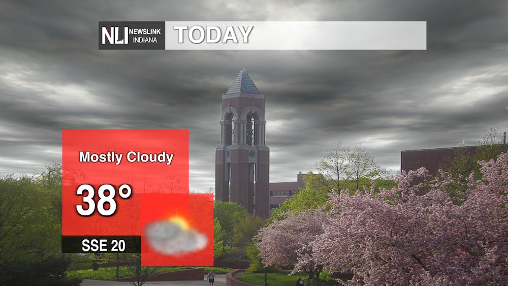
Today: The storm system that brought yesterday's weather will continue to move out of the area pulling in cold air accompanied by strong winds. Expect winds about 20 mph with gusts up to 40 mph to continue in the morning but slowly fade over the afternoon. Also, look for the sky to clear going into later hours. The high today should not pass 40 degrees.
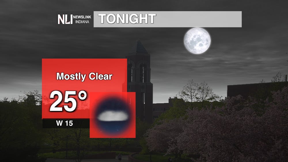
Tonight: Winds will continue to blow into the night around 15 mph. Temperatures will dip into the twenties and could get as low as 25 degrees. If going out for this Friday evening, make sure to wear a warm coat and bring those gloves and a hat.
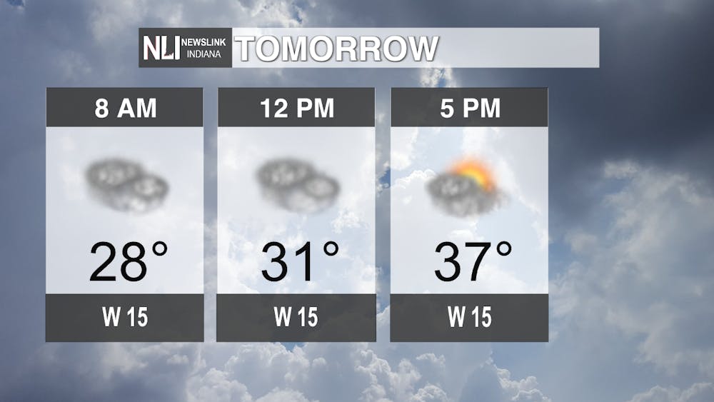
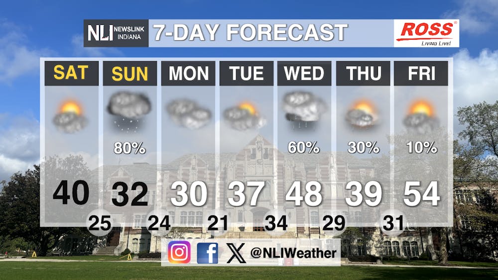
Tomorrow: Saturday will see the sun be shrouded until the late afternoon. Clouds and cold will dominate the morning hours. Winds will continue to blow rather steadily at about 15 mph.
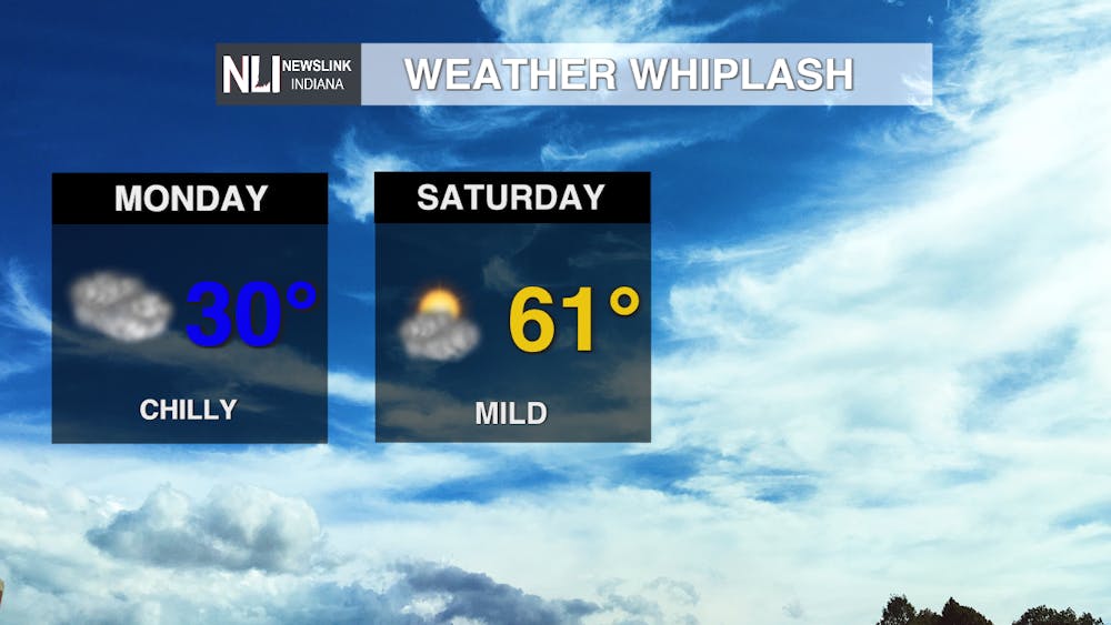
Seven-Day Forecast: The spring season will continue to battle the winter this coming week. Winter weather including snow, wind, and cold will dominate this weekend while the spring takes its turn again later in the week. Look for some snow showers on Sunday with accumulations around a half to one inch. Later in the week, another low pressure system will began to suck warmer temperatures into the region with rain possible.
- Weather Forecaster Edward Hill
Follow us on Facebook, Instagram, and X @NLIWeather for breaking weather updates.
NewsLink Indiana is a proud Ambassador for the NOAA Weather-Ready Nation program.
For more information about the Weather-Ready Nation program please click HERE
