


Tonight: Conditions this evening will be similar to what we experienced this afternoon. Flurries will linger throughout the night with occasional heavier snow showers possible. Temperatures stay steady in the low-20s and actually rise slightly. Winds begin to pick up, but nothing crazy, coming from the southwest at 10 mph.

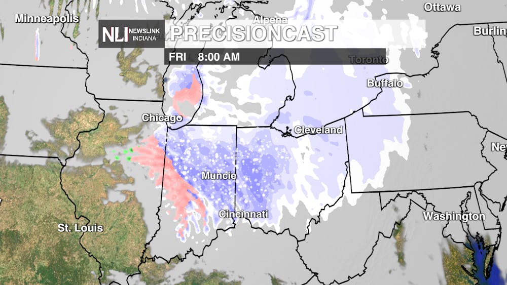
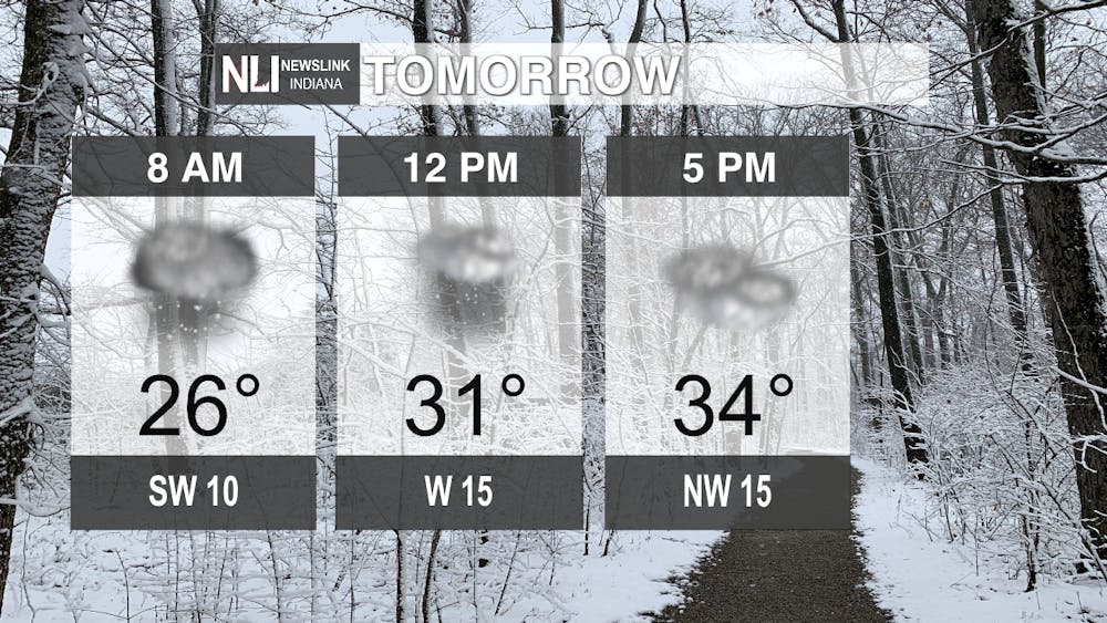
Tomorrow: Temperatures have a great chance to break the freezing point tomorrow for the first time since January 22. However, winter will not stay away. Another round of snow moves in tomorrow morning. This will impact the morning commute a bit with accumulations between 1-2 inches likely. Isolated areas of 2+ inches are also possible. The snow moves out by noon and clouds persist throughout the day. Winds will pick up with gusts up to 35 mph as a cold front moves through. This will knock temperatures back down to what we've been dealing with recently.
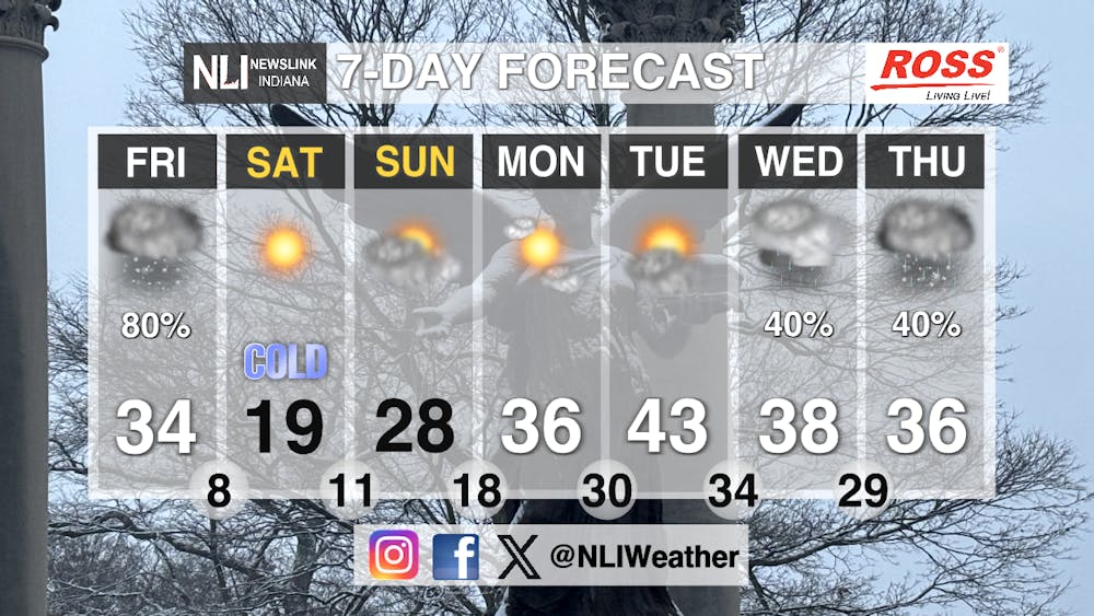
Seven-Day Forecast: The weekend starts off on the chilly side with temperatures in the teens and wind chills below zero once again. Sunshine does return Saturday, with clouds lingering at periods through the next few days. Highs reach above freezing by Monday with a great chance of breaking 40 degrees Tuesday. Rain enters the picture by mid-week with a wintry mix possible next Thursday as temperatures begin to slide. Stay safe on the roads and warm over the weekend!
- Chief Weather Forecaster Joseph Sawicki
Follow us on Facebook, Instagram, and X @NLIWeather for breaking weather updates.
NewsLink Indiana is a proud Ambassador for the NOAA Weather-Ready Nation program.
For more information about the Weather-Ready Nation program please click HERE
