


For yesterday's article with a full preview of the winter weather this weekend, click HERE
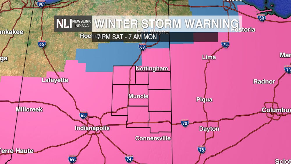
We're here to provide a few updates about this weekend's winter storm and what it means for the NewsLink Indiana viewing area. We have been upgraded from a winter storm watch to a winter storm warning, which will last from 7 p.m. Saturday to 7 a.m. Sunday. This was done following models continuing to show high snowfall totals for the Muncie area over the weekend.
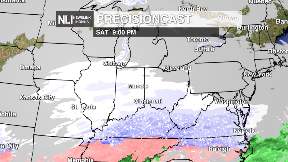
Heavy snow with wind gusts up to 25 mph will make conditions Sunday very hazardous. Paired with wind chills continuing to be in the negatives, and Sunday continues to be optimal for staying indoors.
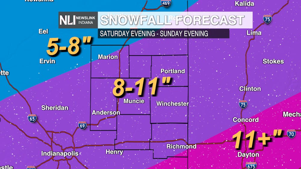
Our estimate for snowfall totals has moved upward since yesterday. Muncie is now forecasted to receive between 8-11 inches of snow this weekend. The snow begins to move in around dinnertime tomorrow and persist all day Sunday. The snow moves out Sunday evening into very early Monday morning.
Once again, travel is set to be difficult this weekend. If you need to go somewhere, give yourself plenty of time to get to your destination. This includes Monday morning, where roads will likely still be covered with snow.
If you're looking for relief from the cold, you sadly will not find it anytime soon. Temperatures are not expected to break 20 degrees within the next seven days. Get ready to bundle up, stay warm, and keep that shovel handy throughout the week ahead. Continue to stay safe and warm this weekend!
-Chief Weather Forecaster Joseph Sawicki
Follow us on Facebook, Instagram, and X @NLIWeather for breaking weather updates.
NewsLink Indiana is a proud Ambassador for the NOAA Weather-Ready Nation program.
For more information about the Weather-Ready Nation program please click HERE
