


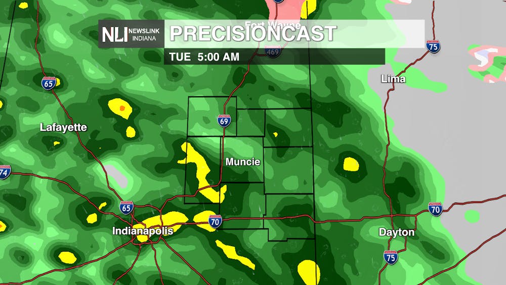
Tonight: An upper-level trough three miles above us is expected to shift very slightly creating a broad upward motion ahead of it. This lift will bring about increasing cloud coverage as well as scattered showers occurring Tuesday morning. A stray thunderstorm or two is possible because of cooler, higher up air, but overall these storms should be weak.

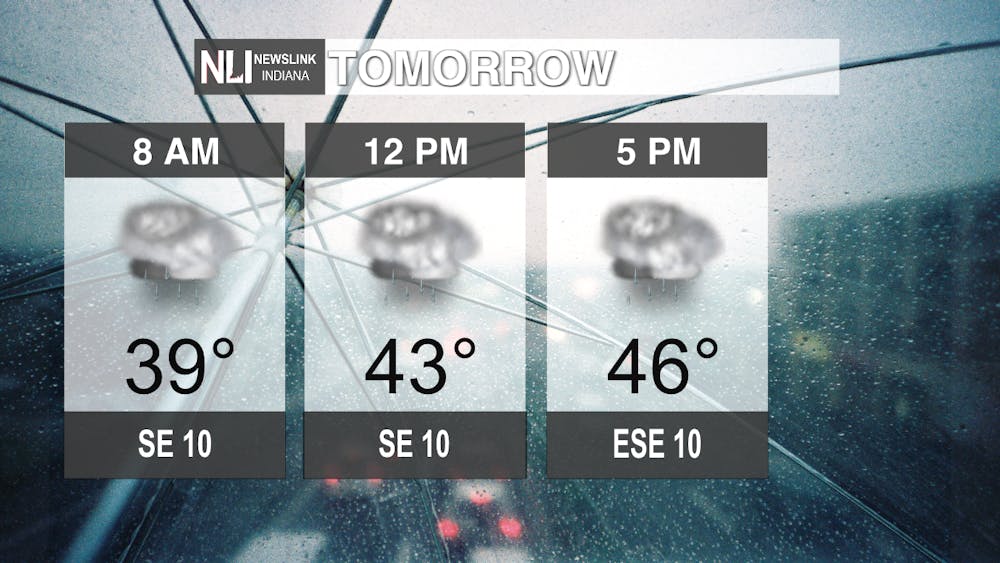
Tomorrow: A shortwave will cause a small disturbance tomorrow bringing about a lot of rainfall for much of the day. The beginning of this rainfall is expected tomorrow morning around 4:00 a.m. Rain should start to taper off late Tuesday night as a brief ridge of high pressure moving in towards the north brings about drier, calmer conditions with cloud coverage slightly decreasing.
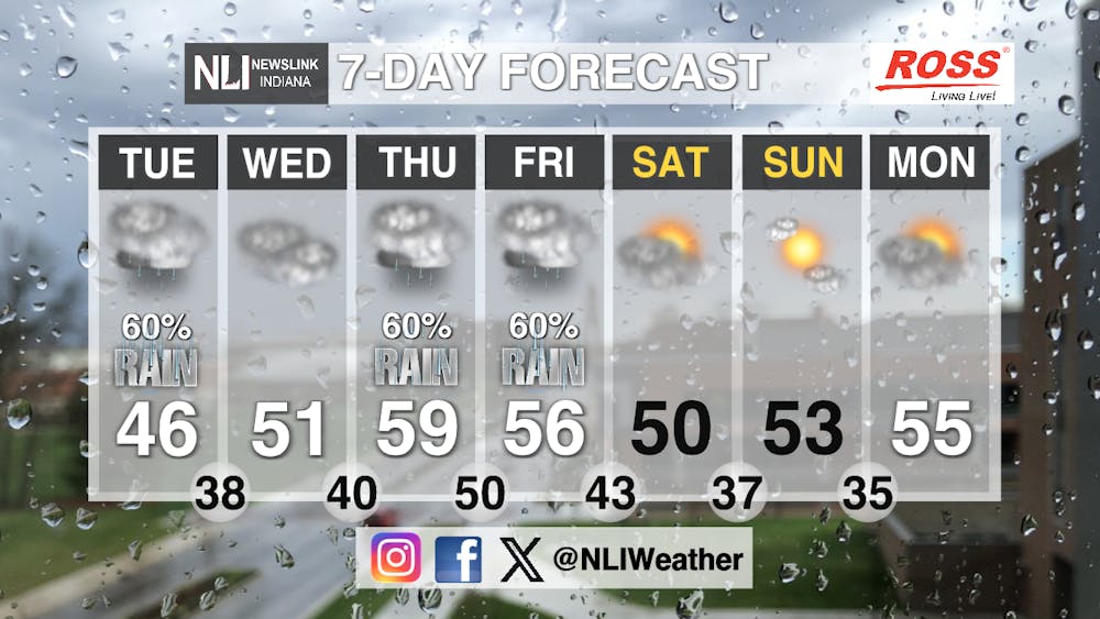
Seven-Day Forecast: For the next several days there will be a series of pattern changes relating to weather phenomena as well as several isobaric changes. Towards the middle to more later in the week a much stronger short wave is expected. Southerly flow along with warm air advection should increase the temperature Thursday and Friday. With additional rain showers along with a possibility of weak thunderstorms. After this shortwave moves out, high pressure will make an appearance Friday night into Saturday bringing about quiet and dry conditions. This high will remain stable until about Monday where we will see increasing cloud coverage along with possible precipitation.
- Weather Forecaster Rachel Fulton
Follow us on twitter @NLIWeather for breaking weather updates.
NewsLink Indiana is a proud Ambassador for the NOAA Weather-Ready Nation program.
For more information about the Weather-Ready Nation program please click HERE.
