


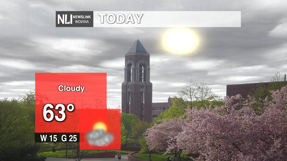
Today: A very average fall day getting up to 63 degrees. We will continue to see strong winds coming out of the west at 15 mph. There will also be several wind gusts getting up to 25 mph. We are also seeing a lot of cloud cover throughout the day.
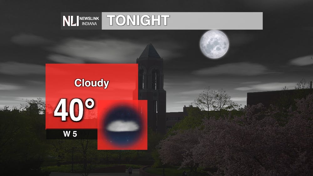
Tonight: Those clouds we are experiencing today are going to stay with us throughout the night. The temperature will get down to 40 degrees as the low and the winds will start to calm only coming from the west at 5 mph.
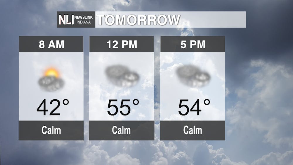
Tomorrow: It will be a brisk start to the morning at only 42 degrees. It won't warm up too much more throughout the day only getting up to the mid-50s. Still seeing that cloud coverage and calm winds, hopefully giving us a much needed break from those strong wind gusts.
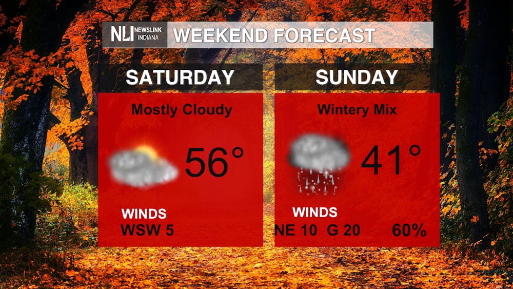
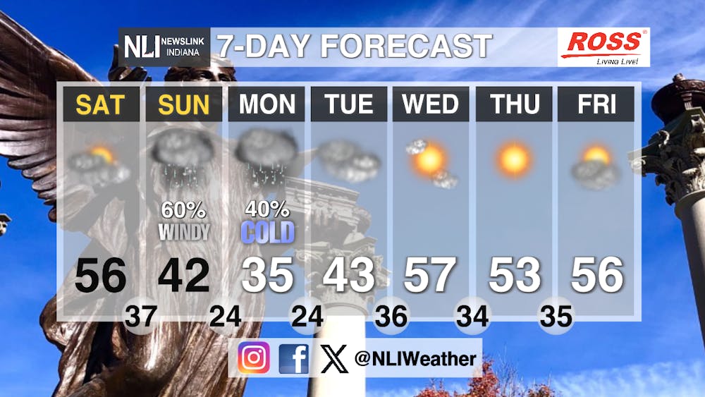
Seven-Day Forecast: Saturday will start off as a typical, mid-50s, fall day but we see Sunday might hold the first winter-like event of the season. These afternoon snow showers, that we are anticipating, may bleed over into Monday morning. It will be a very cold day on Monday only getting up to 35 degrees as the high. Luckily, after these showers pass through, it will start to warm up getting us back into those mid-50s that we usually see this time of year.
-Weather Forecaster Orion Lucas
Follow us on Twitter @NLIWeather for breaking weather updates.
NewsLink Indiana is a proud Ambassador for the NOAA Weather-Ready Nation program.
For more information about the Weather-Ready Nation program please click HERE
