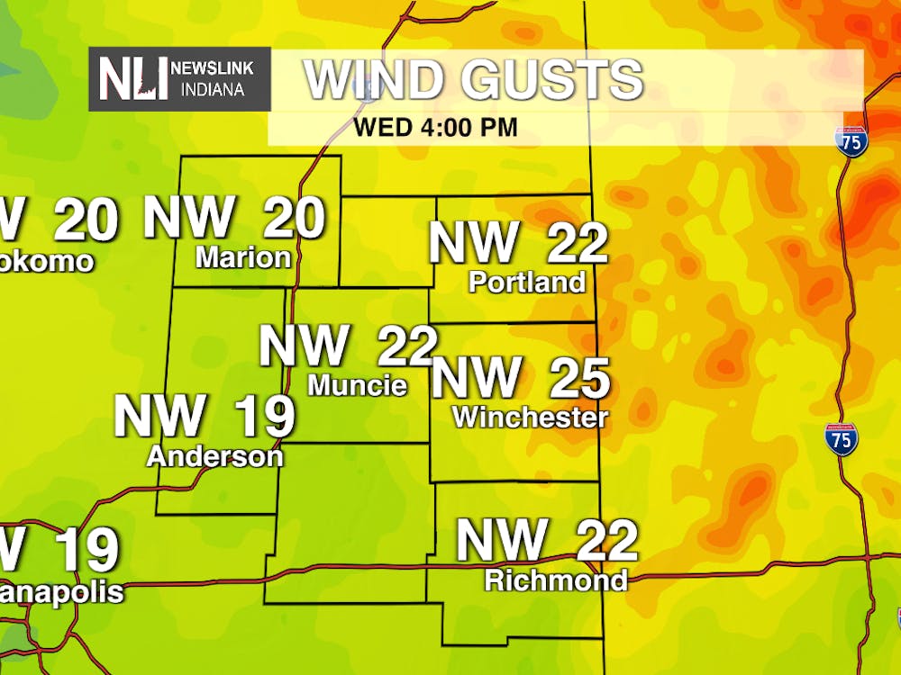
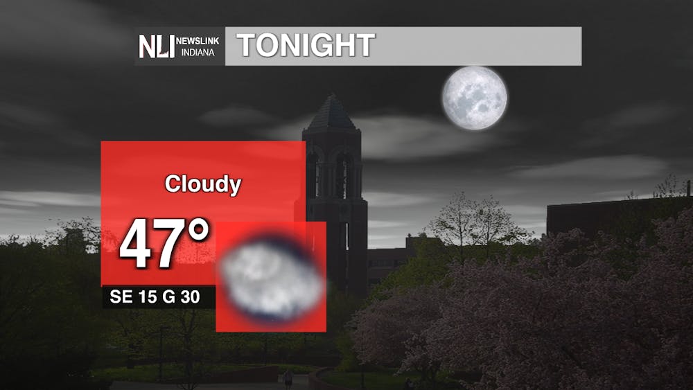
Tonight: Temperatures decreasing into the mid-40's. Winds coming from the southeast at 15 mph with gusts up to 30 mph possible. Rain chances increase as we go into the overnight hours.
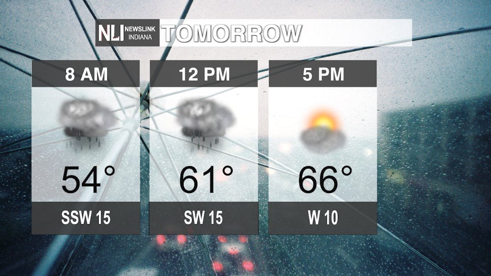
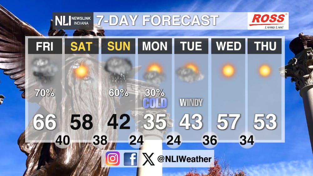
Tomorrow: Rainy start to the day. 70 percent coverage as we start the morning that should clear out by the mid-afternoon. High of 66 degrees. Wind gusts up to 30 mph but will calm down as the rain dissipates out of our viewing area.
Seven-Day Forecast: Very active weather coming our way. Rain chances on Friday. High wind gusts will be coming and going all throughout the weekend. Models are favoring our first snow to occur Sunday evening into Monday morning. High temperatures significantly decrease as we start the workweek, with a high of 35 degrees on Monday. Wind chills in the 10s are possible Sunday and Monday night.
-Weather Forecaster Elia Stowers
Follow us on Twitter @NLIWeather for breaking weather updates.
NewsLink Indiana is a proud Ambassador for the NOAA Weather-Ready Nation program.
For more information about the Weather-Ready Nation program please click HERE