


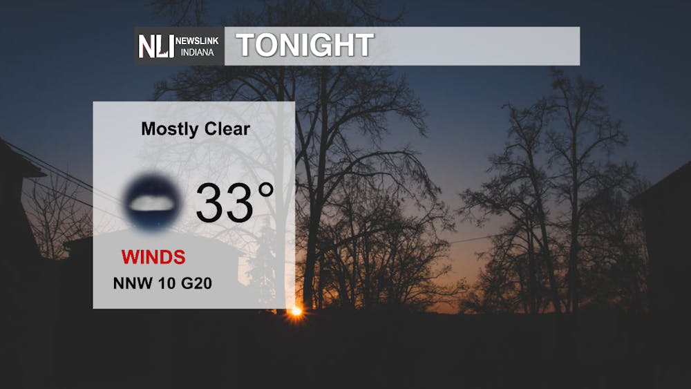
Tonight: It will start to cool off quickly tonight with lows expected to be 33 degrees. I would recommend a heavier coat tonight, not just to help with the cold, but to keep off the wind. Winds will blow 10 mph with gusts up to 20 mph.
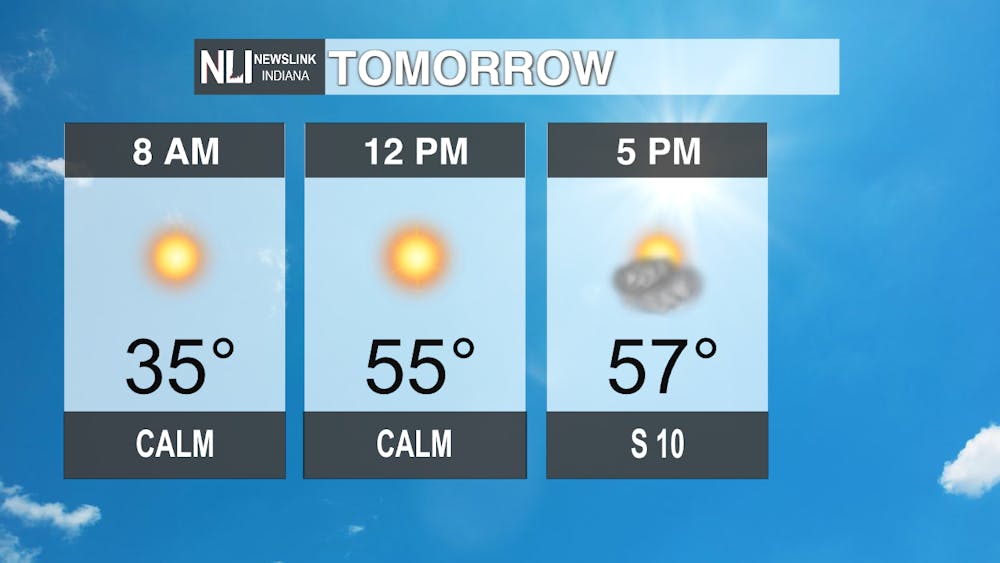
Tomorrow: It will reman cooler tomorrow morning as you start your walk to work or school. Temperatures will remain in the mid 30s for most of the morning, then at noon we will have beautiful sunny conditions and 55 degree weather. Clouds will start to move into our area around 4 with our high tomorrow being 57 degrees with those partly cloudy conditions to finish the day.
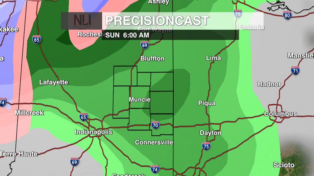
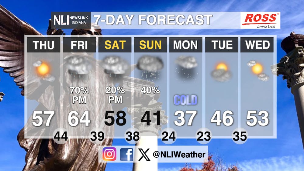
Seven-Day Forecast: Temperatures will remain higher towards the end of the week with Thursday's high being 57 degrees and Friday the high is expected to be 64 degrees. Unfortunately, on Friday is when the rain chances begin, as there is a 70 percent chance of showers in the afternoon. These chances will continue into Saturday afternoon with a 20 percent chance of showers Saturday evening. Sunday the temperatures will start to drop more drastically with the high being only 41 degrees and the first chances of snow come into our area. The coldest day of the next seven days will be Monday with the high only being 37 degrees with chances of light snow throughout the day. The sun will start to return in the middle of next week and temperatures slowly returning to those mid 40s and low 50s.
-Weather Forecaster Evan Reed
Follow us on Twitter @NLIWeather for breaking weather updates.
NewsLink Indiana is a proud Ambassador for the NOAA Weather-Ready Nation program.
For more information about the Weather-Ready Nation program please click HERE
