


Tonight: Get ready for some late-night thunder action! Some storms are expected to roll through the area after midnight with some models as late (or as early) as 2 am! These should be quick hitters, but it would not be surprising to see some of these hit with some locally damaging winds and the threat of some hail. These should clear well before daybreak, though, so those morning commutes should be in the clear!

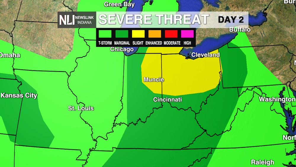
Tomorrow: Another wave of severe weather on deck as we destabilize from morning to afternoon! The storms should mature right as they get over our area and some models have differing opinions on where they fire up & get stronger. Based on past setups like this, I would not be surprised to see this threat stay or perhaps shift west - stay tuned for updates!
7-day Forecast:We drop down to the 50s for the weekend, but might be able to squeeze out a nice Late-Nite Carnival day before we really get chilly. Frost concerns are really more of a thing for Sunday night/Monday morning before we recover for nicer temperatures in time for next Tuesday!

-Weather Forecaster Ryan Hill
Follow us on Twitter @NLIWeather for breaking weather updates.
NewsLink Indiana is a proud Ambassador for the NOAA Weather-Ready Nation program. For more information about the Weather-Ready Nation program please click HERE


