
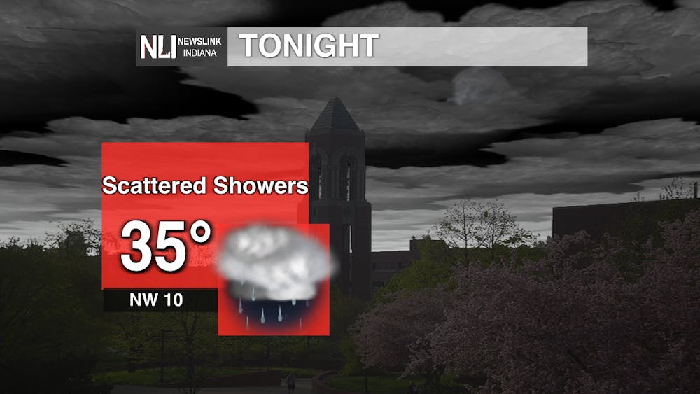
Tonight: Rain should begin to taper off the further we head into the evening, with rain chances minimal after midnight, with a cool overnight low of 35.
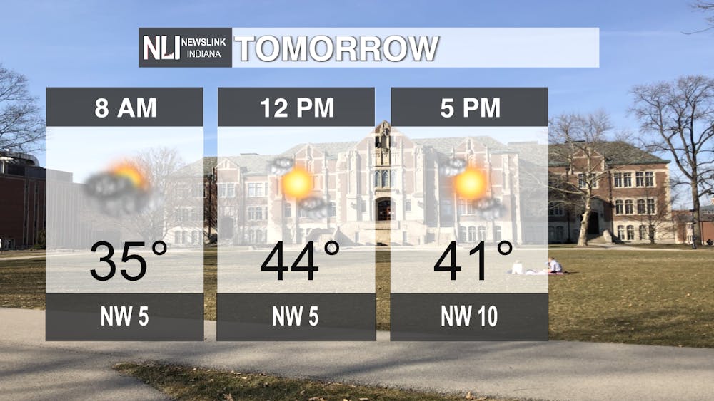
Tomorrow: A much cooler but dry Friday is ahead, with abundant sunshine and a high of 44 degrees.
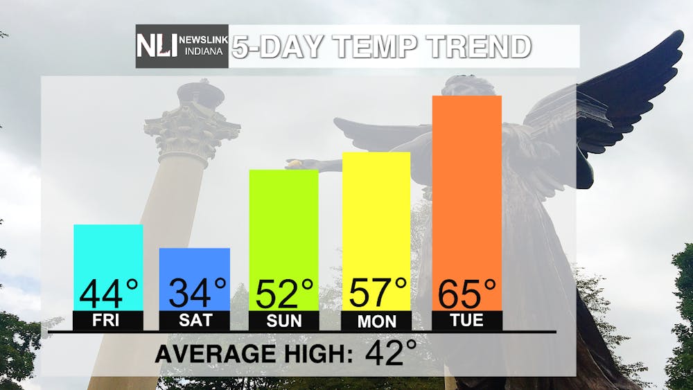
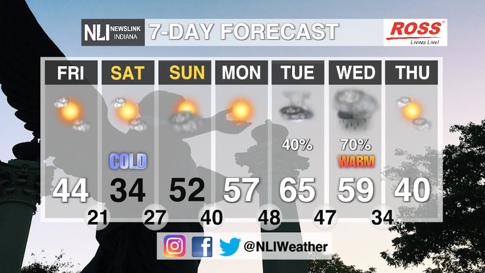
7-Day Forecast: Weather whiplash is in full effect over the next seven days, with a wide variety of effects here in East Central Indiana. Saturday looks to be sharply colder, with temperatures struggling to make it above freezing. Occasional snow showers are also a possibility in the pre-dawn hours early Saturday. Sunday looks to be nearly twenty degrees warmer, with temperatures reaching into the sixties by Tuesday. This "false spring" feel will come to end by Tuesday afternoon, as showers and possibly even some thunderstorms return Tuesday and Wednesday. After the warm-up, temperatures look to return to near average by the end of the week.
-- Weather Forecaster Noah Gordon
Follow us on Twitter @NLIWeather for breaking weather updates.
NewsLink Indiana is a proud Ambassador for the NOAA Weather-Ready Nation program. For more information about the Weather-Ready Nation program please click HERE
Read More
Cardinals elect a new pope, the first American pope in history
By Staff Reports / YesterdayCardinal Robert Prevost, an American missionary who spent his career ministering in Peru and leads the Vatican’s powerful office of bishops, was elected the first American pope in the 2,000-year history of the Catholic Church, according to the Associated Press (AP).
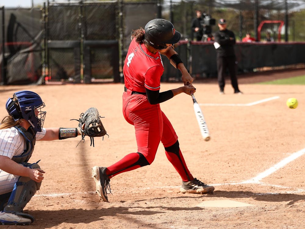
'A blue-collar team:' Ball State run rules Akron in opening game of MAC Softball Championship
By Zach Carter / 2 days agoNo. 4 Ball State topped No. 5 Akron 9-1 in the Cardinals' first game of the Mid-American Conference Softball Championship Wednesday afternoon.

9-1-1 What's Your Hot Take E8: Season 4 Recap
By Willow Emig and Sam Jasionowski / 2 days agoIn this episode of 9-1-1 What’s Your Hot Take, Sam and Willow discuss the events of season 4 of 9-1-1.
