


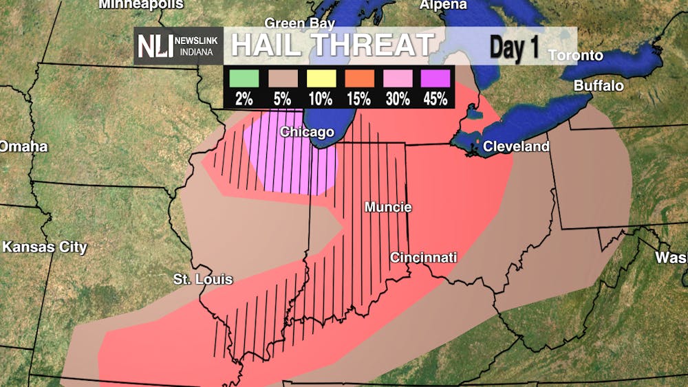
Tonight: Wild ride for us as our best shot of storms rolls through before midnight, then our next showers and gusty winds herald the arrival of a potent cold front that sends our temperatures tumbling. That 63° you see will be our high just after midnight for tomorrow, as temps continue to fall throughout the day. Stay weather aware by following our Facebook, X/Twitter & Instagram for details as they happen. We also recommend you have your NOAA Weather Radio handy as well as Wireless Emergency Alerts on as these storms carry a risk of significant hail , damaging winds and even the threat of an isolated tornado!
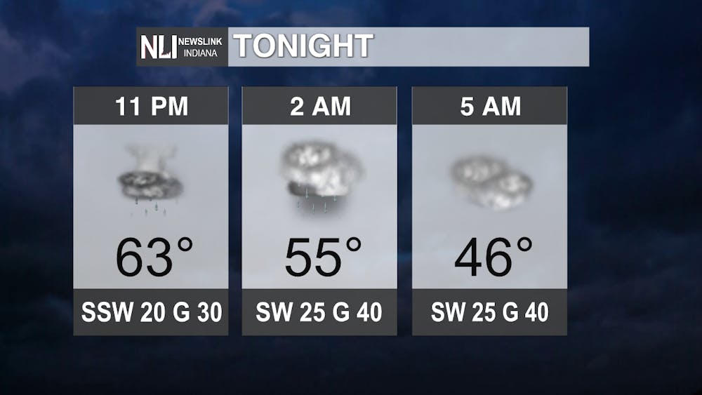
Tomorrow: Expect temperatures to crash through the 40s to the upper 30s by lunchtime & any outdoor plans call for everyone to bundle up with winds continuing to be gusty just like they were the night before!

7-Day Forecast: We then look to go back up another big hill on an ongoing weather rollercoaster as upper 60s - possibly flirting with 70s - return to Cardinal Country by the weekend. Our next weather maker will be in the form of some showers making their way in this time next week.

- Weather Forecaster Ryan Hill
Follow us on Twitter @NLIWeather for breaking weather updates.
NewsLink Indiana is a proud Ambassador for the NOAA Weather-Ready Nation program.
For more information about the Weather-Ready Nation program please click HERE
