


Today: Today we near a record high of 80 degrees as the sun peaks, with mild winds being out of the northwest around 5 mph.

Tonight: Temperatures are expected to fall to colder 35 degrees as a cold front moves through the area bringing rain and a chance of thunderstorms this evening before quickly moving out of the area before tomorrow morning.
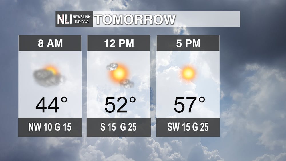
Tomorrow: Temperatures will start off at a cool 44 degrees around 8:00 AM with clouds sticking around from tonight but quickly moving out of the area to bring us clear skies. Temperatures are expected to peak around 5:00 pm at 57 degrees with a mostly clear sky before more clouds settle in late tomorrow night and early Friday morning.
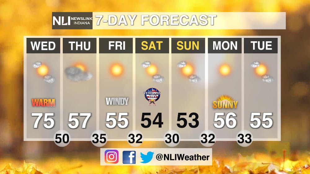
Extended: As we get into Veteran Day Weekend temperatures are expected to even out in the mid 50's with lows sticking around those near freezing temperatures so expect frost on certain mornings. The sky should remain mostly clear throughout the week as a low pressure system moves out of the area taking the vast majority of clouds.
-- Tyler Miller
Follow us on Twitter @NLIWeather for breaking weather updates.
NewsLink Indiana is a proud Ambassador for the NOAA Weather-Ready Nation program.
For more information about the Weather-Ready Nation program please click HERE
