
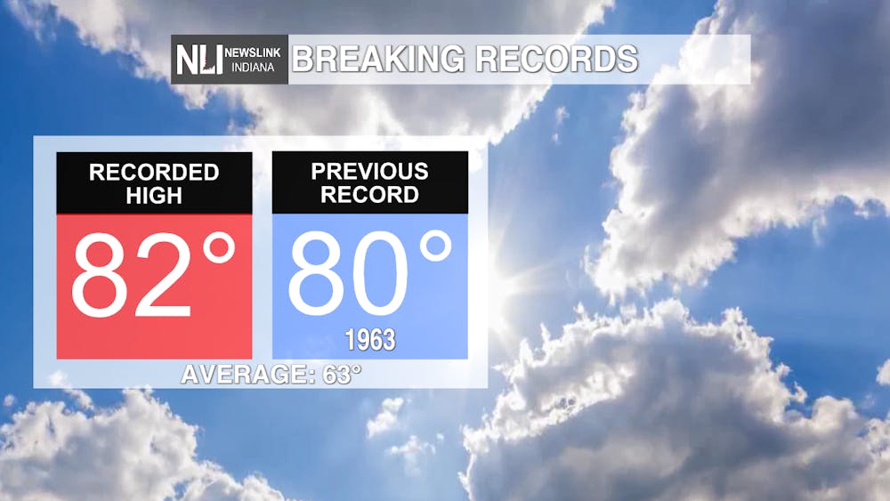
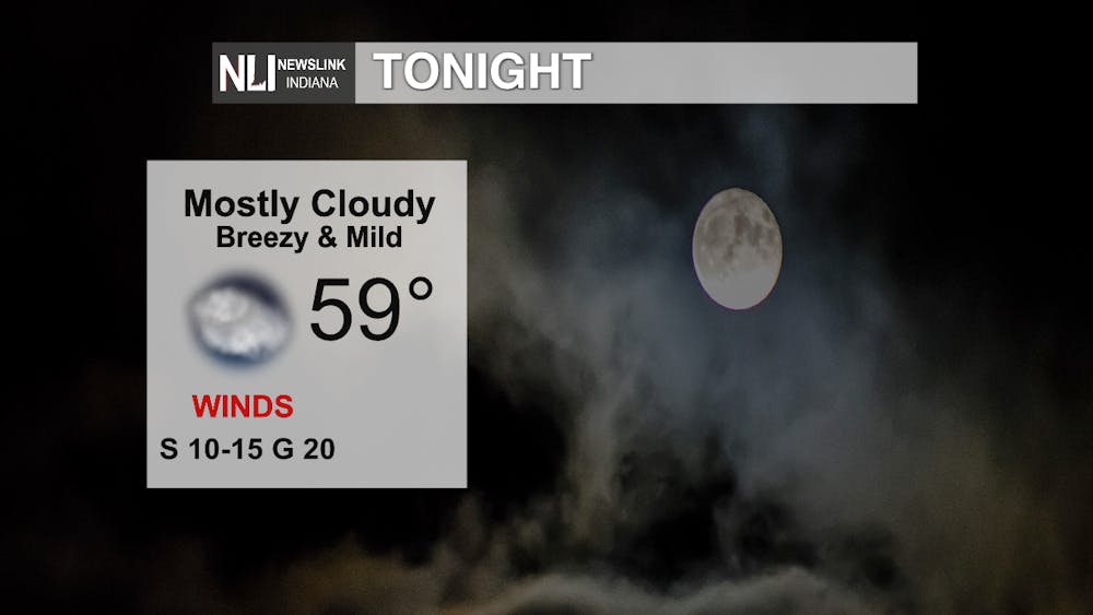
Tonight: After record breaking warmth today, temperatures will remain mild going into tonight. Typical lows for this time of year should be in the lower 40s! Breezy conditions will persist, however, which is fueling the warm temperatures we are seeing.
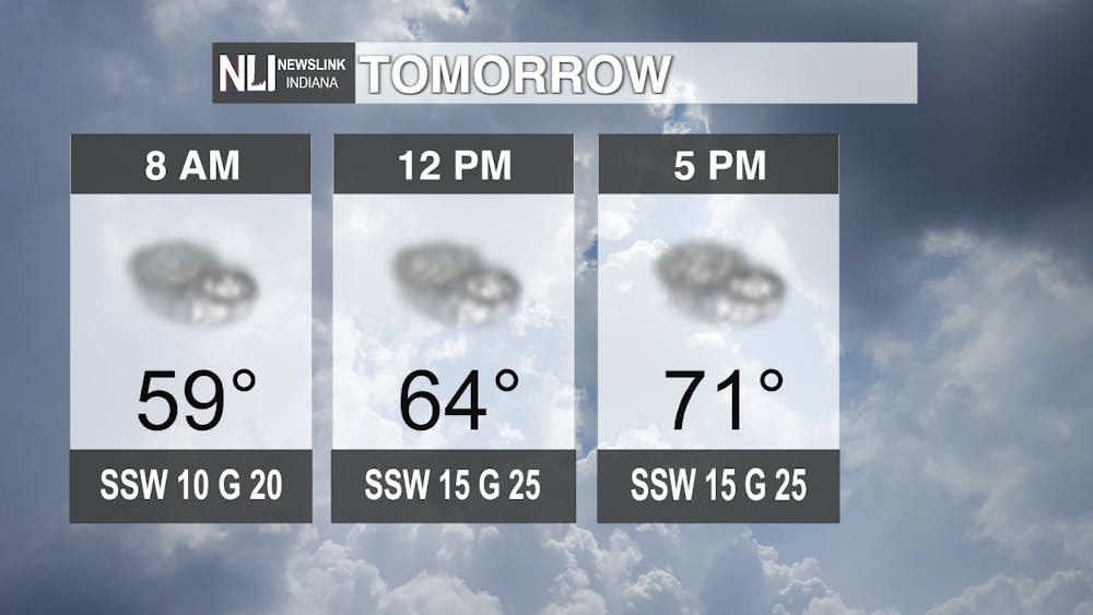
Tomorrow: Highs will climb back into the 70s and clouds will start to build. We could see a passing light shower throughout the day, but most places will remain dry. Winds will stay breezy with gusts up to 25 mph.
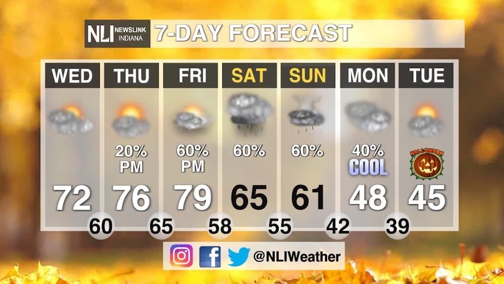
7-Day Forecast: Quite the wild ride we have in store! Temperatures hang in the 70s for the remainder of this work week. We could even be flirting with the record high on Friday! The weekend brings our next big weather maker. Expect widespread rain showers Friday night through Sunday. The greatest chance for heavy rain and scattered thunderstorms looks to be mainly on Sunday. Check out those temperatures on Monday and Tuesday! The last time we saw highs in the 40s was the first of MAY (176 days ago)! Spooky cold temperatures on Halloween, so be sure to dress accordingly!
-Chief Weather Forecaster Hope Kleitsch
Follow us on Twitter @NLIWeather for breaking weather updates.
NewsLink Indiana is a proud Ambassador for the NOAA Weather-Ready Nation program.
For more information about the Weather-Ready Nation program please click HERE
Read More

Former Ball State Mens Tennis member Gene Orlando set to coach team
By Staff Reports / 4 hours agoFormer Ball State Men's Tennis Hall of Famer Gene Orlando has been named the new head coach of the team, according to Ball State Athletics, following the departure of long-time Head Coach Bill Richards, announced last week.

Muncie Moments: July Kick-off
By Ball State Daily / 10 hours agoLooking for free fun around Muncie? From June 29 to July 4, enjoy a creative Sunday at Stitch ‘n Bitch, connect with local health and food support at Open Door Connections, and savor powerful words at the Taste of Poetry reading. Then, explore local art during First Thursday, and wrap the week with fireworks, live music, and a foam party fun at Minnetrista’s Fourth of July Celebration.

Deena's Coffee House looks to serve a cup of community
By Kylee White / YesterdayLocated on 417 N. Reserve St, Deena’s Coffee House hopes to welcome and promote the community.
