


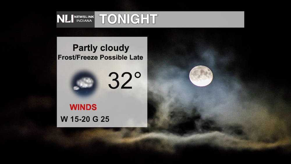
Tonight: Temperatures will drop down to a low of 32 degrees under partly cloudy skies. It will be breezy at times as well. A frost or freeze is possible late with temperatures dropping to near freezing. Make sure to take any perishable plants inside to keep them from perishing in the cold weather.
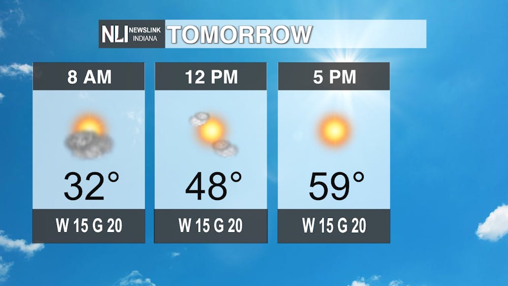
Tomorrow: It will be much warmer for your Tuesday with temperatures reaching the upper 50s by late afternoon after a cold morning near the freezing mark. It will be a bit breezy as well with the milder temperatures.
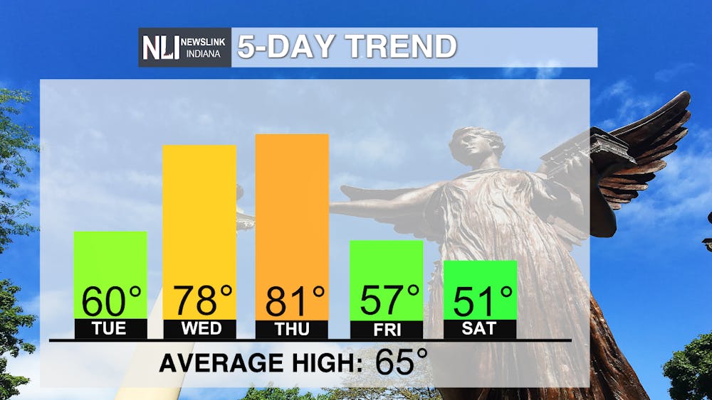
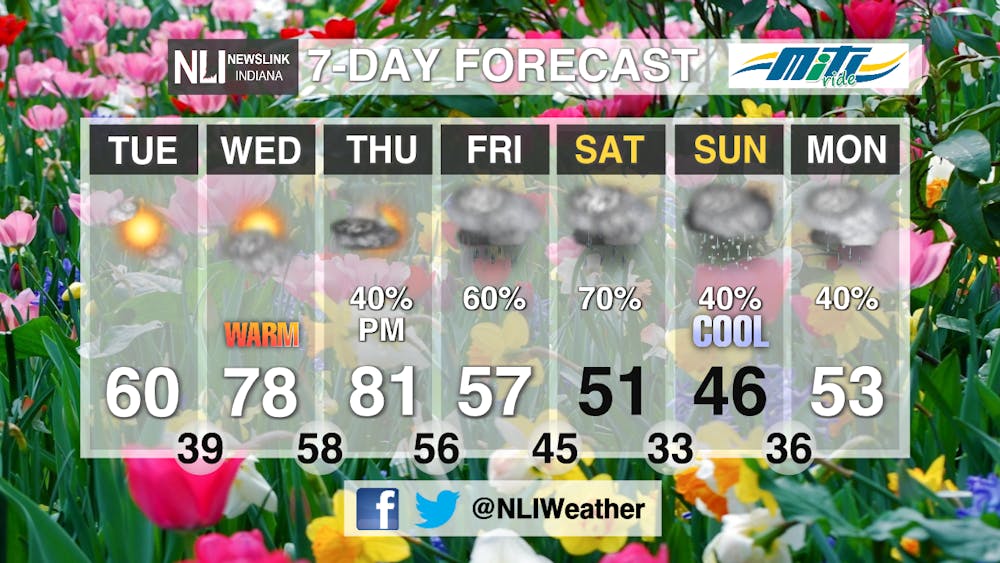
7-Day Forecast: Temperatures will continue to increase through Thursday with temperatures reaching 81 degrees on that day. However, a cold front that will showers and thunderstorms Thursday night will bring back cooler temperatures starting Friday and continuing into early next week with daily rain chances. The coldest looks to be Sunday with a high of only 46 degrees along with the potential for snow showers to mix in with the rain chances.
-- Weather Forecaster Eric Segbor
Follow us on Twitter @NLIWeather for breaking weather updates.
NewsLink Indiana is a proud Ambassador for the NOAA Weather-Ready Nation program. For more information about the Weather-Ready Nation program please click HERE
