


Tonight: An unseasonably warm night as temperatures only drop into the 40s! Winds will start lighter than they were today, but will build up again along with an increase in cloud cover through the morning hours.

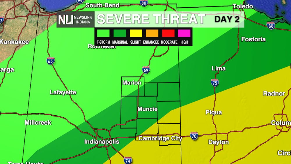
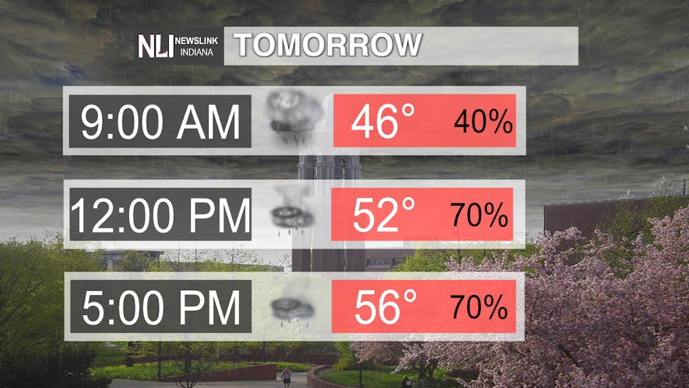
Tomorrow: The unseasonable warmth holds on for one more day, but let's face it, folks: Yesterday was definitely the pick day for the week as although this day will also be warm, it will be quite unsettled. We have two periods where the weather could be quite nasty out compared to what today was, and the evening holds the threat of strong to severe thunderstorms capable of producing isolated damaging gusts to 60 mph along I-69, with a better chance of seeing more of that kind of activity through Southern Randolph, Henry and Wayne Counties at this point. Keep an eye on updates from us at facebook.com/NLIWeather & on our Twitter, @NLIWeather along with the National Weather Service webpage as more updates develop.
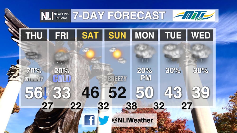
7-day Forecast: A typically Midwestern forecast with a couple notable ups and downs: We turn frigid Friday with 30s and feels-like temperatures in the lower and mid teens, but we rebound into the 50s by the weekend. Another dip in the jet stream brings another possibility of unsettled weather as systems swing through as we hit next week, and we could see a possible return to wintry conditions the second half of next week - what a ride, yes?
--Weather Forecaster Ryan Hill
Follow us on Twitter @NLIWeather for breaking weather updates.
NewsLink Indiana is a proud Ambassador for the NOAA Weather-Ready Nation program. For more information about the Weather-Ready Nation program please click HERE
