


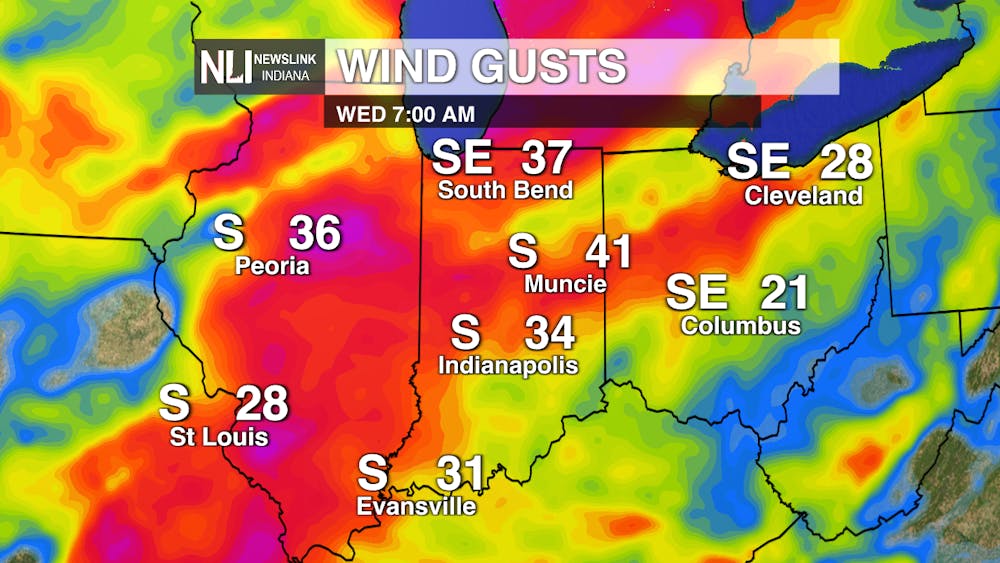
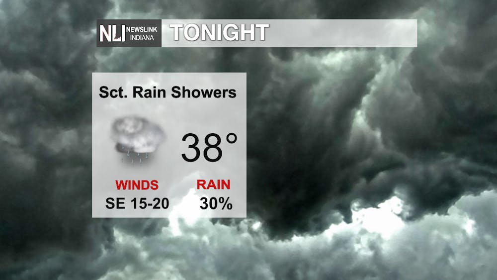
Tonight: Scattered rain chances throughout the night, otherwise mostly cloudy conditions. Winds will start to increase, coming out of the south at 15-20 MPH, gusts up to 35 MPH. Be sure to tie down any loose objects once winds start to pick up.
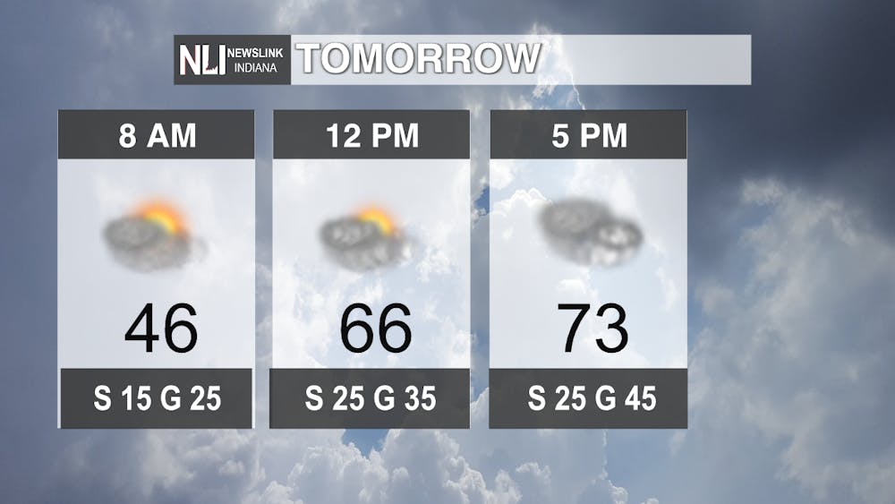
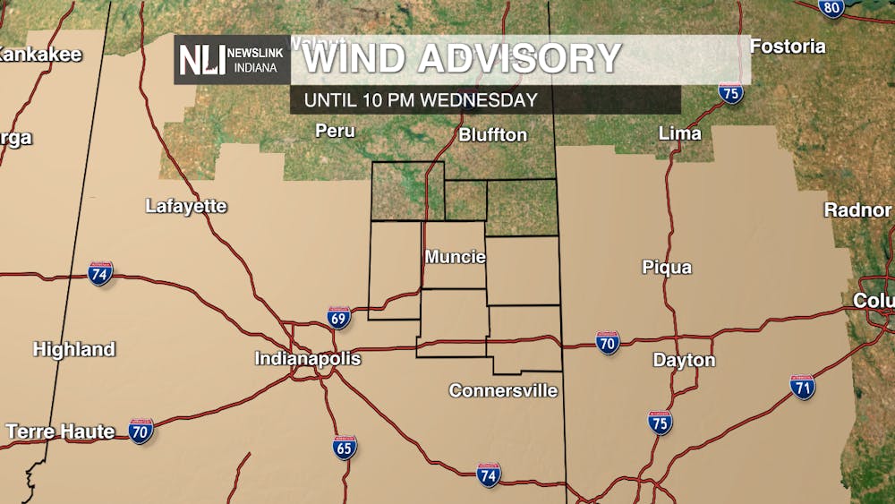
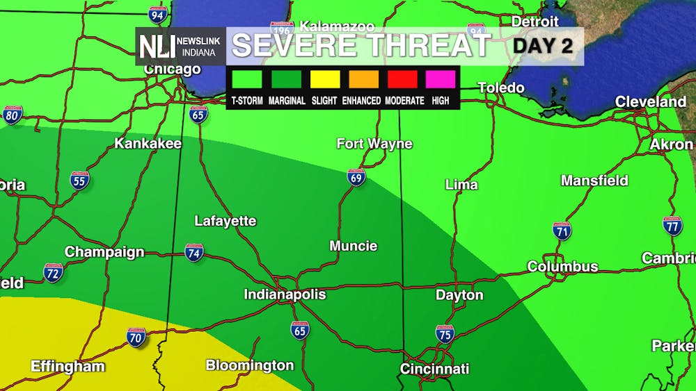
Tomorrow: A breezy but nice day is in store! Mostly cloudy conditions will persist throughout the day, yet temperatures will climb to the lower 70s! A Wind Advisory will go into effect for much of the viewing area at 10 AM and will expire at 10 PM. Expect steady winds around 20-30 MPH with gusts up to 50 MPH. Showers will enter the area in the evening and will linger overnight. The greatest threat for severe weather is between 5PM-9PM.
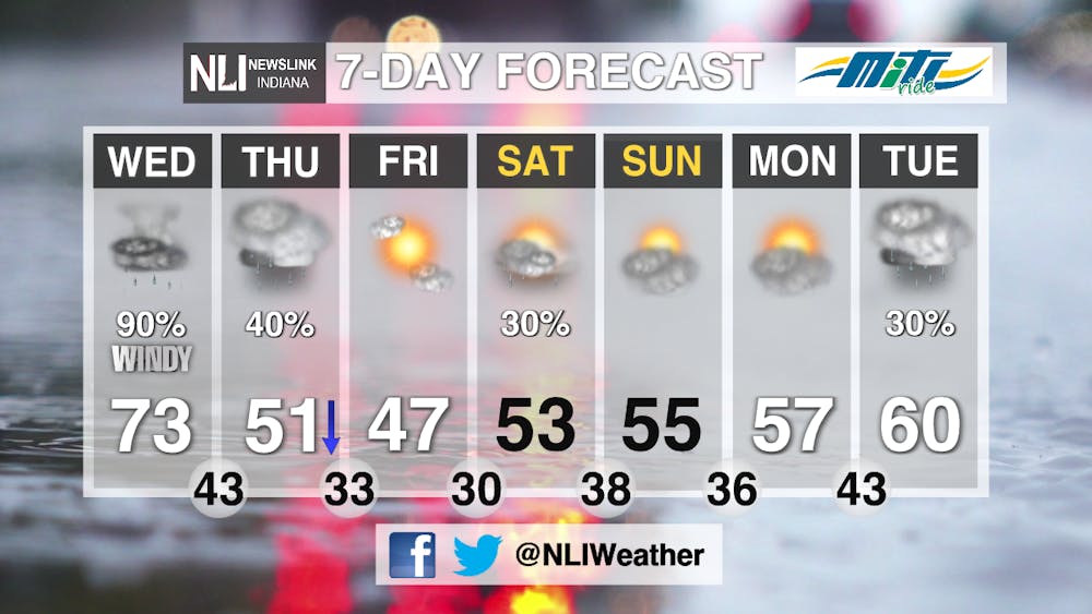
Seven-Day Forecast: Rain chances will continue into Thursday, yet the weekend will bring a break in the rain, although there is a slight chance of rain showers on Saturday. Temperatures will hover right around average going into the start of next week with rain chances returning on Tuesday.
---Assistant Chief Weather Forecaster Hope Kleitsch
Follow us on Twitter and Facebook @NLIWeather for breaking weather updates.
NewsLink Indiana is a proud Ambassador for the NOAA Weather-Ready Nation program.
For more information about the Weather-Ready Nation program please click HERE
