


Today: After chilly conditions paid us a visit yesterday, we are on our way through a rebound starting with a small warmup today & some *much* better sky conditions. Other than some high clouds streaming in, that should help make things a bit better with the sun being able to do more of its lovely work. In all, great conditions as you head out for afternoon or Spring Break plans!

Tonight: Somewhat lower and thicker clouds will move in through the overnight period heralding the arrival of the warm front that will make the big difference for our high temperatures for tomorrow. Along with that, we should wind up with much warmer conditions than the past couple of nights, giving us a much better environment for evening activities to be planned out.

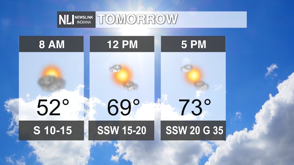
Tomorrow: A stellar and jazzy day awaits us tomorrow after our warm front clears! We will see temperatures soar to about 25 degrees above average with those strong SSW winds bringing in some tropical-feeling air from the Gulf of Mexico region. Hold on to your hats and make sure that small lawn objects are secure, as some of those gusts will be strong with gusts even higher than 35 mph not out of the question. Also, being that those winds will bring in a Gulf-of-Mexico-style airmass with increasing moisture, that sets the stage for our big system on Sunday.
7-day Forecast: Active day ahead on our Sunday with a chance of some showers and thunderstorms (some heavy/strong), with 1-2 inches of rain expected. Higher amounts could be possible, especially to our south, and precipitation may change over later on into your Monday to a wintry mix. Temperatures will feel Arctic compared to Saturday's balmy conditions, and we will try to recover, but another system knocks us back Thurs-Fri with maybe a more decent shot at snow on the back end of that system by Friday of next week. The wild weather rollercoaster ride we Midwesterners so commonly experience this time of the year continues as that jet stream stays wavy!

--Weather Forecaster Ryan Hill
Follow us on Twitter @NLIWeather for breaking weather updates.
NewsLink Indiana is a proud Ambassador for the NOAA Weather-Ready Nation program.
For more information about the Weather-Ready Nation program please click HERE


