


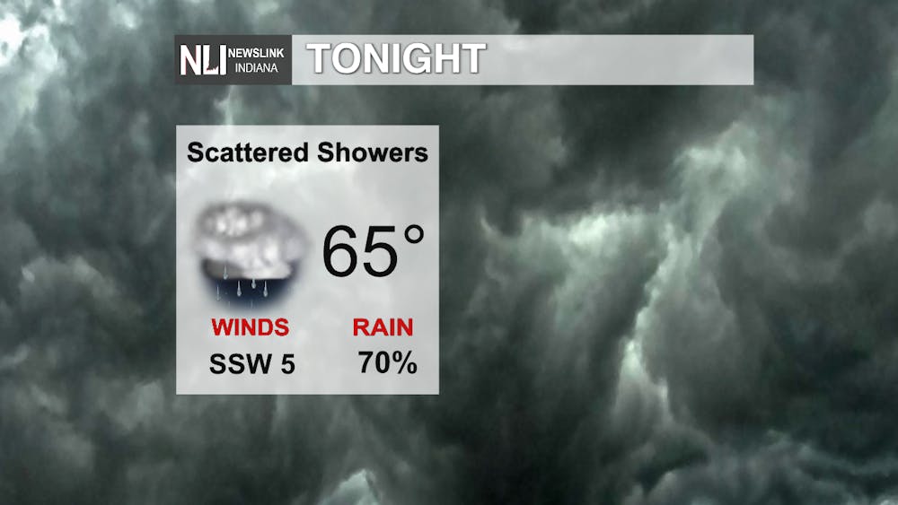
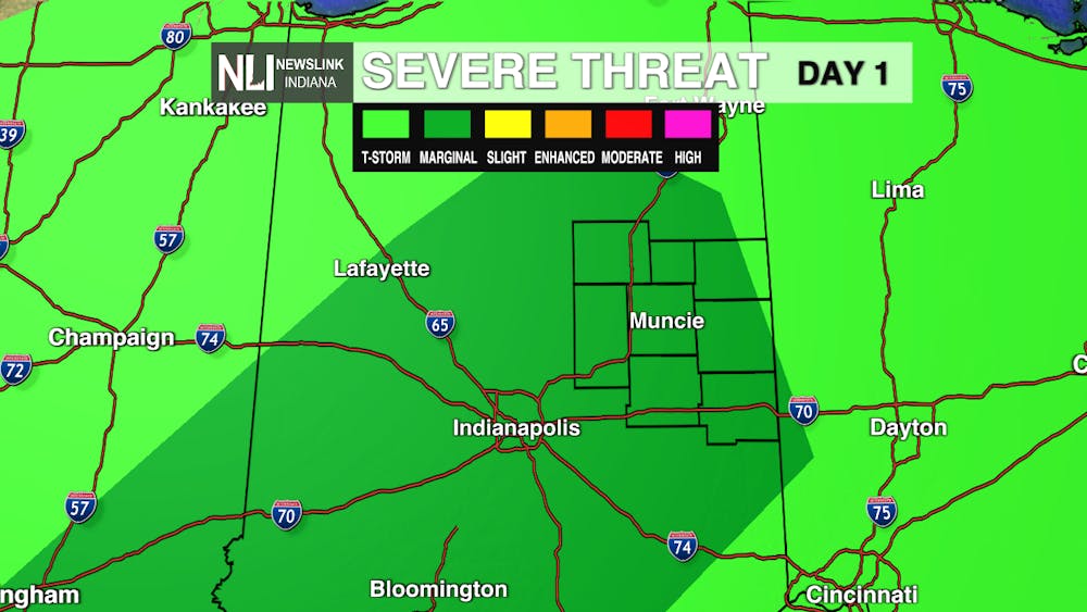
Tonight: Tonight, as a cold front passes over the area, scattered showers track over Muncie. Skies remain cloudy overnight with a low of 65 degrees. Across the viewing area there is a Marginal Risk of severe weather tonight into tomorrow with the possible development of isolated thunderstorms. Risks include damaging winds, heavy rainfall, and the possibility of an isolated brief tornado cannot be ruled out.
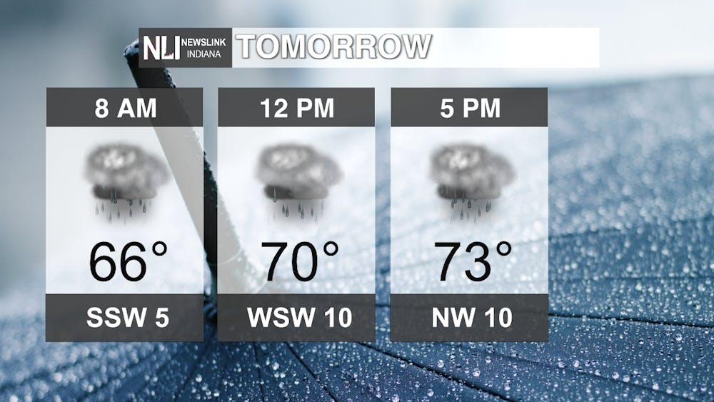
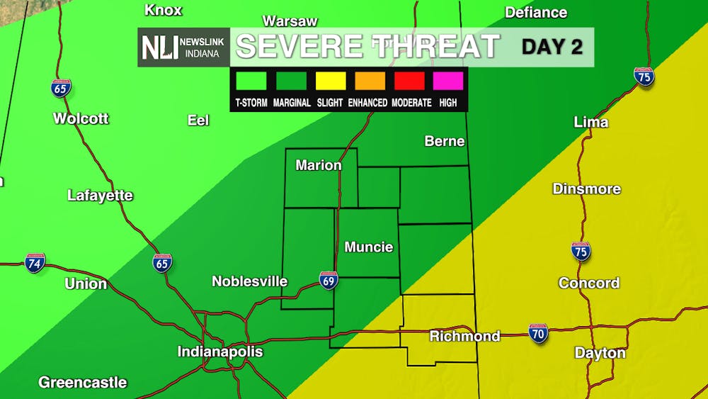
Tomorrow: Friday, rain continues to scatter over the region with a Marginal Risk to Slight Risk of severe weather. Risks include damaging winds, heavy rainfall, and the possibility of an isolated brief tornado cannot be ruled out. Temperatures are a bit cooler than they have been only making into the low-mid 70s later in the afternoon. Overnight, temperatures drop all the way in to 40s with continued showers!
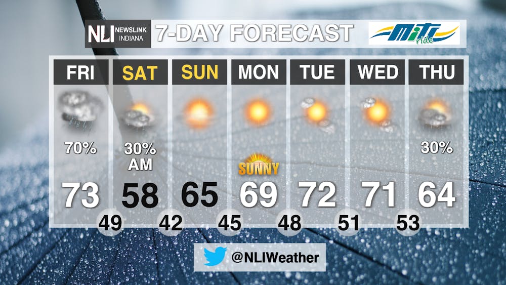
7-Day: Much cooler temperatures ahead for this weekend. Rain clears out early Saturday with mostly sunny skies and highs in upper 50s to mid 60s for this weekend. Next week, the forecast is looking more like fall with highs in the 60s lows in 40s and partly sunny skies for the week.
-------Assistant Chief Weather Forecaster Natalie Fitzpatrick
Follow us on Twitter @NLIWeather for breaking weather updates.
NewsLink Indiana is a proud Ambassador for the NOAA Weather-Ready Nation program.
For more information about the Weather-Ready Nation program please click HERE
