


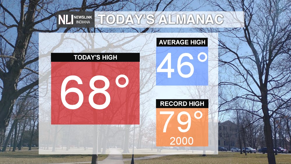
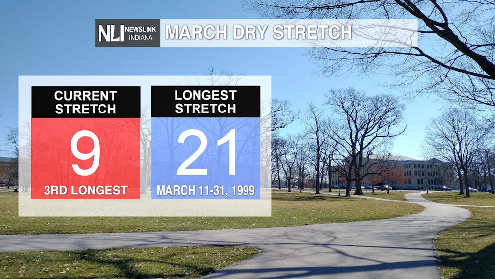
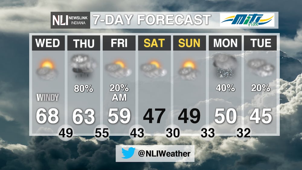
The dry stretch continues today, with temperatures topping out at 68 degrees thanks to sunny skies. Temperatures were about 20 degrees above our average at this time of year, which is 46 degrees. Today marks 9 consecutive days with no precipitation, which is the third longest March dry stretch in Muncie history! This stretch looks to come to an end later this week, as rain chances enter the forecast for the end of the week.
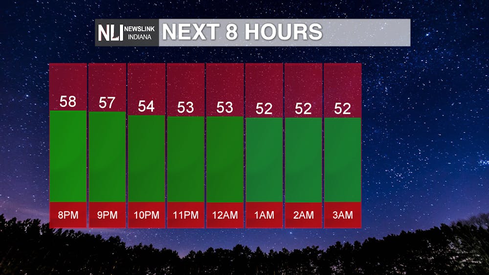
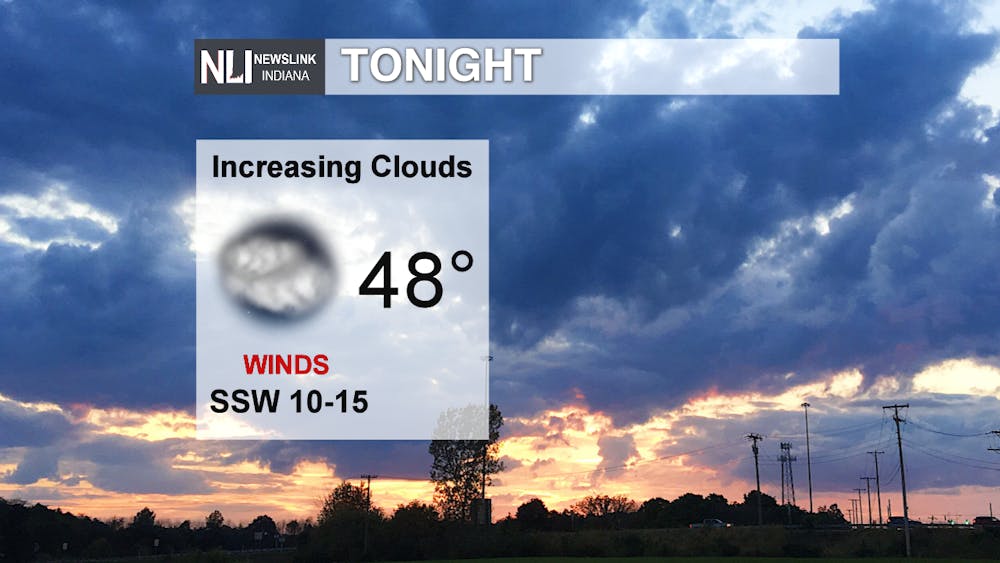
Tonight: A mild night is store, thanks to winds out of the south southwest bringing in warmer air, with temperatures dropping only into the lower 50s this evening. We end with a low of 48 degrees by daybreak, with increasing cloud cover overnight ahead of our next weather system.
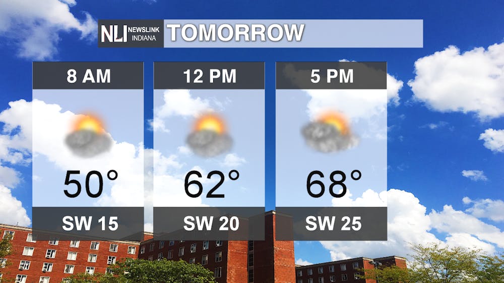
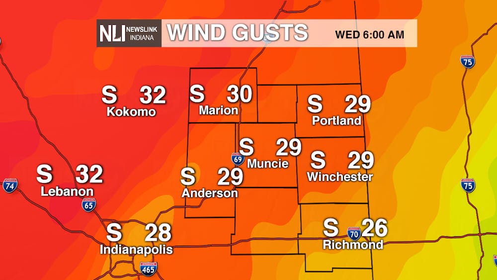
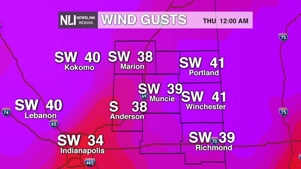
Tomorrow: Cloud cover will increase during the day on Wednesday, but with the help of some sunshine in the afternoon, temperatures rebound into the upper 60s once again. We start out mild at 50 degrees at 8am, so you may need a jacket. You'll be able to ditch the jacket by the afternoon though, with temperatures reaching a high close to 70 degrees. The main story tomorrow will be the winds, which will be sustained out of the southwest at 15-25 mph throughout the day, but could have the potential to gust up to 40 mph. As our next weather system sets up to move in, the winds on Wednesday night into Thursday morning look to consistently gust up to 40 mph.
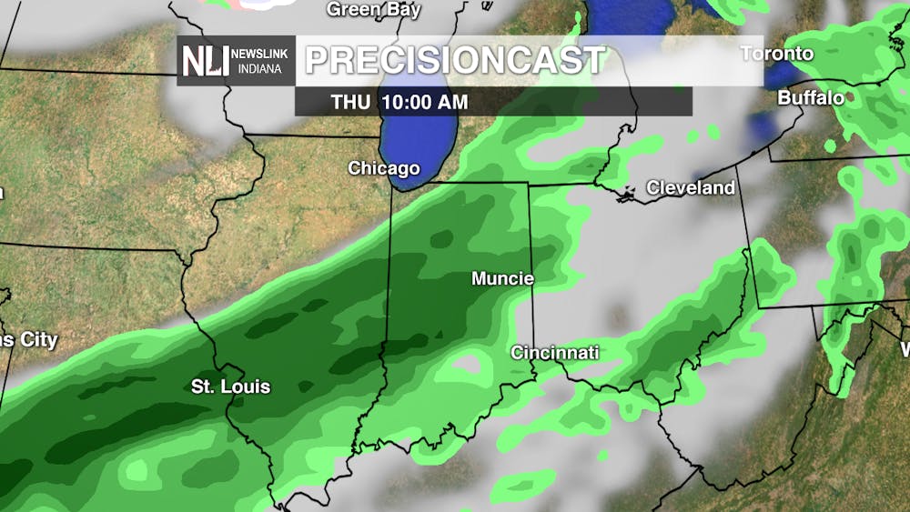
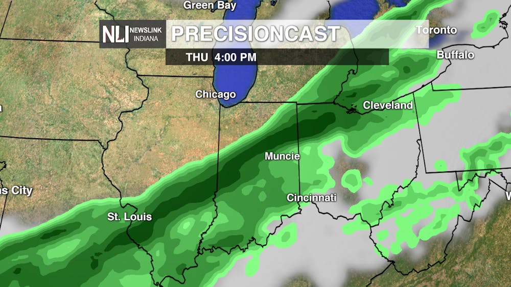
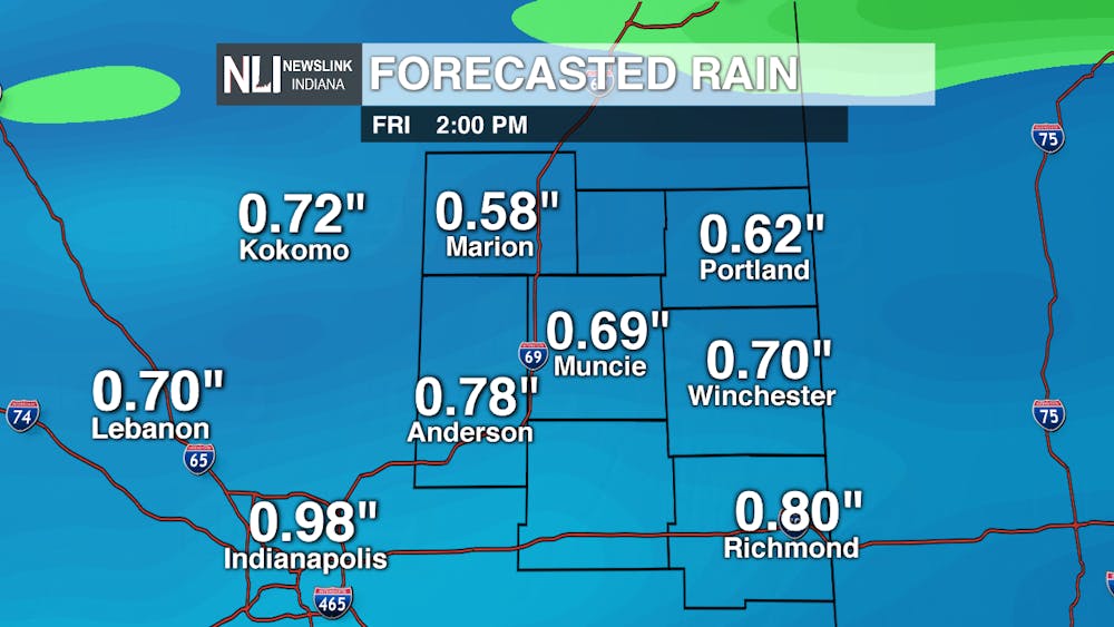
7-day: So far this month. our rain totals are at 0.00", but that all looks to change on Thursday! Widespread rain moves in, moving from the northwest to the southeast, throughout the morning hours on Thursday. Heavier pockets of rain could set up on Thursday afternoon, before the rain moves out by early Friday morning. From this system, we look to see anywhere from a half inch to an inch of rain, depending on location. Our northern counties will see less rain accumulation, with higher amounts off to our south, especially near Indianapolis.
In the 7-day forecast, a cooldown is on the way for the weekend. As of now, the weekend looks to be dry, with temperatures in the upper 40s. Rain/snow chances move in on Monday, as temperatures continue to be in the mid 40s to the lower 50s.
--Assistant Chief Weather Forecaster Maddi Johnson
Follow us on Twitter @NLIWeather for breaking weather updates.
NewsLink Indiana is a proud Ambassador for the NOAA Weather-Ready Nation program.
For more information about the Weather-Ready Nation program please click HERE
