


Following a cooler but pleasant week last week, it is shaping up to be another very pleasant and warm week ahead for us. Rain is in the forecast starting Wednesday evening though, so if you can try and get outside and enjoy the warmth and sunshine today.

Much like last week a cooler start to the week, although it not quite as cold as last Monday morning. It got down to 34 early this morning but temperatures are rapidly increasing as we start to receive more and more sunshine. Temperatures broke into the 40's right around 8 am and 10 am w3ere all the way up to 53. By 1 pm temps will make their way up into the 60's with a high of 66 today
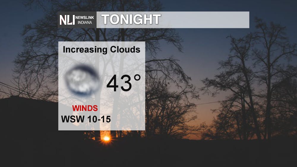
Cooling down a little bit tonight thanks to the sunshine today, but you can expect to see clouds begin to roll in late tonight mainly after midnight, into early tomorrow.
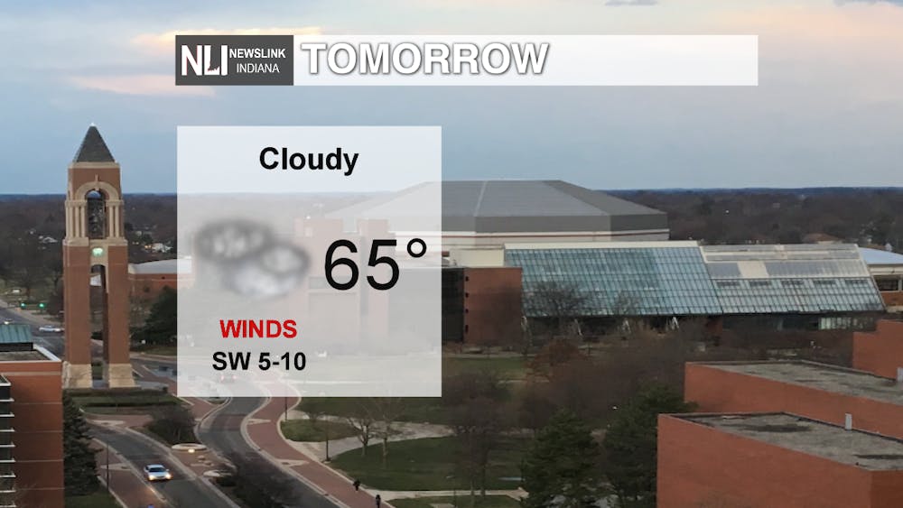
High of 65 tomorrow under cloudy skies. So it is still going to be warm and decently pleasant tomorrow just more on the cloudy side of things.
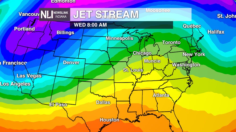
Now that we are 2 weeks away from the first day of spring, which is March 20th, we are starting to get our first real taste of spring thanks to the Jet stream. In the spring and fall seasons, we see the Jet sit right over top of us, leading to days where it is 60 degrees or warmer, but then the next day has a low temperature into the 20's and barely gets above 30. The Jet is far enough north that all the warm air down south is able to make it is way up north. Over the next couple of days, we are looking at that dip in the JET over the Northwest begin to make its way east bringing the clouds for Tomorrow as well as a chance for rain to end the week.

The rain looks to affect the area starting late Wednesday night after midnight. Couple of showers Thursday morning, but becoming more steady as the day goes on. With the warm air from the south as well as this abundance of moisture we are looking at the chance to see our first thunderstorm of the year.

Very pleasant start to the week 66 as our high today and we are going to sit there for the majority of the week. Clouds rolling in late tonight leading to cloudy skies tomorrow as well as some rain showers and Thunderstorms on Thursday into very early Friday morning. A cold front pushes through with that precipitation leading to much cooler temperatures this weekend and into early next week.
-Weather Forecaster Adam Feick
