


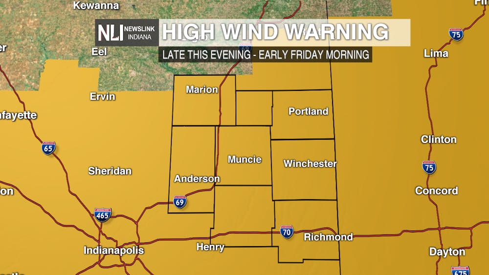
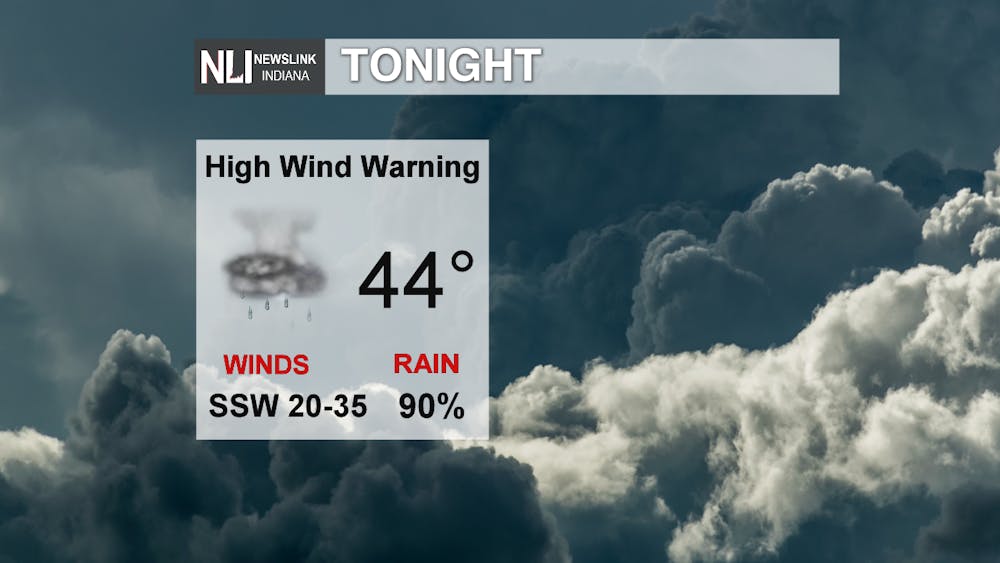
Tonight: More rain moves in overnight with possible isolated severe thunderstorms. The viewing area remains under a marginal risk (level 1/5) for severe weather. Main risks are damaging winds and isolated, weak tornado. Focus will be on the strong winds; a High Wind Warning is in effect tonight with gust up to 60mph possible which is equivalent to severe thunderstorm strength winds. Stay weather aware tonight as wind damage and power outages could be affecting the area.
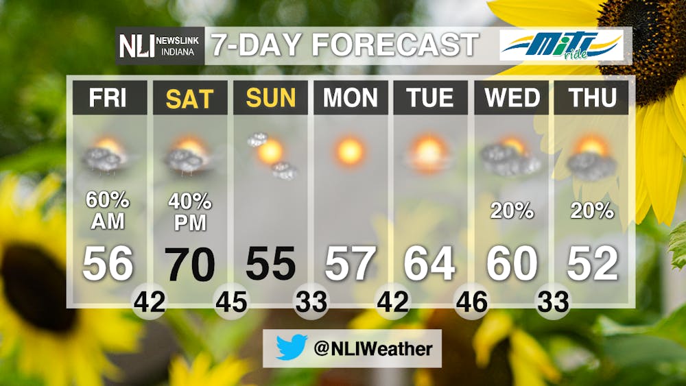
Tomorrow: The rain moves out early Friday morning but the High Wind Warning stays in effect until 9AM when winds begin to calm down after the system passes. A high around 56°F with conditions staying move from cloudy to partly sunny for the remainder of the day. Overnight temperatures drop into the low 40’s with calmer winds.

7-Day: What a sunny start to the weekend with mostly sunny skies and a high of 70°F for Saturday, however, another system moves in Saturday evening bringing another chance of rain late Saturday into Sunday morning. High temperatures fall into the 50s until Tuesday making in back into the 60s.
-------Weather Forecaster Natalie Fitzpatrick
Follow us on Twitter @NLIWeather for breaking weather updates.
NewsLink Indiana is a proud Ambassador for the NOAA Weather-Ready Nation program.
For more information about the Weather-Ready Nation program please click HERE
