


Assistant Chief Weather Forecaster Maddi Johnson has all the details on just how long the sunshine and spring-like warmth will last.
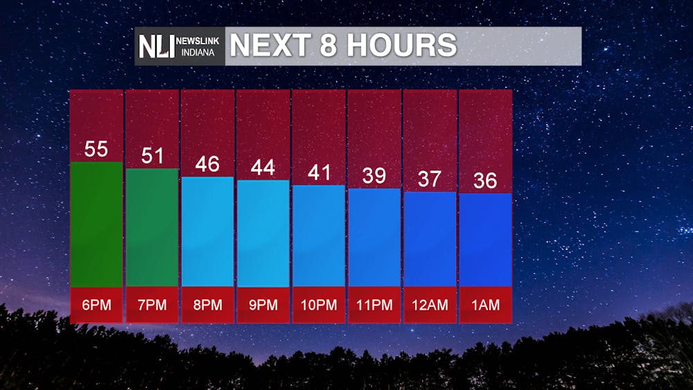
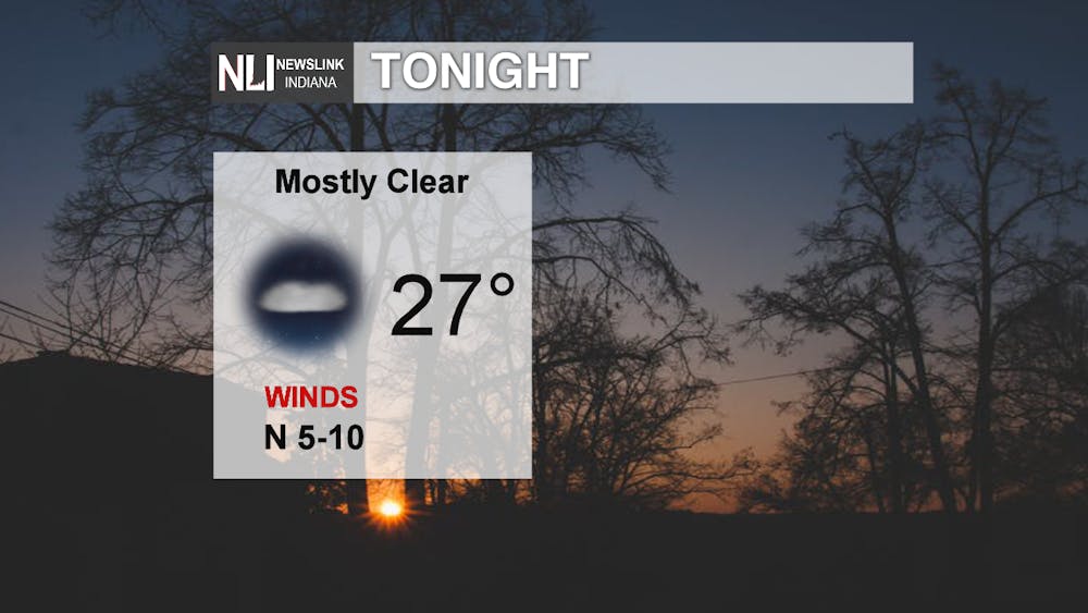
Tonight: Temperatures drop quickly overnight, ending up in the upper 20s by daybreak tomorrow. Winds will be light out of the north at 5-10mph. We could see a few isolated clouds overnight, but overall, skies remain mostly clear.
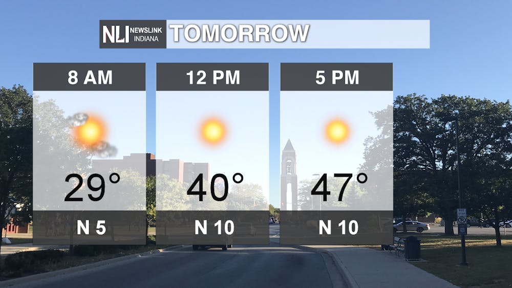
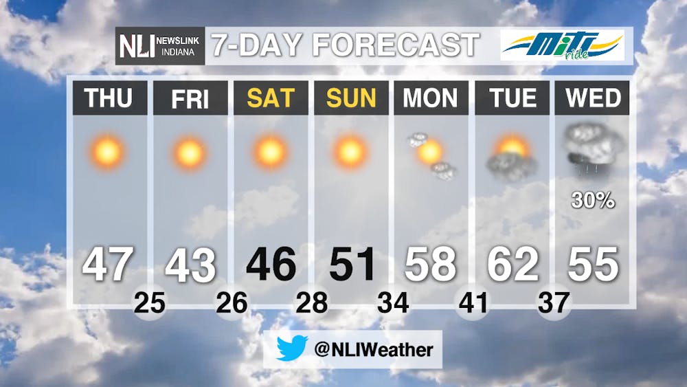
Tomorrow: Another beautiful day is on tap for tomorrow, although it will be cooler than the temperatures we saw today in the upper 50s. Winds remain out of the north tomorrow, helping to keep our temperatures closer to average for this time of year. Make sure to take a jacket with you tomorrow morning as we start out in the upper 20s, reaching the 40s by the afternoon. We top out at a high of 47 under sunny skies.
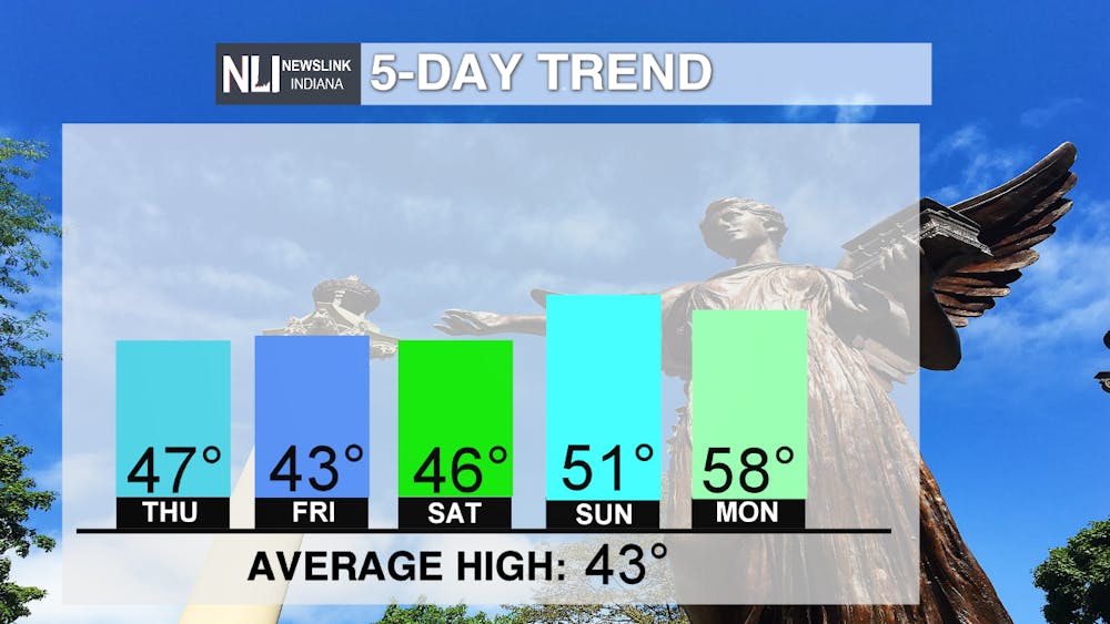
7-day: Over the next 7 days, spring-like weather remains in the forecast! Temperatures are cooler to end the week, in the mid to upper 40s, however we do rebound into the 50s for the weekend. We could even see temperatures pushing into the 60s by early next week! Dry, sunny conditions remain the story for the end of the week and into the weekend. Our next chance for rain comes Tuesday night into the day on Wednesday. Take advantage of the beautiful, sunny weather and get outside!
--Assistant Chief Weather Forecaster Maddi Johnson
Follow us on Twitter @NLIWeather for breaking weather updates.
NewsLink Indiana is a proud Ambassador for the NOAA Weather-Ready Nation program.
For more information about the Weather-Ready Nation program please click HERE


