


Assistant Chief Weather forecaster Maddi Johnson discusses the record high temperature as well as what's in store for this weekend.

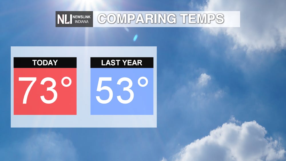
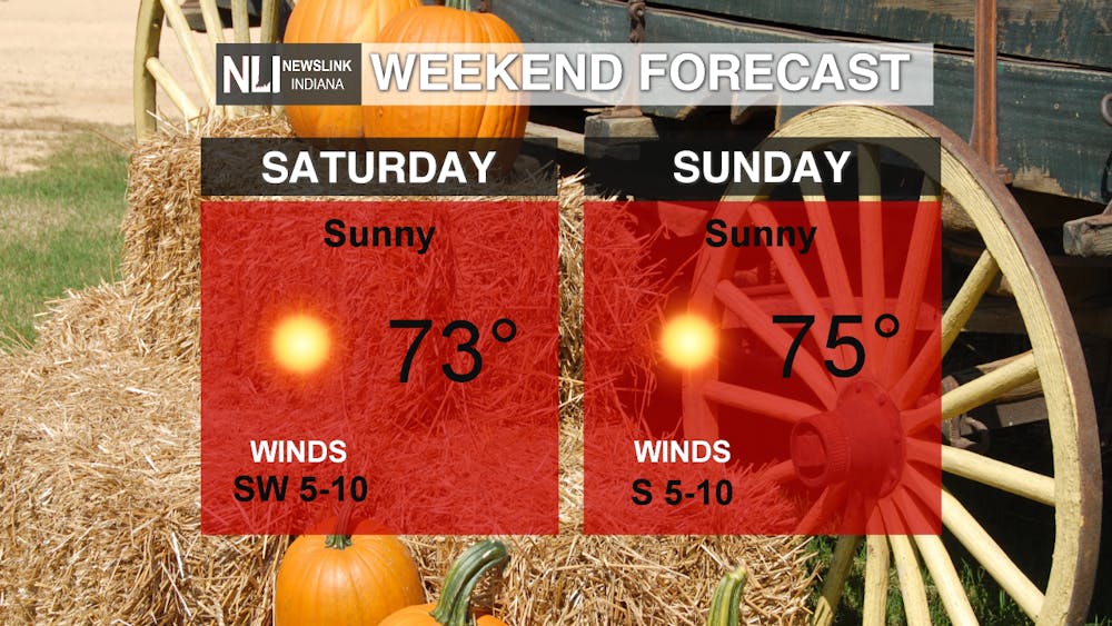
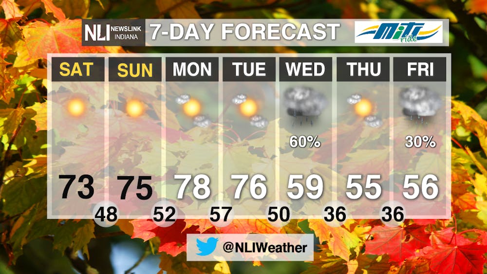
Today's high temperature of 73 degrees tied the record high temperature, which was set back in 1975 and in 2008! Compared to this time last year, we were 20 degrees warmer today! It has been unseasonably warm lately, and this trend will continue throughout the weekend and into early next week.
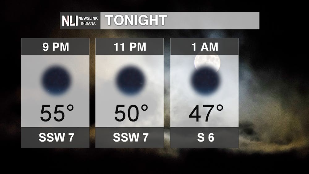
Tonight: Temperatures descend into the mid 50s by 9pm and eventually into the mid 40s during the overnight hours. Skies remain clear, and winds out of the south southwest will help make for a mild November night.
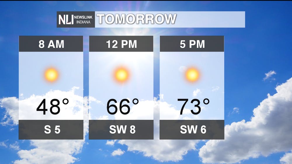
Tomorrow: Expect more of the same: plenty of sunshine and high temperatures in the mid 70s! Winds will continue to come from the south, helping to bring in warmer air. It will be a beautiful weekend, so make sure to take advantage of the warm weather and head outside!
7day: Temperatures continue to be well above average on both Monday and Tuesday, in the upper 70s with lots of sunshine. Early Wednesday morning, a cold front looks to slide through, bringing widespread rain chances to the viewing area. Those rain chances taper off by Wednesday morning, although the colder air brought in by the cold front looks like it will stick around. Temperatures will trend towards a cooler, much more fall-like pattern by the middle of next week.
-Assistant Chief Weather Forecaster Maddi Johnson
Follow us on Twitter @NLIWeather for breaking weather updates.
NewsLink Indiana is a proud Ambassador for the NOAA Weather-Ready Nation program.
For more information about the Weather-Ready Nation program please click HERE


