

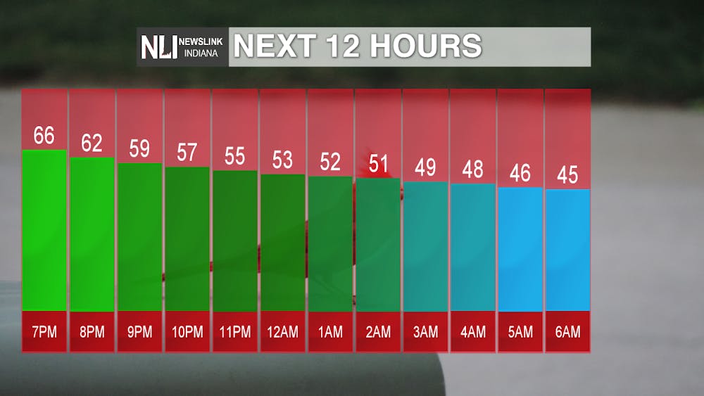
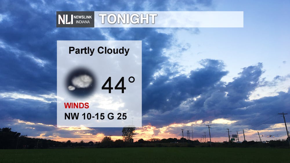
Tonight: We saw some bands of scattered rain and storms move through earlier this evening ahead of a strong cold front. The chances for rain will taper off this evening, making way for a partly cloudy sky overnight. Low temperatures will drop into the mid 40s, so a much cooler October night is in store from what we have been seeing the last few days. Southwesterly winds could gust at times up to 25mph.
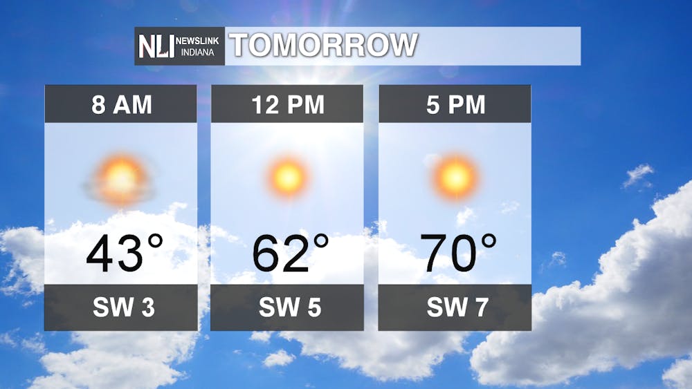
Tomorrow: A great day is on tap for tomorrow! Temperatures warm to near 70 by the afternoon, with plenty of sunshine throughout the day. Winds will still be out of the southwest, but less gusty at only 5-10mph. Get outside and take advantage of the summer-like weather, as it could be one of the last ones this year!
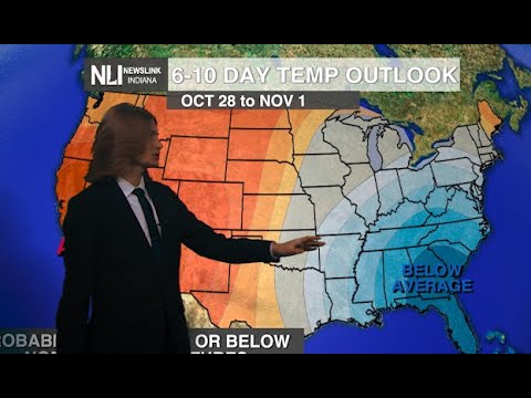
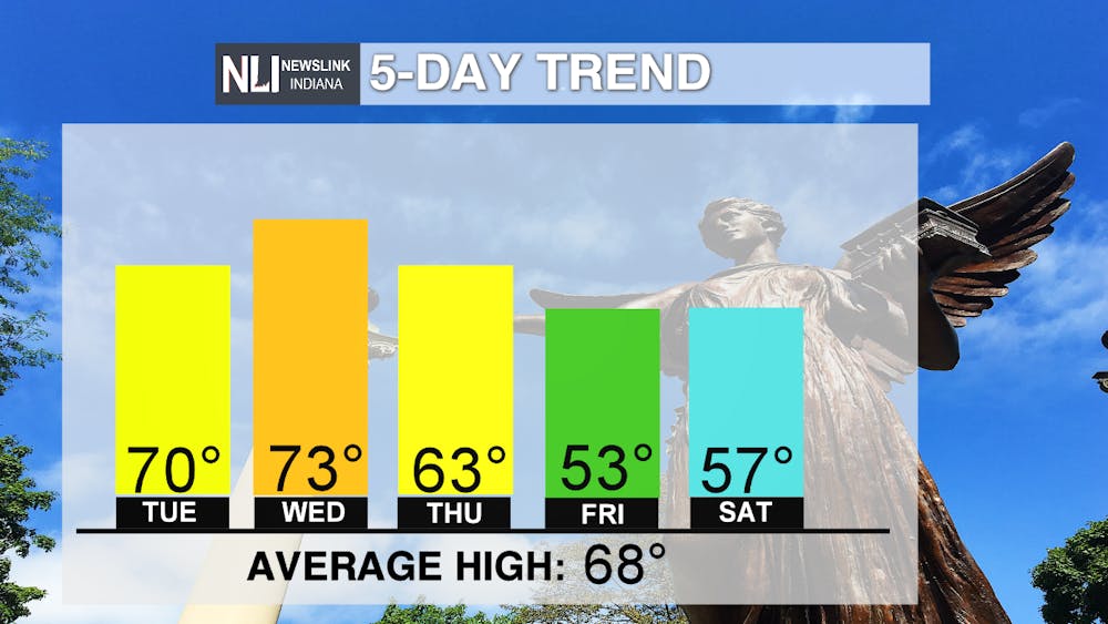
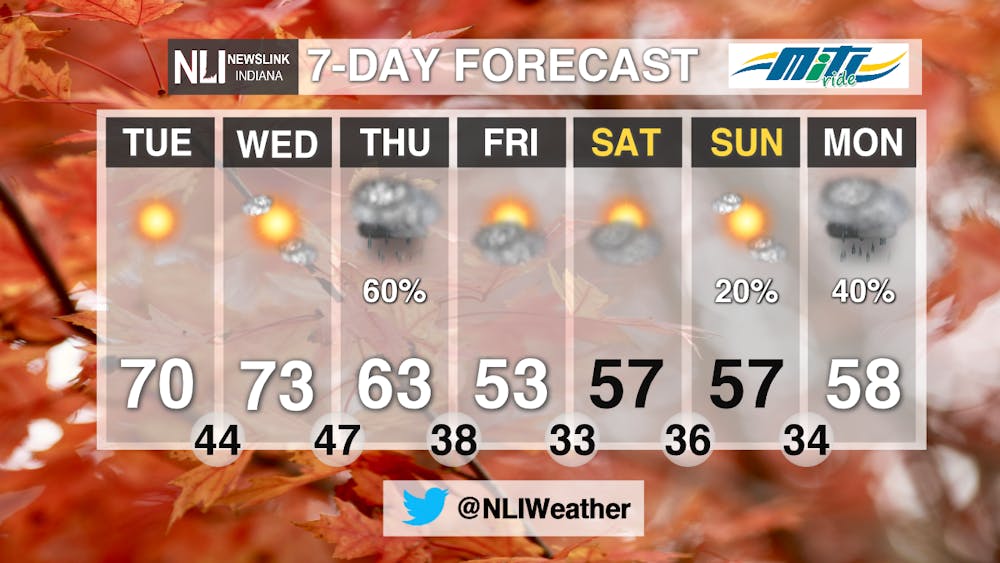
7-day: In the 7-day forecast, temperatures really take a tumble into the lower 50s by Friday. We began the week on Monday 10 degrees above average, and will end it 15 degrees below average. It will start to feel more like fall, as temperatures look to stay in the upper 50s for the weekend into early next week. As for precipitation, our next weather system comes through during the afternoon Thursday, bringing with it chances for rain. However, much of the extended forecast remains dry and sunny. Scattered rain chances return for late this weekend, as widespread rain chances exist for next Monday.
-Weather Forecaster Maddi Johnson
Follow us on Twitter @NLIWeather for breaking weather updates.
NewsLink Indiana is a proud Ambassador for the NOAA Weather-Ready Nation program.
For more information about the Weather-Ready Nation program please click HERE