
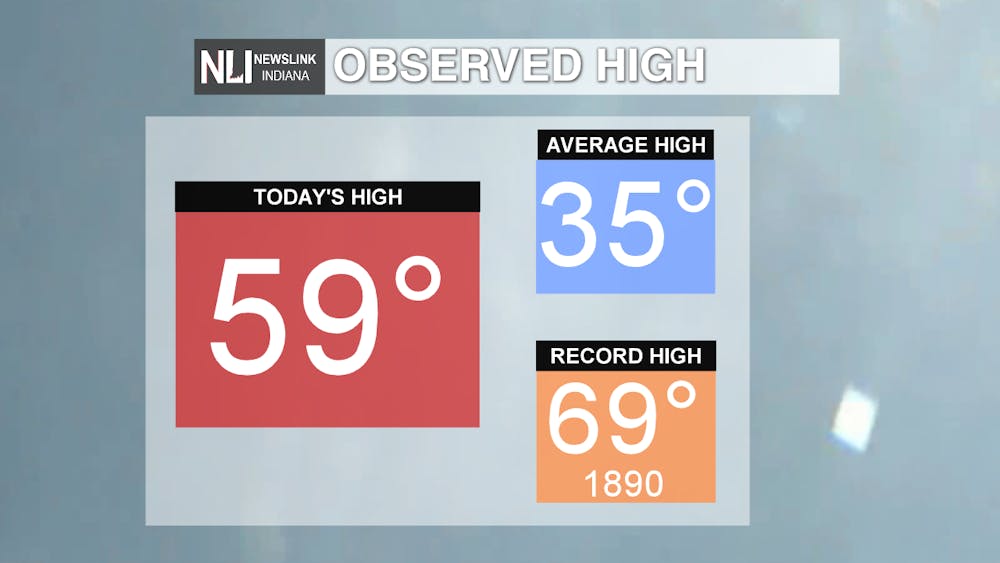
Today: Today we saw abnormally warm conditions, with the high reaching near 60°F, only 10° off of the all time record of 69°F set in 1890.
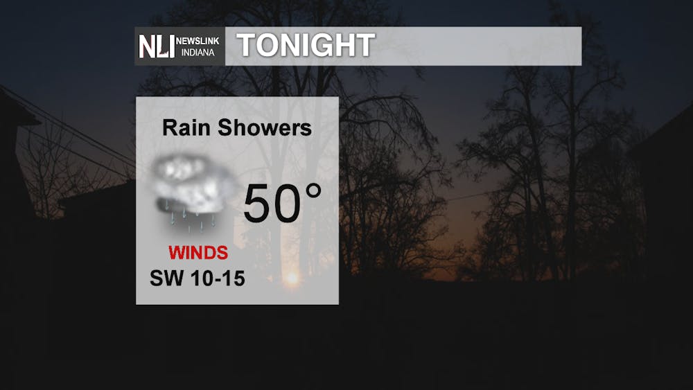
Tonight: Overnight tonight we will begin to see rain move into the area around 11pm or midnight, and light rain continuing through the evening. Low temperatures will reach down to about 50, and it will be gusty as well.
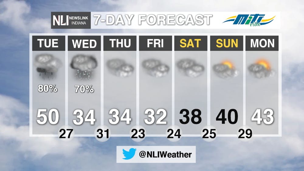
Tomorrow: Tomorrow, we have rain, rain and more rain. Gusty winds continue as temperatures decrease throughout the day.
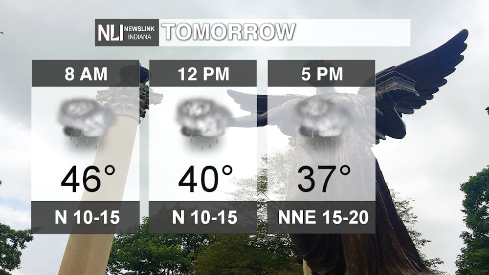
Showers will continue through the night and into tomorrow. Make sure you have the umbrella when you head out in the morning for your commute!
Sometime tomorrow evening, rain showers will transition into a wintry mix or snow. Not much accumulation is expected, but since it is right on the line, we could see rain or all snow as well.

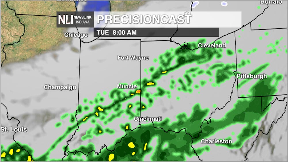
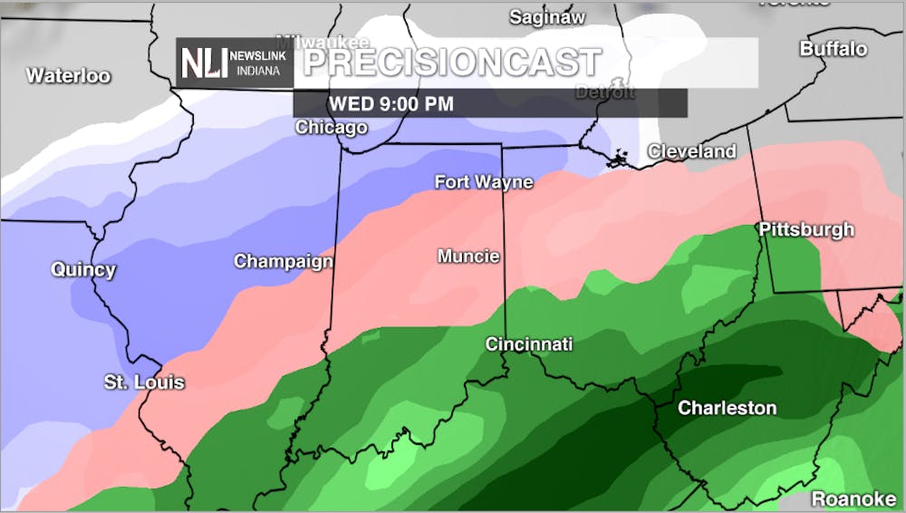
Wednesday: On Wednesday, we will see the back end of the system continue through the region. We will get all three types of precipitation at some point during the day Wednesday.
7 Day: Through the next 7 days, we will see temperatures back to more seasonal, and cloudy conditions continue. We will see the sun return late next weekend.
-NewsLink Indiana Weather Forecaster Jordan Wolfe
Follow us on Twitter @NLIWeather for breaking weather updates.
NewsLink Indiana is a proud Ambassador for the NOAA Weather-Ready Nation program.
For more information about the Weather-Ready Nation program please click HERE
Read More

Muncie launches Designated Outdoor Refreshment Areas
By Staff Reports / 51 minutes agoBeginning July 7, the City of Muncie announced three new Designated Outdoor Refreshment Areas (DORAs).
IPR: Gov. Mike Braun says tolling needs to be an option for Indiana’s road funding future
By Indiana Public Radio / 20 hours agoGov. Mike Braun was given slightly more expansive authority this year to explore tolling Indiana’s interstate highways.

Fairs, Fiction and Fun: Muncie’s Week of Events
By Ball State Daily / YesterdayMuncie is buzzing with events July 6–12 that won’t break the bank. Cheer on young talent at the Delaware County 4-H, or give back during Cardinal Greenway Volunteer. Prefer stories over sports? Don’t miss a cozy Evening with Author Robin Lee Lovelace. Then, tee off for a cause at the Liberty Township Fire Department Golf Tournament. Farm, read, or rally — whatever your vibe is, Muncie can match it.
