
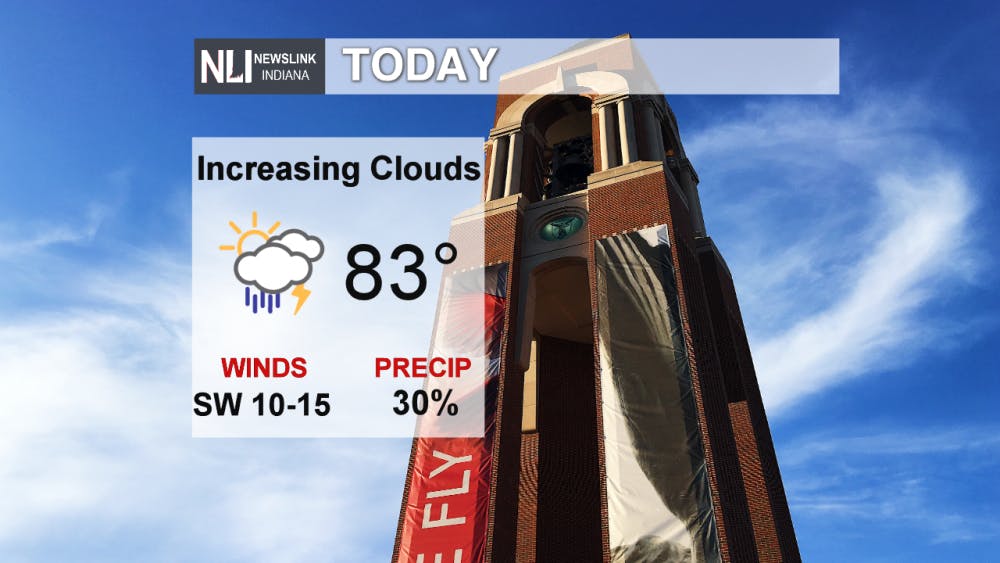
Today: Winds increasing gusting over 20mph this afternoon as a weakening cold front moves into the region. It won't bring any relief to the area as we have a high of 83 degrees today. Most of the day will be sunny with an increase in clouds throughout the afternoon.
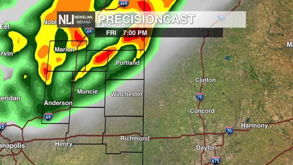
Precisioncast: Clouds increase through the day with rain moving into the area ahead of a weakening cold front. The first round will mainly move through the northern counties in the early to mid evening. Into the overnight hours another round will move through bringing a chance of storms for the entire area. As we go through Saturday isolated rain showers and storms will be possible with the chances decreasing through the afternoon.
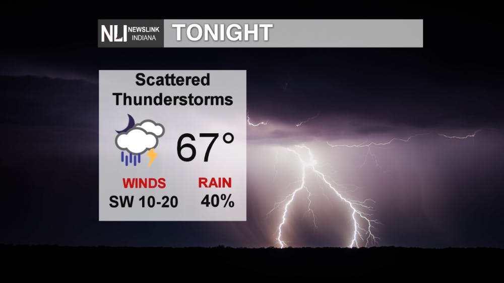
Tonight: Storm chances increase through the overnight hours as a weakening line of storms move through. South winds 10-15mph will bring in more warm and moist air making a low of 69 degrees.
7-Day Forecast: Taking a look at the 7-Day forecast a frontal system will move through tonight bringing some scattered rain and storms tonight and some isolated storms Saturday. After that we stay dry with increasing temperatures and humidity. With a high of 85 Sunday and 90 Monday and Tuesday. Clouds will increase Wednesday with increasing storm chances. A cold front will move through Wednesday night bringing in cooler and dry air making a significant difference in high temperatures.

-------Weather Forecaster Aaron Jones
Follow us on Twitter @NLIWeather for breaking weather updates.
NewsLink Indiana is a proud Ambassador for the NOAA Weather-Ready Nation program.
For more information about the Weather-Ready Nation program please click HERE
Read More

Muncie launches Designated Outdoor Refreshment Areas
By Staff Reports / 20 hours agoBeginning July 7, the City of Muncie announced three new Designated Outdoor Refreshment Areas (DORAs).
IPR: Gov. Mike Braun says tolling needs to be an option for Indiana’s road funding future
By Indiana Public Radio / YesterdayGov. Mike Braun was given slightly more expansive authority this year to explore tolling Indiana’s interstate highways.

Fairs, Fiction and Fun: Muncie’s Week of Events
By Ball State Daily / YesterdayMuncie is buzzing with events July 6–12 that won’t break the bank. Cheer on young talent at the Delaware County 4-H, or give back during Cardinal Greenway Volunteer. Prefer stories over sports? Don’t miss a cozy Evening with Author Robin Lee Lovelace. Then, tee off for a cause at the Liberty Township Fire Department Golf Tournament. Farm, read, or rally — whatever your vibe is, Muncie can match it.
