
Tonight: Rain has moved out of the area and we will be mostly clear as the night progresses. Temperatures will be in the low 40's with a low of 40. We will have a Southwest wind at 5-15 mph with gust reaching 30 mph.

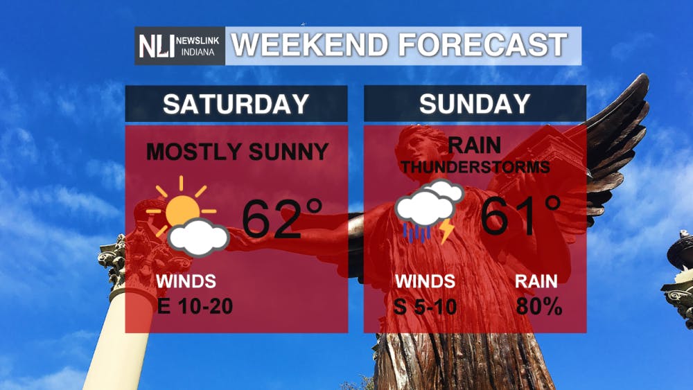
Weekend: Saturday is shaping up to be a beautiful day with temperatures in the mid 60's. However as we go into the overnight rain will start to make it's way into the forecast starting after midnight. 62 will be the high for Saturday and we will have a low of 40.
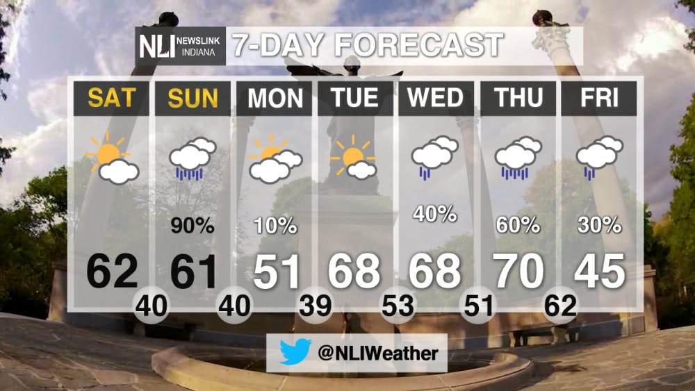
Sunday is looking like a washout for the majority of the day. Rainfall amounts will be ranging from a quarter to a half of inch. Temperatures will be in the high 50's with high temperature of 61.
7-Day: Once the rain moves out of our viewing area from the weekend, we will start to warm up in the mid part of the week. Monday will be well below average as the high is expected to reach only 51. The average temperature for this time of year is 61. Then we will start to warm up for Tuesday and Wednesday with temperatures in the high 60's. We are tracking another system for Wednesday so make sure to tune in at the beginning of the week to Newslink Indiana Weather for your updates on the system.
Read More

Road closure between Warwick and Briar road
By Staff Reports / 10 hours agoThere is a road closure on Riverside Avenue between Warwick and Briar roads directly in front of the Cooper Science Building due to a geothermal leak.

Tagayi to Represent France at U19 Tournament Before Joining Ball State
By Staff Reports / YesterdayBefore making her debut in the Mid-American Conference, incoming Ball State women's basketball player Aniss Tagayi will compete for her home country as part of the French national team in the U19 competition.

IPR: Ball State Village hotel project granted tax abatement for 10 years
By Indiana Public Radio / YesterdayThe new hotel being built next to Ball State University in the Village has been given a tax abatement for the next decade. But as IPR’s Stephanie Wiechmann reports, an agreement with the developer means Muncie coffers will see some money from the project in that time.
