
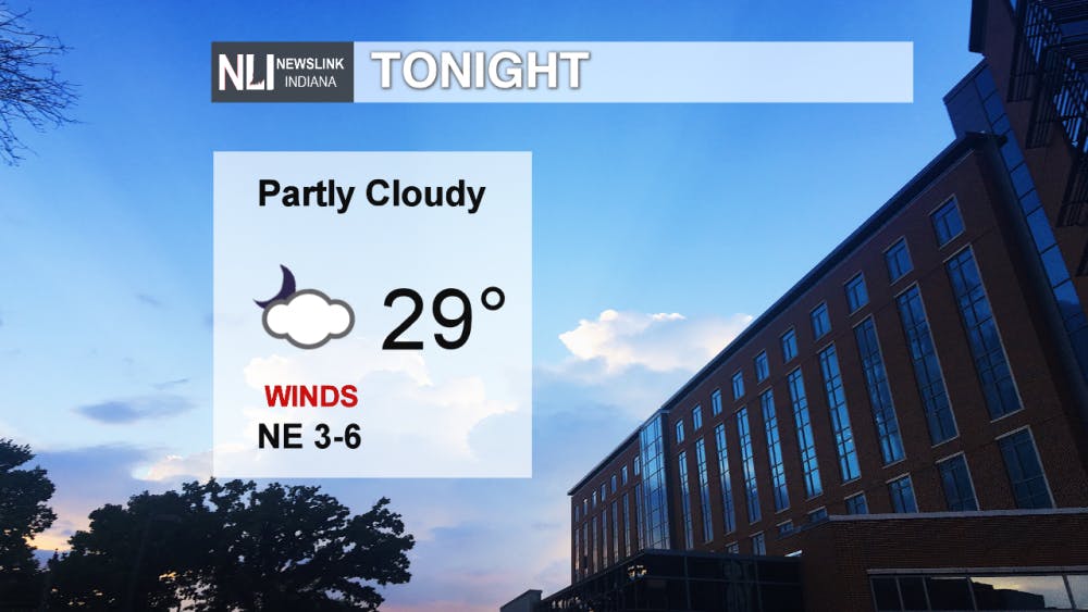
Tonight: Temperatures drop from the 40s to a low of 29°F overnight. Skies remain mostly cloudy throughout the evening hours. A calm wind from the Northeast around 3-6 mph keeps the air cool moving into early Saturday morning.
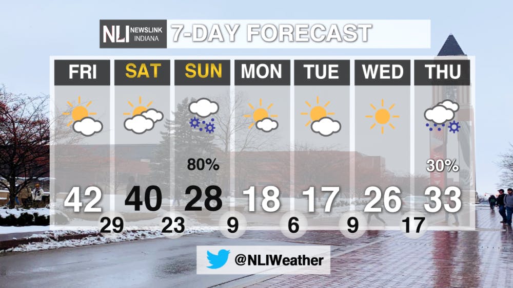
Tomorrow: A high around 40°F with Northwest winds between 6-9 mph to kick off the weekend. Mild temperatures throughout the day combined with mostly cloudy skies makes for a good Saturday compared to the falling temperatures in the evening that will continue through most of the week.
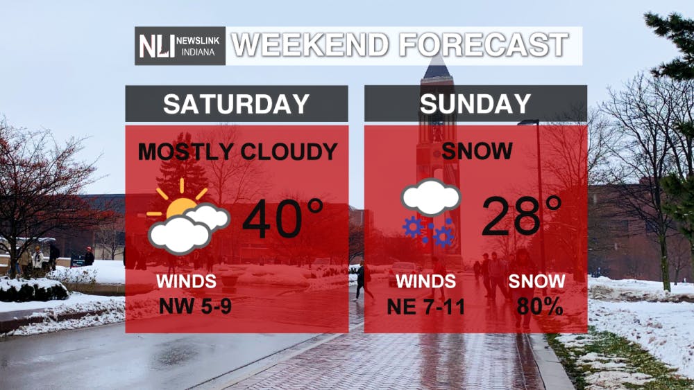
7-Day Forecast: Sunday snow is expected to fall over our viewing area starting in the morning hours until 11:00PM Sunday evening. Following the snow is a shift of Arctic air causing frigid temperatures for the week to come. Temperatures reaching all the way down in single digits making for a cold start for March 2019.
-------Weather Forecaster Natalie Fitzpatrick
Follow us on Twitter @NLIWeather for breaking weather updates.
NewsLink Indiana is a proud Ambassador for the NOAA Weather-Ready Nation program.
For more information about the Weather-Ready Nation program please click HERE
Read More

PHOTOS: Fourth of July 2025
By Staff Reports / 14 hours agoIndependence day in Muncie featured celebratory events at Minnetrista Museum and Gardens and Muncie Central Highschool.

Ball State adjusts 51 degree programs amid statewide enrollment mandate
By Trinity Rea / YesterdayIn a statement to The Ball State Daily News, the university says its academic changes reflect long-standing internal planning, not just compliance with new state requirements.
IPR: Trump administration withholds over $100 million in education funding from Indiana schools
By Indiana Public Radio / YesterdayThe Trump administration told states this week that it won’t be dispersing over $6 billion in federal education grants, according to reporting from NPR.
