
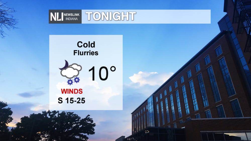
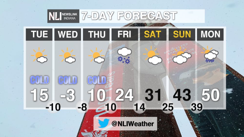
Tonight: Tonight we will be seeing lows down into the teens approaching single digits. Winds coming out of the South will cause wind chill values to be below 0 degrees. If you are going to be out and about tonight be sure to bundle up. We will also see a chance of flurries this evening, no significant accumulation is expected.
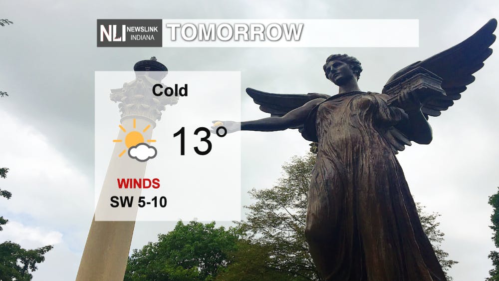
Tomorrow: Tomorrow we will see highs only into the teens. Winds will still persist with cold wind chill temperatures. Over the course of the day, we will see temperatures slowly decreasing with winds still persisting.
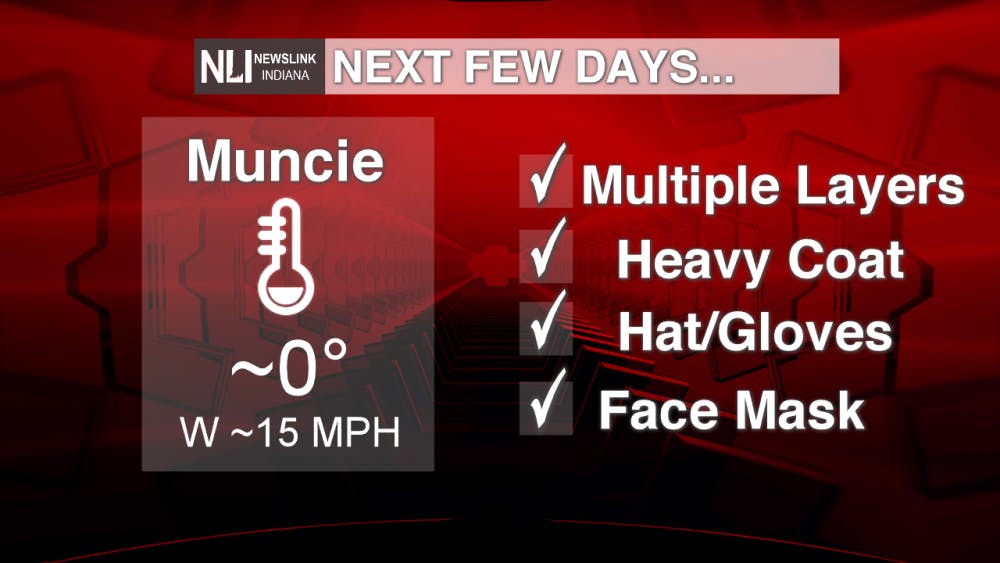
Next few days: Over the next few days we will be seeing bitterly cold temperatures moving into the area. Wednesday the high may not even get above 0 degrees. Winds will pick up and cause very dangerous wind chills. Some tips to dress warmly in the weather are posted below!
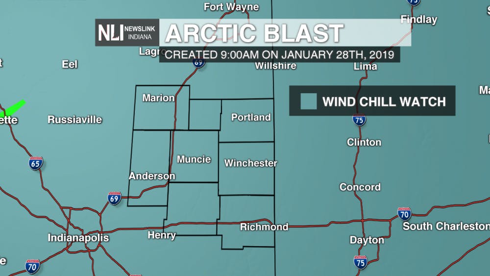
WIND CHILL WATCH: We are currently under a Wind Chill Watch from Tuesday evening through Thursday afternoon. Wind chills could be seen pushing into the -30s or -40s. Be sure to dress warmly if you must go out at all!
7-Day Forecast: Over the next 7 days the temperatures begin to drop tomorrow afternoon, and will be continuing to stay very cold through Thursday. Our biggest concern is wind chills and the dangerous cold temperatures on the way. Over the weekend, we finally see the cold let up and milder temperatures return.
Follow us on Twitter @NLIWeather for breaking weather updates.NewsLink Indiana is a proud Ambassador for the NOAA Weather-Ready Nation program. For more information about the Weather-Ready Nation program please click HERE
Read More

Music for all presents free concerts for the Muncie community June 23-27
By Trinity Rea / 5 hours agoAccording to a press release from Music for All, the Muncie community is invited to enjoy performances for free fromvarious ensembles and acts June 23-27.

Missed It? We’ve Got You Covered - CommCenter Catch-Up
By Ball State Daily / 10 hours agoWith summer internships ramping up, hanging out with friends and family, and making sure you have enough time for yourself – it’s easy to miss Ball State’s Communication Center announcements! This week’s catch-up highlights free Premium Google AI for students, free planetarium shows for June and July, and 2025 U.S. News “Best Online Programs” announced.

9-1-1 What's Your Hot Take E11: Season Ranking
By Willow Emig and Sam Jasionowski / 11 hours agoIn this episode of 9-1-1 What’s Your Hot Take, Sam and Willow rank the seasons of 9-1-1 from their favorite to least favorite.
