
Tonight: After a mild day here in East Central Indiana the clear skies this evening will allow for temperatures to cool down rapidly. A few clouds could build into the region later this evening into the early morning hours on Thursday. Overnight temperatures are expected to drop down to 47 degrees.

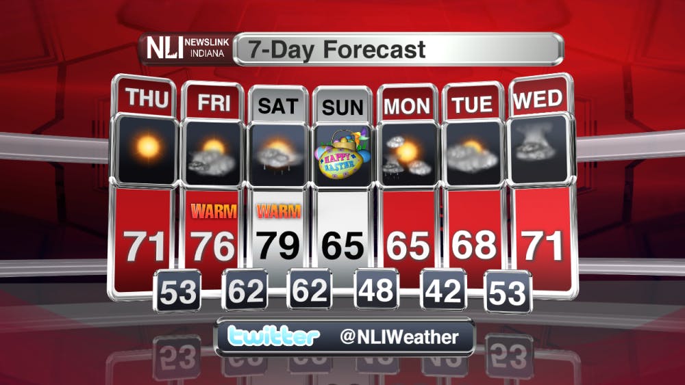
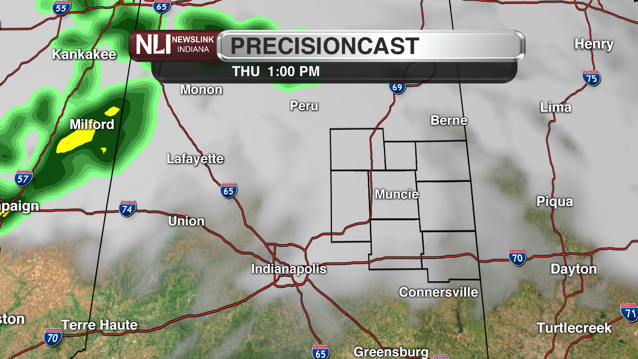
Thursday: Skies will remain mostly clear for the early morning hours but more overcast conditions will begin to build into the area late in the afternoon. The warm weather will continue in all of East Central Indiana with highs reaching the low 70's. A few scattered rain showers are possible in the afternoon and evening. These showers will be light and are not expected to produce a significant amount of precipitation.

7-Day: Above average temperatures will return back to the forecast headed into Easter weekend. Expect cloudy conditions to dominate the forecast Thursday evening into the daytime on Friday and Saturday. Rain showers and thunderstorms will be possible throughout the weekend. Although the chances of these rain showers and thunderstorms will be scattered in nature, therefore precipitation amounts are expected to be on the low end. Easter Sunday plans may need to be moved indoors in the afternoon; scattered rain showers are possible. Make sure to stay tune into NewsLink Indiana for continual updates leading into the holiday weekend.

Read More

IPR: Gov. Mike Braun says tolling needs to be an option for Indiana’s road funding future
By Indiana Public Radio / 6 hours agoGov. Mike Braun was given slightly more expansive authority this year to explore tolling Indiana’s interstate highways.

Fairs, Fiction and Fun: Muncie’s Week of Events
By Ball State Daily / 13 hours agoMuncie is buzzing with events July 6–12 that won’t break the bank. Cheer on young talent at the Delaware County 4-H, or give back during Cardinal Greenway Volunteer. Prefer stories over sports? Don’t miss a cozy Evening with Author Robin Lee Lovelace. Then, tee off for a cause at the Liberty Township Fire Department Golf Tournament. Farm, read, or rally — whatever your vibe is, Muncie can match it.

Mental health care and facilities are almost non-existent in rural communities
By Trinity Rea / YesterdayFor a large number of Indiana’s rural residents, access to specialty care — specifically that for psychiatry and mental health — is a struggle.
