
Snowfall forecast: For tonight snowfall amounts the farther north you are the higher the snowfall amounts will be. But as you go further south you will be mostly getting rain and mixed precipitation.
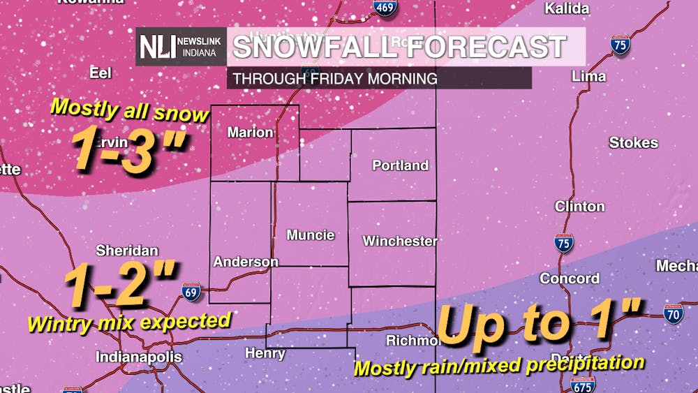
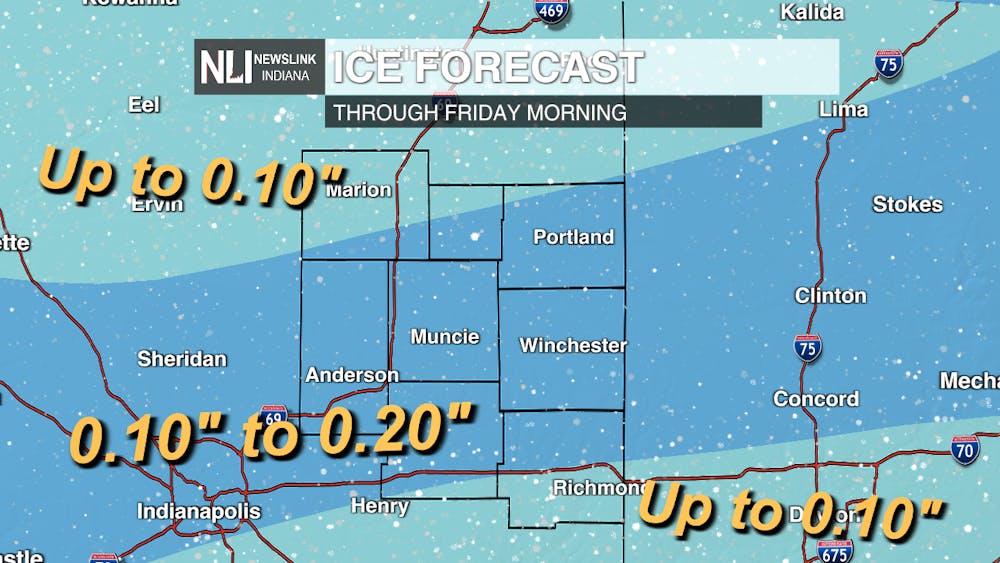
Ice forecast: Places in Central Indiana will be on the rain/snow line for tonight. This is an area that could get as much as .20 inches of ice through tonight. Areas south of Indianapolis and in the northern half of Indiana will see less around .10 inches of ice as the areas south of Indianapolis will be seeing more rain and northern Indiana will see more snow.
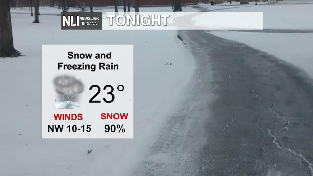
Tonight: For tonight snow and freezing rain will continue, the low will be 23. Northwest winds will be 10-15 mph. Ice accumulations will be around 0.2 inches and the snow accumulations will be 1-3 inches.
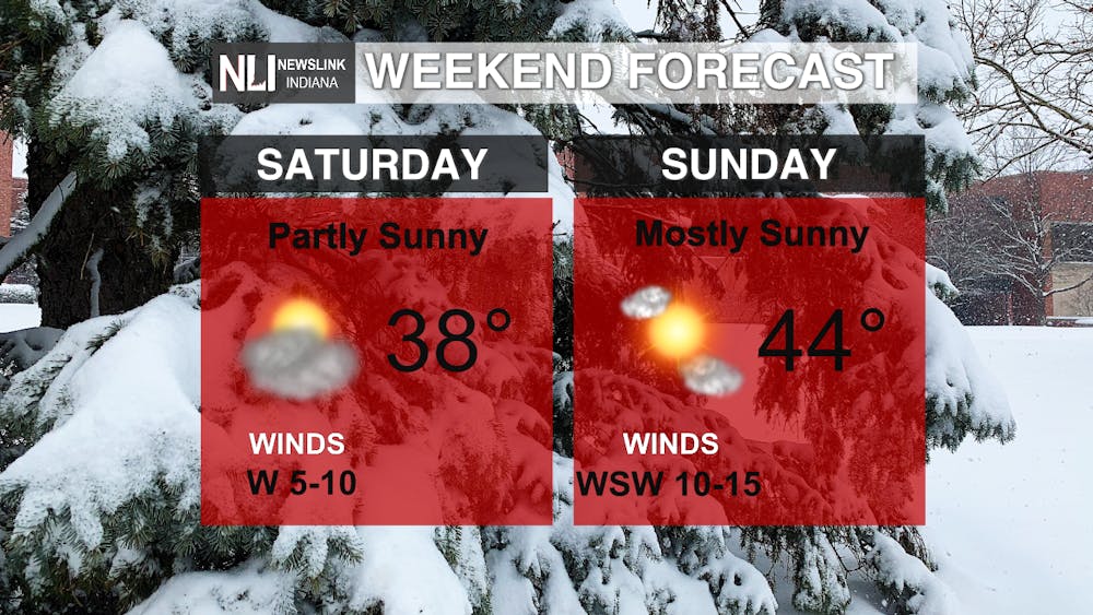
Weekend Forecast: For this weekend we will be drying out as sunshine will be returning, temperatures will be warmer especially in the ladder half of the weekend. Temperatures will be in the 30s on Saturday and 40s on Sunday.
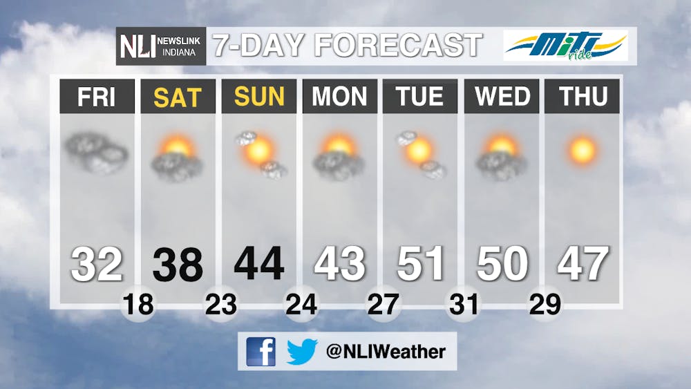
7 Day Forecast: For Friday clouds will dominate the day as temperatures will remain in the 30s, but for the weekend the sunshine will be returning, temperatures will be warmer especially in the ladder half of the weekend. Temperatures will be in the 30s on Saturday and 40s on Sunday. For the beginning of the work week the temperatures will be warmer and we will be seeing an abundance of sunshine.
---Weather Forecaster Ryan Crump
Follow us on Twitter @NLIWeather for breaking weather updates.
NewsLink Indiana is a proud Ambassador for the NOAA Weather-Ready Nation program.
For more information about the Weather-Ready Nation
program please click HERE
