
Warm to end the weekend yesterday, getting up to 63 with some rain showers as a warm front passed through in the morning hours. Some parts of southern Indiana, Kentucky, and Tennessee saw some thunderstorms early yesterday morning, bringing the first storms of 2021 to the area. A cold front came as affected the area, moving through late last night into early this morning leaving us with temperatures in the lower 30's. All of the rain has moved on East leaving us with some clouds, but expect to see clearing skies as the day goes on.
Winds have kicked in a little as the cold front has fully moved on through, bringing breezy conditions for most of the week this week as well as early next week. Expect to see winds 10-20mph for the majority of the week, and some possible stronger gusts up to 30-35mph today, tomorrow, and on Wednesday.

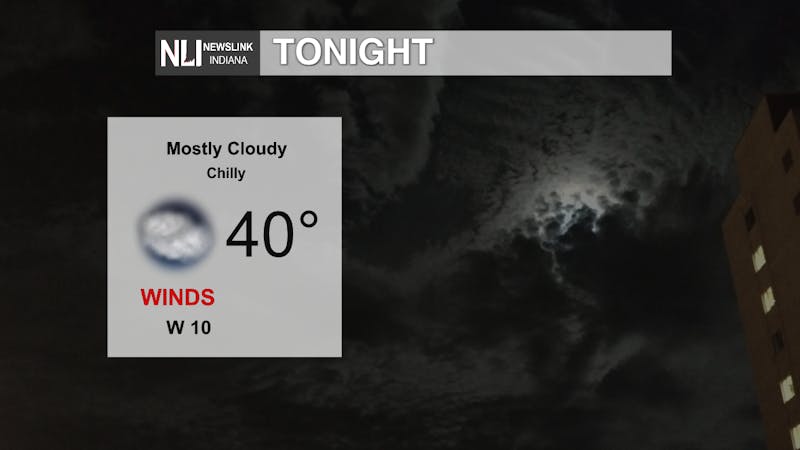
Not getting very warm today, the high is expected to get up to only around 41 this afternoon. 41 is actually the average high temperature for March 1st, so we are sitting right at the average of not too hot but not too cold either.

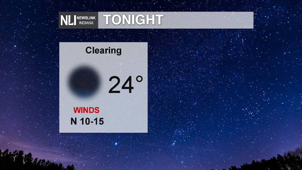
Pretty chilly evening tonight, reaching down to 24 under clear skies. Winds 10-15mph look to continue to linger around as well. Clear skies actually lead to cooler overnight temperatures. Since there are clearingclouds during the daylight hours, the sunshine is able to warm up the ground a little bit, and no clouds overnight allow the warm air to escape and cool down overnight leader to cooler temperatures tomorrow morning.
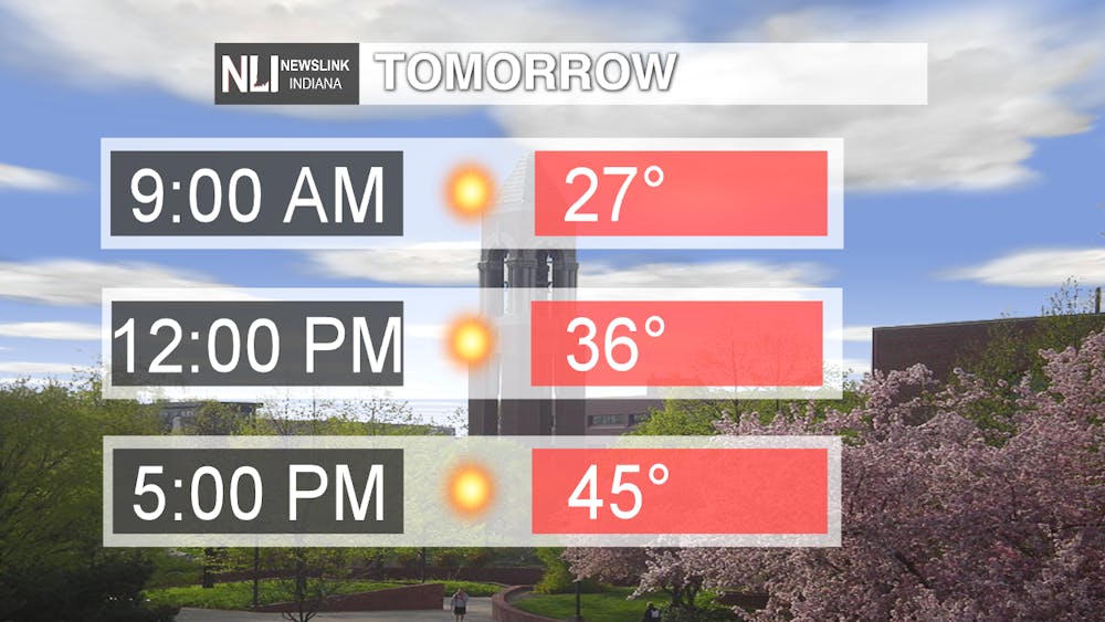
Cold start to the day tomorrow sitting at 27 in the morning hours but warming up to the Mid to upper 40's by the late afternoon hours. Not quite as warm as we saw on Sunday where the high got up to 63, but just a little bit warmer than it is going to be today. Expect to see warming temperatures over the next couple of days leading up to mid-week where we could see temperatures in the high 50's.
It is shaping up to be a pretty nice week as a high pressure looks to settle in across the Eastern Great Plains and parts of the Great lakes Today into Tomorrow. It is going to be sunny for all of this week but we are going to see a pattern where it is warming for a day or 2 then the next day it is colder. Cooler temperatures today and tomorrow and then up to 57 on Wednesday before cooling down to 44 on Saturday, then right back to warmer temperatures in the 50's on Sunday to start the week next week.

-Weather Forecaster Adam Feick