
Today: This morning and this afternoon we saw some light snowfall that has now made its way out of the city. Throughout today we will continue to see cloud cover.
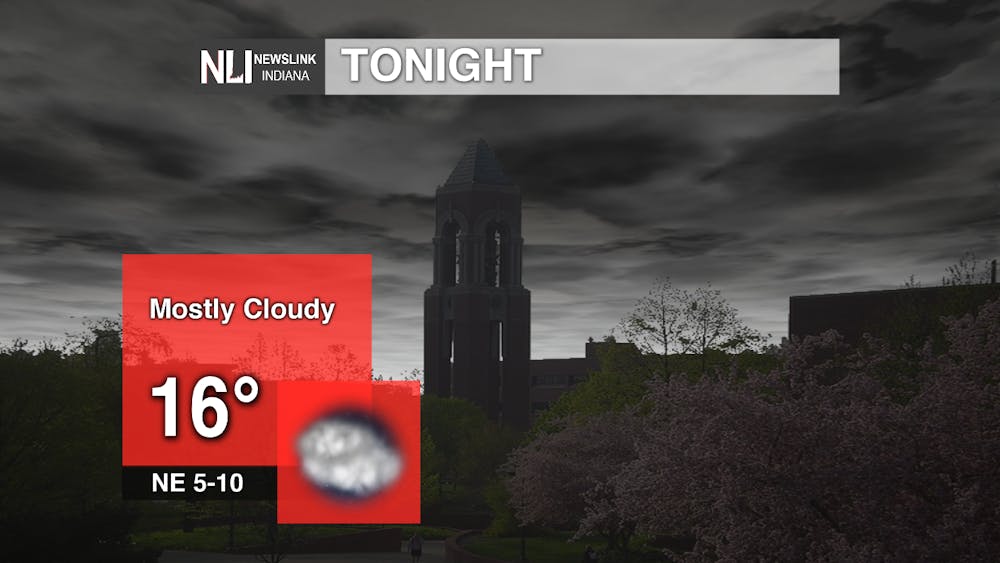
Tonight: As we move into the evening hours, we will start to see clearing skies. We will see a low of 16 degrees with mostly cloudy skies. The winds will be coming out of the northeast at 10 mph.
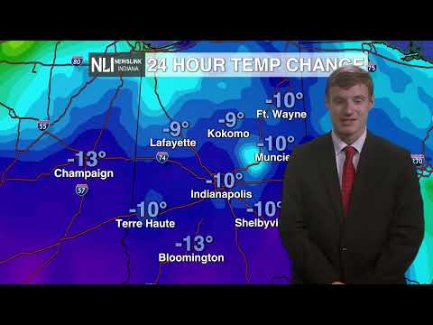
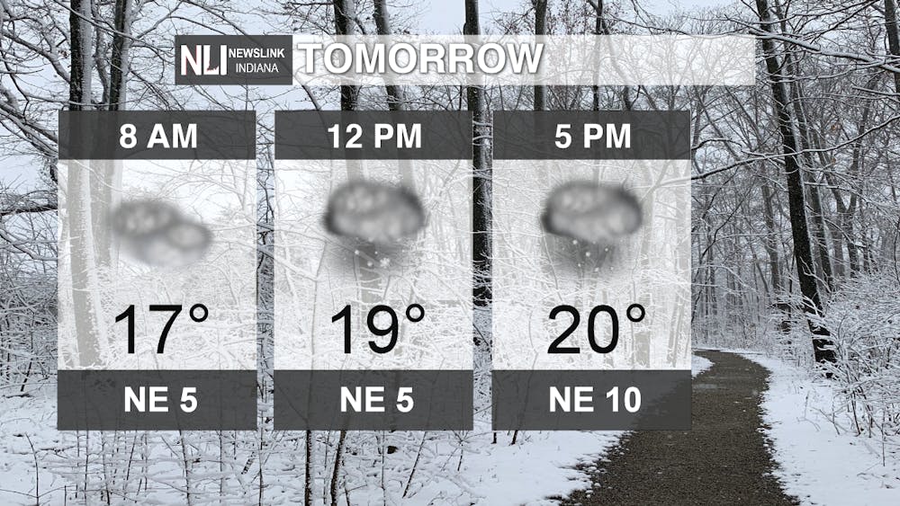
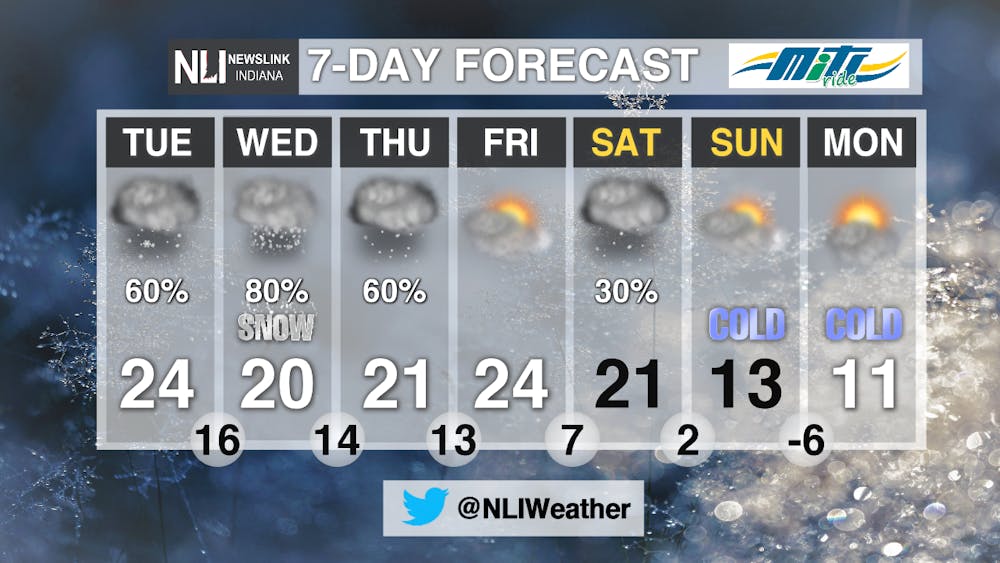
Tomorrow: Temperatures will continue to drop into tomorrow and we will be getting snowfall in the late evening hours. The high will reach 20 degrees and we will see a low of 14 degrees.
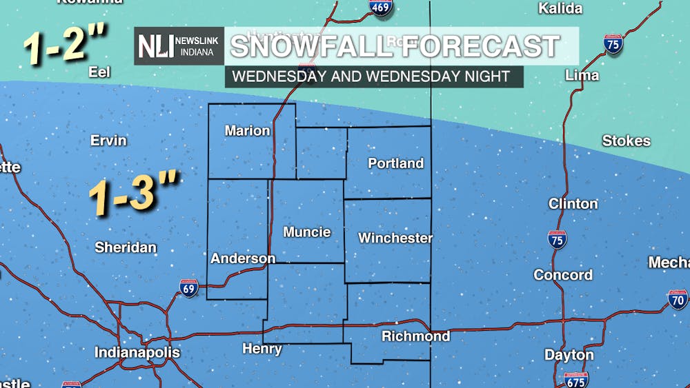
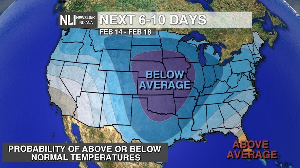
7 Day Forecast: As the system moves out today, we will only see a small amount of dry time between now and Wednesday. By Wednesday evening we will be seeing some snowfall move into the area. By Thursday, the snow will begin to move out of the area by mid-afternoon. Late Friday evening into Saturday we will start to see another system make its way into the state. The system stays in the state through Sunday morning. As the system moves out, clouds will linger until Sunday late evening. Even though the system has moved out, we will still be experiencing the arctic air well into next week. We will even see lows below zero in the next week.
---Weather Forecaster Rachel Stinger
Follow us on Twitter @NLIWeather for breaking weather updates.
NewsLink Indiana is a proud Ambassador for the NOAA Weather-Ready Nation program.
For more information about the Weather-Ready Nation program please click HERE