
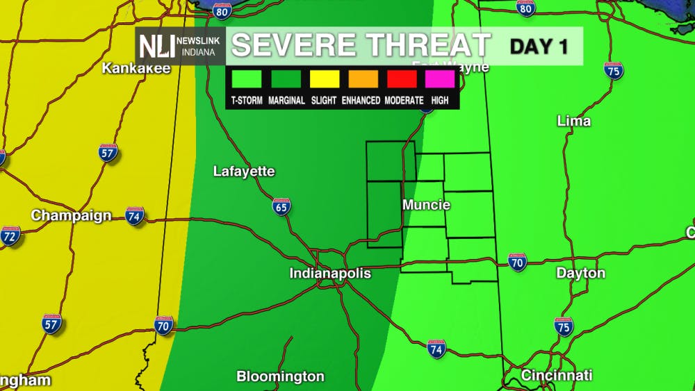
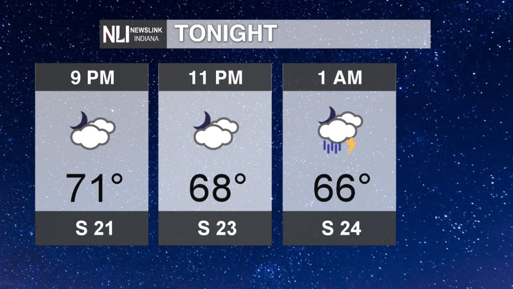
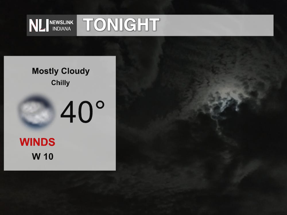
Tonight: The Storm Prediction Center places portions of our viewing area, mainly Grant and Madison counties, under a marginal risk for severe weather through this evening. The main threats continue to be strong winds, but hail and heavy downpours are possible. Temperatures will drop down to the mid-60s by 1AM.
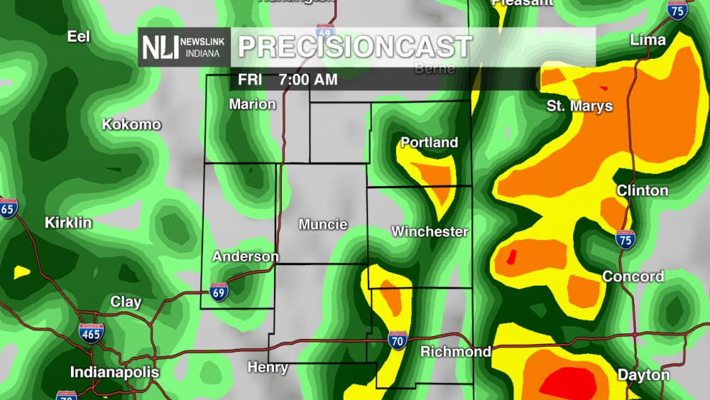
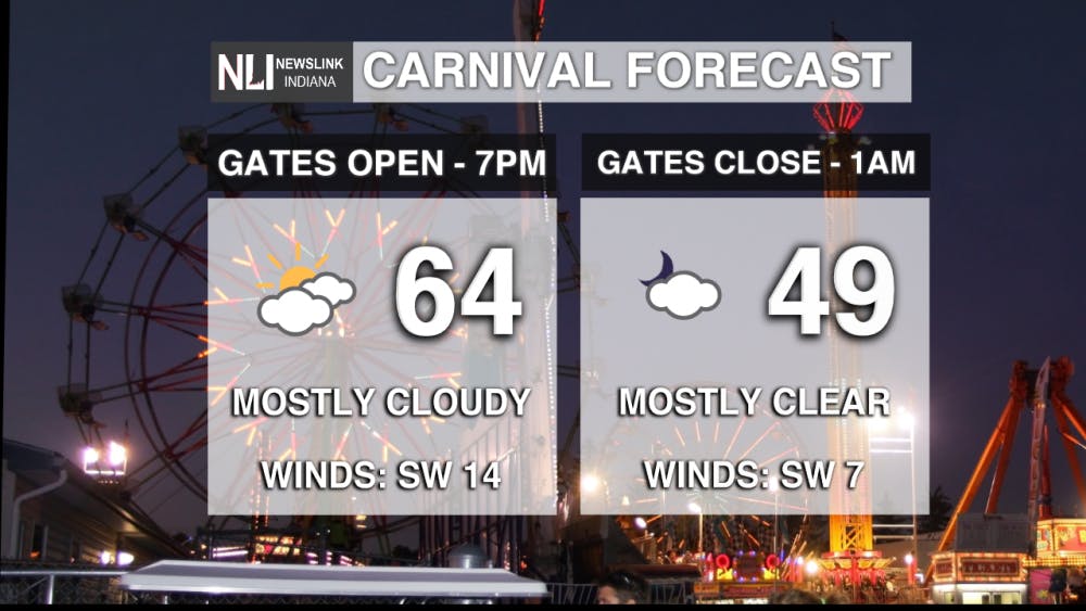
Tomorrow (Late Nite Carnival): Widespread showers and thunderstorms impact the early morning hours and extend into mid-morning as well. By 8AM, temperatures will be in the upper-50s, but winds will remain gusty. Opt for the rain jacket instead of the umbrella when heading out the door. By 3PM, rain chances subside and mostly cloudy skies remain with temperatures in the mid-60s. For Ball State's Late Nite Carnival, temperatures will remain in the mid-60s as the gates open, but by closing, at 1AM, temperatures will return to the upper-40s. Dress in layers as you will want an additional one as the evening progresses!

7-Day Outlook: Next week, temperatures stabilize a bit more than this past week. Saturday seems to be the best day to get out this week while Sunday brings increased rain chances back into play. To start off the beginning of next work week, low-50s will kick us off with a forward trend of sunshine for the next few days. Later in the week, Thursday marks the spot for our next significant rainfall.

-- Chief Weather Forecaster Payton Domschke
Follow us on Twitter @NLIWeather for breaking weather updates.
NewsLink Indiana is a proud Ambassador for the NOAA Weather-Ready Nation program.
For more information about the Weather-Ready Nation program please click HERE
Read More

Man who self-immolated outside Manhattan courthouse where Trump trial is adjourned pronounced dead
By Staff Reports / 1 hours agoAzzarello was initially extinguished and rushed away by emergency services. He was in critical condition at Weill Cornell Medicine - Burn Center, according to a press conference held by the New York Police Department (NYPD).
Stretch of cooler temperatures entering into the weekend
By Evan Reed / 8 hours agoWeather Forecaster Evan Reed has the latest on the continuing cooler temperatures next week.
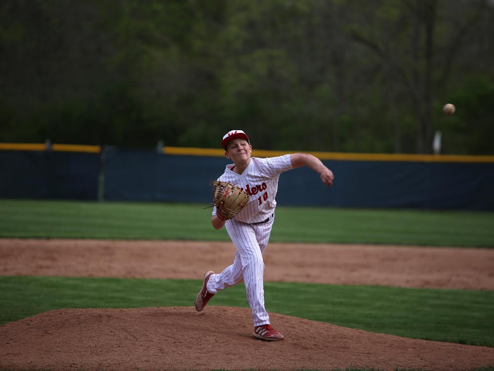
‘The program is still alive:’ Wapahani baseball defeats Alexandria on Raiders’ special night
By Zach Carter / 11 hours agoAfter having multiple ceremonies before the game, Wapahani baseball defeated Alexandria 4-2. Raiders' starting pitcher Kayson Perdue threw a complete game with six strikeouts.
