
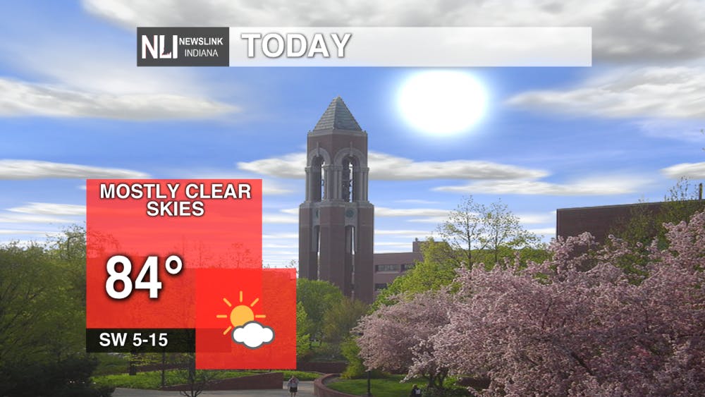
Today:
A nice day is in store today, although it will feel more like mid-July than it will early October. Highs in the low-to-mid 80s with mostly clear skies will be the rule for this afternoon and evening. Dew points should stay reasonable, and with the addition of light winds from the southwest, it will be a very nice day to get things done outside today.
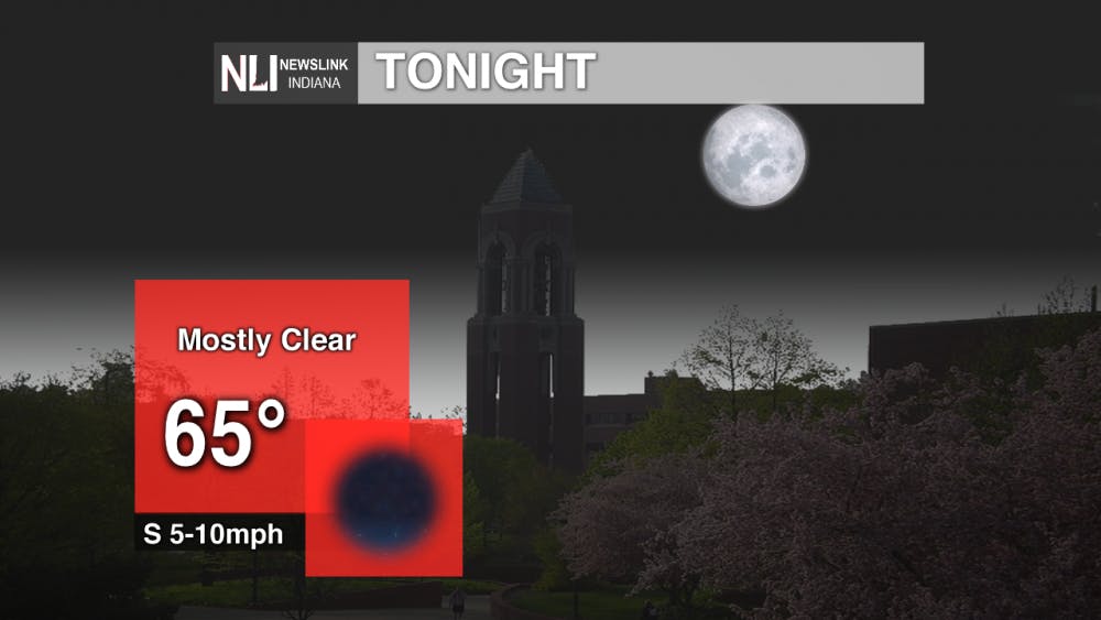
Tonight:
It will be a good night tonight to be outside as well! Mostly clear skies will be the rule, but clouds will start to roll in during the early morning hours. Lows should stay in the mid-to-upper 60s with winds staying light.
Tomorrow:
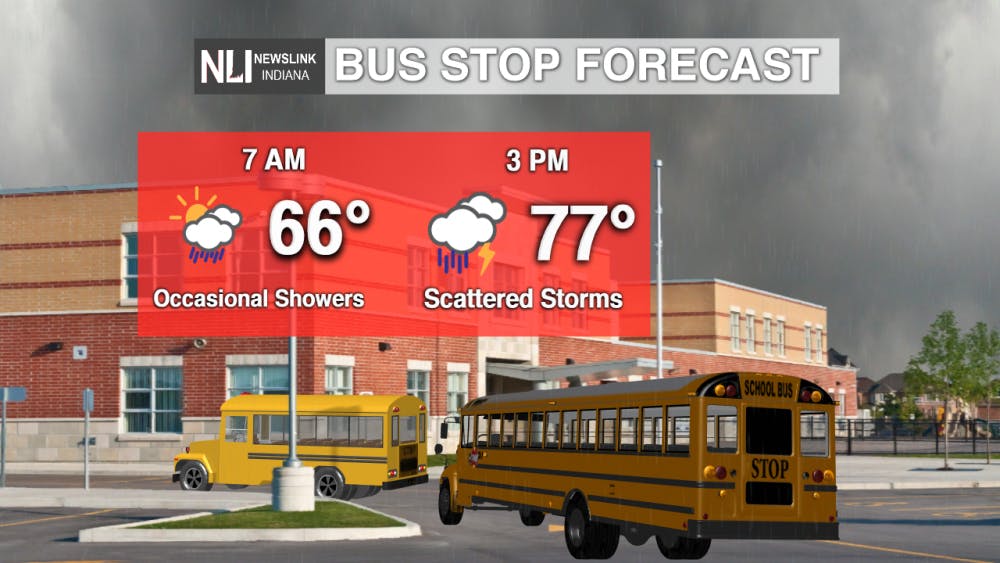
It will feel more like spring tomorrow, with temperatures still getting into the upper 70s, but it will be rainy most of the day. Could have isolated showers on your commute in tomorrow morning, but the real story is scattered thunderstorms possible mid-day tomorrow and into the afternoon. No severe weather is expected, but lightning and heavy rain could potentially impact both your lunch and commute home tomorrow.
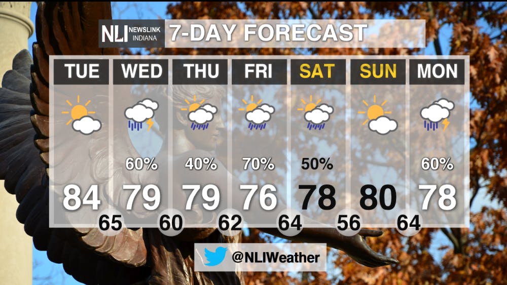
7-Day Forecast:
A change is in the 7-day forecast - more rain chances! While temperature will mostly stay in the same range in terms of highs and lows, an active weather pattern will finally return to East Central Indiana. The highest chance for rain (and associated rain totals) will fall on Friday. We'll have a clear day on Sunday before rain haunts our start to next week's work schedule.
Make sure to follow us on Twitter @NLIWeather.---Weather Forecaster Adam Grimes
NewsLink Indiana is a proud Ambassador for the NOAA Weather-Ready Nation program. For more information about the Weather-Ready Nation program please click HERE
Read More

Representation for all
By Jayden Vaughn / 2 hours agoThe LGBTQ+ community is finally getting the comprehensive on-screen representation that it deserves.
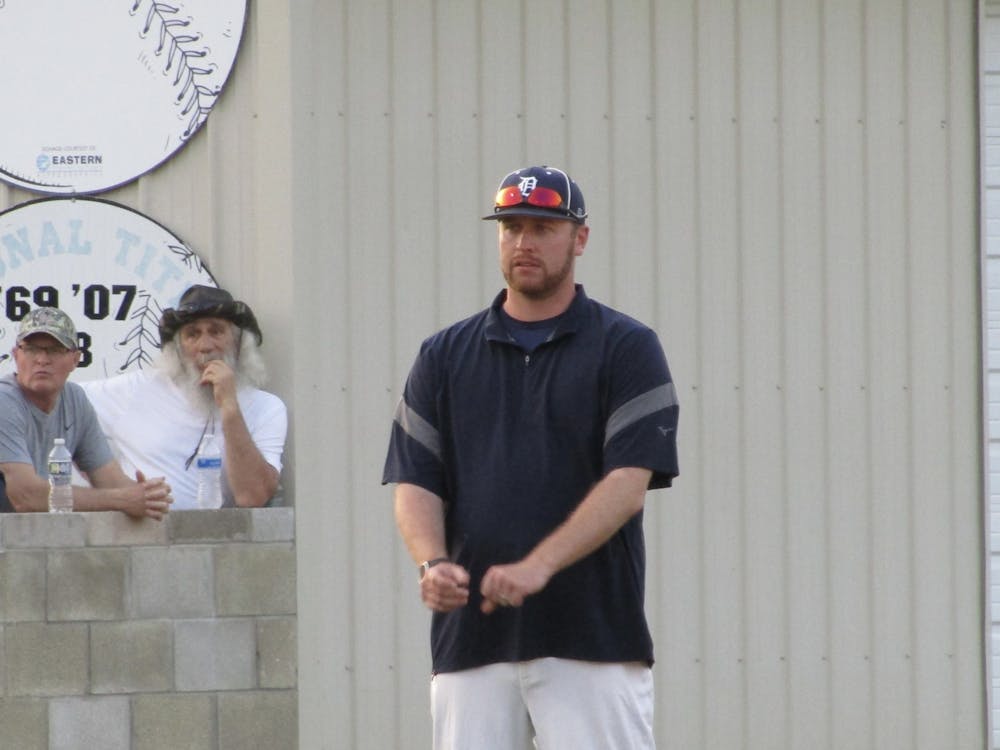
Bearcat pitching struggles lead to Muncie Central loss at Delta in Delaware County baseball clash
By David Moore / 16 hours agoAt the end of the evening, it was the Eagles who ended their four-game skid as Delta took the victory against the Bearcats 16-1 in five innings. Delta will be on the road for its next contest against Hoosier Heritage Conference rival Shelbyville April 23 at 6 p.m. Muncie Central will travel to Muncie Burris for its next matchup, also April 23 at 6 p.m.
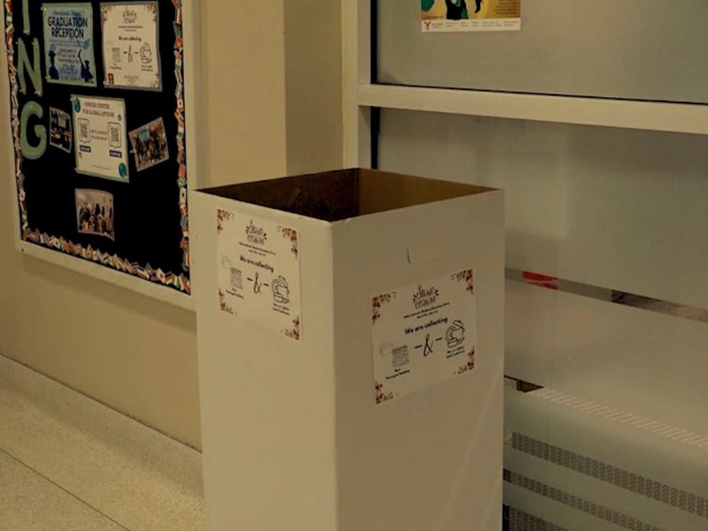
Spring donation drive
By Amelia Winter / 21 hours agoBrand-new spring donation drive to help international students at Ball State University.
