
Tonight: Those cold temperatures you've been feeling throughout the day will linger on into tonight. Temperatures dip below freezing by 1 AM. Make sure those windows are locked so no cold air seeps through.

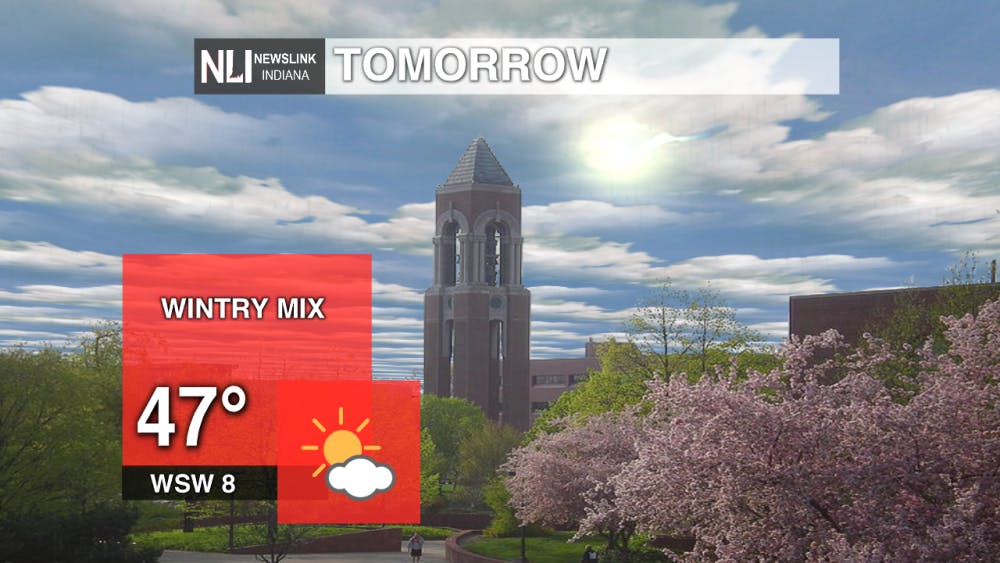
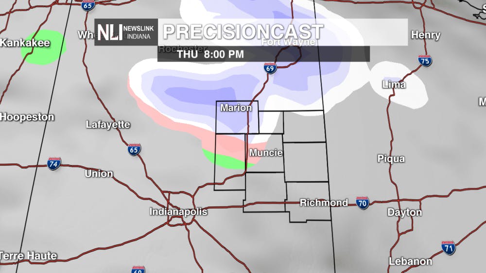
Tomorrow: Temperatures will feel warmer compared to today, but that is no indication of spring-like conditions. A wintry mix of precipitation is likely to come into our northern counties in the afternoon, bringing with it on-and-off precipitation throughout the late afternoon/ early evening hours. Most of this looks to clear by 10 PM.
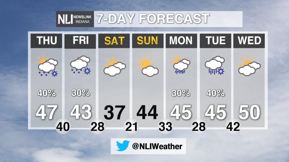
7-Day Forecast: Whoever called Spring the "transition season" is correct because the next seven days definitely illustrate this. As we round our the last part of the work week, a wintry precipitation mix will batter back and forth, but the weekend will help dry us out a bit. Kicking off Monday, we will be seeing rain come back into the forecast as temperatures warm up to the 50s by Wednesday.
---Weather Forecaster Liz Szewczyk
For more updates be sure to follow us on Twitter @NLIWeather.
NewsLink Indiana is a proud Ambassador for the NOAA Weather-Ready Nation program.
For more information about the Weather-Ready Nation program please click HERE
Read More

Top-seeded Cardinals’ postseason run ends with upset loss to Lindenwood
By Adam Altobella / 6 hours agoNo. 10 Ball State was upset by No. 18 Lindenwood in a five-set battle (25-20, 21-25, 25-23, 19-25, 11-15) on the Cardinals’ home court Thursday night. With how scarce at-large bids to the NCAA men’s volleyball tournament are, it is likely that the red and white’s 2024 campaign is over.
Thunderstorms likely tonight
By Lance Huffman / 7 hours agoWeather Forecaster Lance Huffman is tracking the potential for some strong/severe thunderstorms tonight.

Retired high school teacher holds presentation about history of Berlin Wall
By Emma Matlock / 12 hours agoTom Schwartz, a retired Bluffton High School Teacher, talks about the art on the Berlin Wall on April 15, 2024.
