
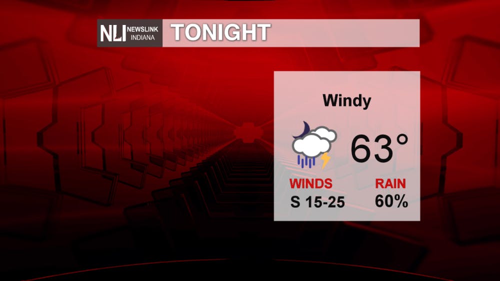
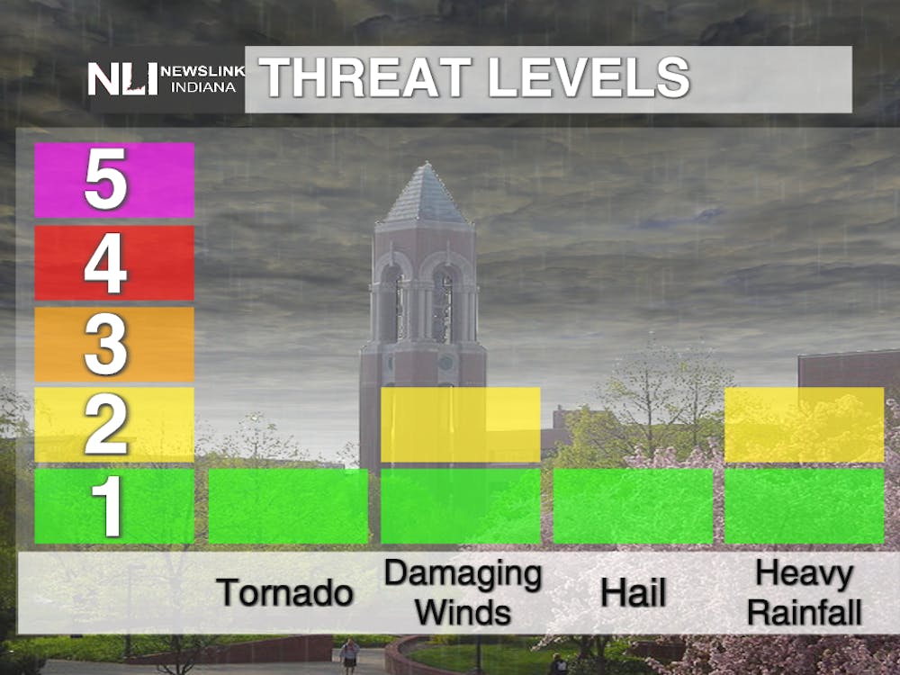
Tonight: Rain and thunderstorms will start to affect us tonight as a low pressure system moves through the area. Temperatures will be dropping into the lower 60's, and we will have winds coming from the South between 15 and 25 mph.
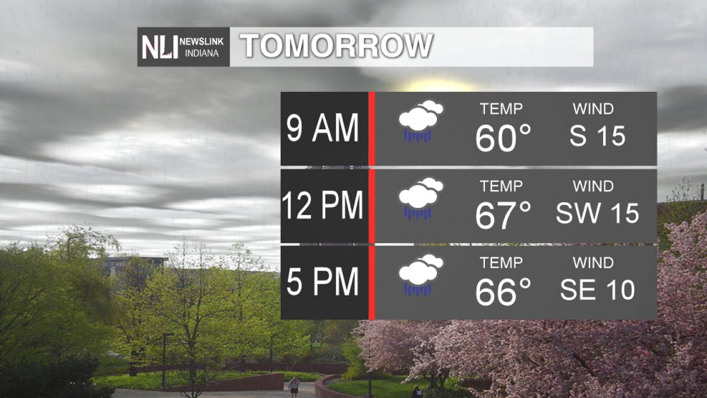
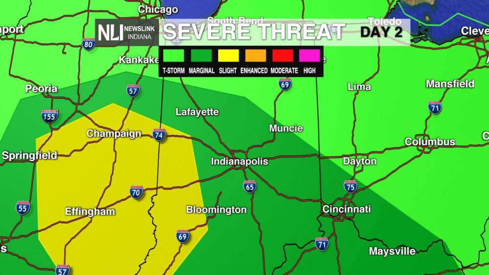
Tomorrow: We are under a risk for thunderstorms tomorrow. Things to look out for would include thunder, lightning, and heavier wind gusts.We will have chances of rain all throughout the day and into the evening hours. Temperatures will reach a high in the upper 60's, and we will have wind gusts reaching around 35 mph from the South.
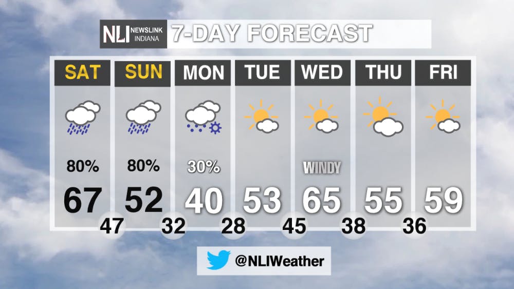
7-Day Forecast: We have have more rain in store for us through Sunday morning, and this is followed by a cold front, bringing cooler temperatures for Monday. Temperatures on Monday will only be reaching 40 degrees, and we could see a bit of snow early in the morning. However, we will see a warm-up and more sunshine by the end of next week.
---Weather Forecaster Brandi Geister
For more updates be sure to follow us on Twitter @NLIWeather.
NewsLink Indiana is a proud Ambassador for the NOAA Weather-Ready Nation program.
For more information about the Weather-Ready Nation program please click HERE
Read More

Top-seeded Cardinals’ postseason run ends with upset loss to Lindenwood
By Adam Altobella / 8 hours agoNo. 10 Ball State was upset by No. 18 Lindenwood in a five-set battle (25-20, 21-25, 25-23, 19-25, 11-15) on the Cardinals’ home court Thursday night. With how scarce at-large bids to the NCAA men’s volleyball tournament are, it is likely that the red and white’s 2024 campaign is over.
Thunderstorms likely tonight
By Lance Huffman / 10 hours agoWeather Forecaster Lance Huffman is tracking the potential for some strong/severe thunderstorms tonight.

Retired high school teacher holds presentation about history of Berlin Wall
By Emma Matlock / 15 hours agoTom Schwartz, a retired Bluffton High School Teacher, talks about the art on the Berlin Wall on April 15, 2024.
