
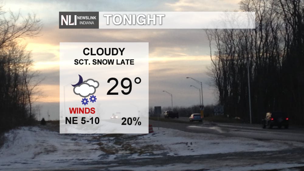
Tonight: Scattered snow showers will pass through the area overnight, with a low of 29°. These should not have a big impact for your Saturday morning commute, but a few slick spots are possible in the morning.
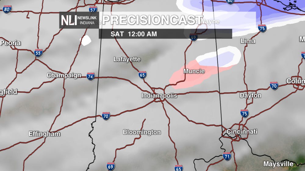
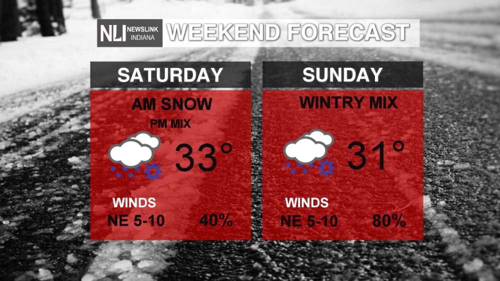
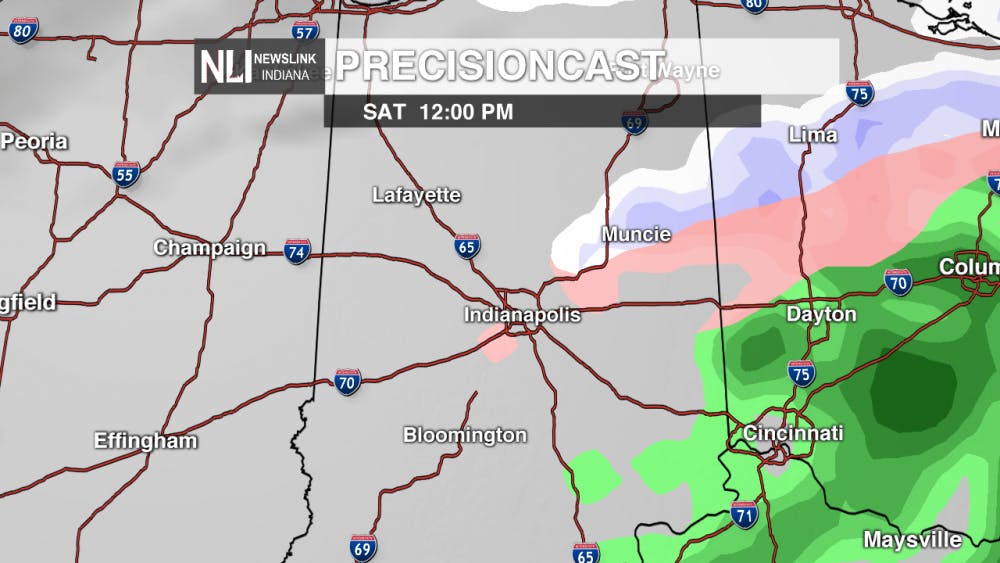
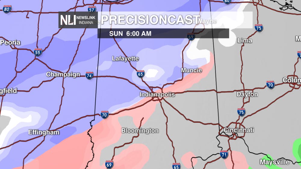
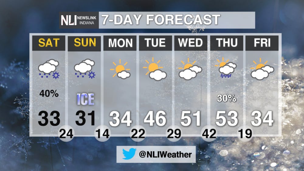
Weekend forecast: Saturday will feature scattered snow showers and freezing rain. Slow down and be careful when encountering any wintry precipitation. The chances for a wintry mix will come to an end by the evening. Saturday's high temperature will hover right around 33°. Sunday features a much better chance at widespread wintry weather. Snow looks to be more likely in the morning, before transitioning to a mix of ice and sleet. Less than one inch of snow and light ice accumulations are possible. Stay tuned, because even a slight change in the track of this system could change snow and ice totals dramatically.
7-Day Forecast: The extended forecast shows clearing conditions to start the week. A big warmup is in store by the middle to late part of the week, before temperatures return to near normal on Friday. A slight chance of rain is possible Thursday as a cold front passes through the area. Low temperatures will also rise into the 40s ahead of the cold front.
Stay tuned to NewsLink Indiana for the latest regarding this weekend's wintry weather. Have a great weekend!
---Weather Forecaster Nathan Gidley
Follow us on Twitter @NLIWeather
NewsLink Indiana is a proud Ambassador for the NOAA Weather-Ready Nation program.
Read More
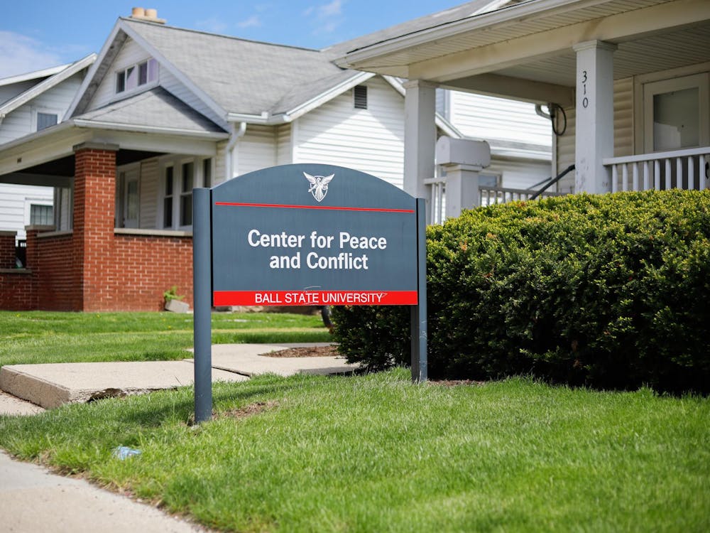
Center for Peace offers academic opportunities
By Meghan Braddy and Grayson Joslin / 4 hours agoOver the years, the center has offered a peace studies minor, conflict resolution training and grant funding.
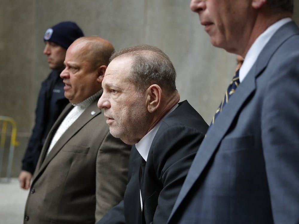
AP: New York appeals court overturns Harvey Weinstein’s 2020 conviction
By Staff Reports / 5 hours agoNew York’s highest court on Thursday overturned Harvey Weinstein’s 2020 rape conviction, finding the judge at the landmark #MeToo trial prejudiced the ex-movie mogul with “egregious” improper rulings, including a decision to let women testify about allegations that weren’t part of the case, according to the Associated Press (AP).

AP: Hamas willing to enact ceasefire if an independent Palestinian state is established
By Staff Reports / 5 hours agoWednesday, April 24th, a top Hamas political official said the group is willing to agree to a truce of five years or more with Israel and that it would lay down its weapons and convert into a political party if an independent Palestinian state is established along pre-1967 borders, according to the Associated Press (AP).
