
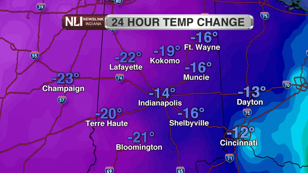
After severe weather moved through last night, we are getting back down to average temperatures in the next few days. We hit our high very early this morning around 3 a.m. and temperatures continued to cool throughout the day. From 24 hours ago, we are about 16 degrees cooler here in Muncie.

Tonight:
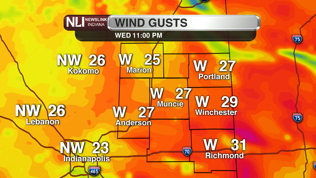
Lows tonight in Muncie will be near the freezing point at 32 degrees. Expect overcast and cloudy conditions with a possible chance of snow. Winds will be staying pretty high around 15-25mph with winds gusting up to 40mph.

Thursday:
Highs tomorrow will not be as warm as the past few days. Here in Muncie we will be around 40 degrees, which is back on average for the beginning of March. Cloudy conditions will continue after this cold front moved through earlier this morning. Winds will be around 10-15mph and gusting up 20mph. You are going to want to grab the winter coast again, as wind chills will be in the teens out the door in the morning.


Thursday Night:
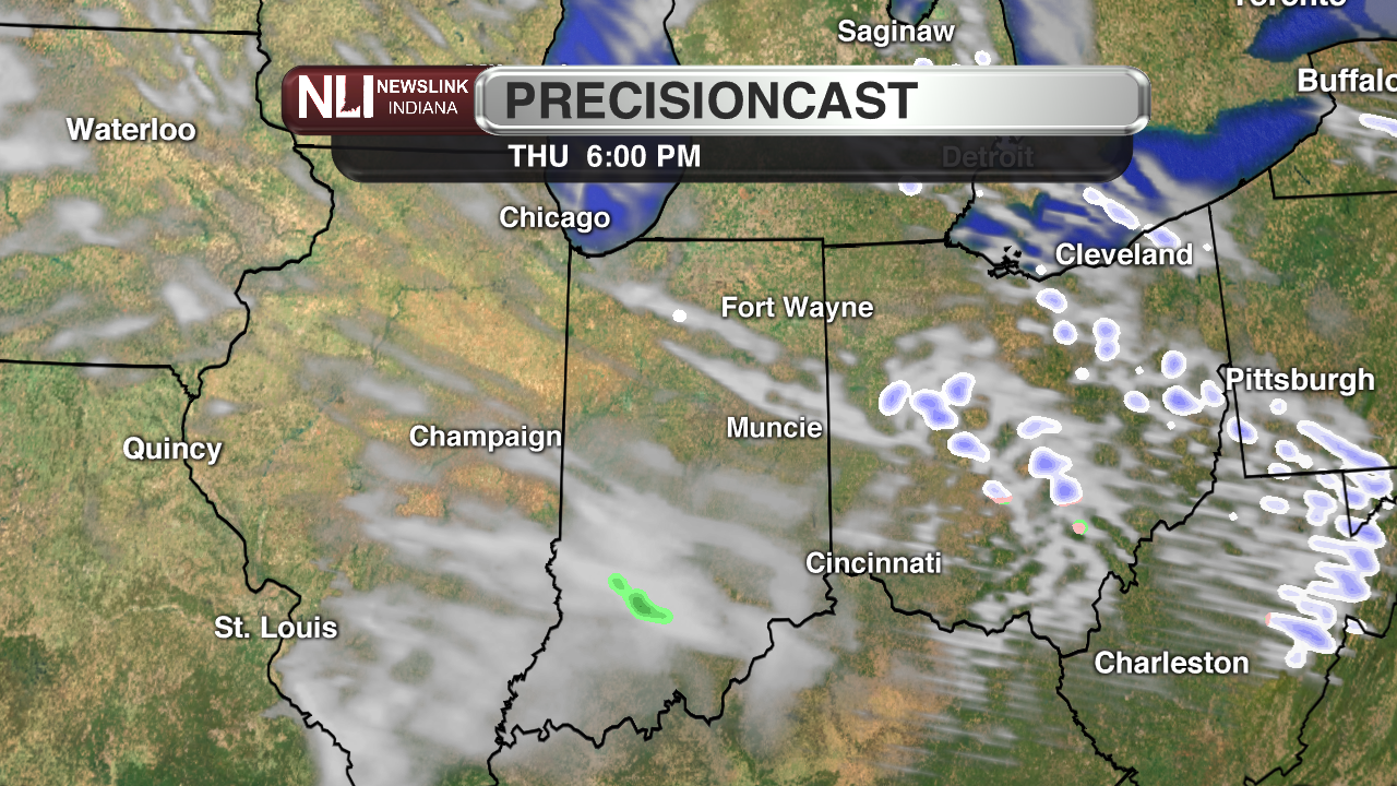
Lows will in the 20s tomorrow night. Expect a few pop up rain showers as well.
7-Day Forecast:
The next few days will be back to normal in the mid-30s to 40s. When we get to the weekend, temperatures will start to rise again and we will be back up in the 50s and 60s by the beginning of next. There is a chance of some morning flurries son Saturday and our next chance of rain looks to be Monday night.

--- Assistant Chief Weather Forecaster Kalie Pluchel
Read More

Representation for all
By Jayden Vaughn / 1 hours agoThe LGBTQ+ community is finally getting the comprehensive on-screen representation that it deserves.

Bearcat pitching struggles lead to Muncie Central loss at Delta in Delaware County baseball clash
By David Moore / 15 hours agoAt the end of the evening, it was the Eagles who ended their four-game skid as Delta took the victory against the Bearcats 16-1 in five innings. Delta will be on the road for its next contest against Hoosier Heritage Conference rival Shelbyville April 23 at 6 p.m. Muncie Central will travel to Muncie Burris for its next matchup, also April 23 at 6 p.m.
Spring donation drive
By Amelia Winter / 20 hours agoBrand-new spring donation drive to help international students at Ball State University.
